Santa Barbara County, California facts for kids
Quick facts for kids
Santa Barbara County
|
|||
|---|---|---|---|
| County of Santa Barbara | |||
|
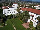
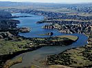
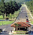
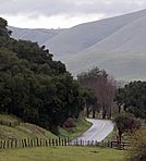
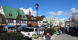
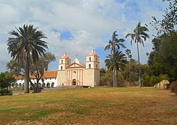
Images, from top down, left to right: The Santa Barbara County Courthouse; Lake Cachuma; Vandenberg Space Force Base's main gate; along Foxen Canyon Road, running between the Santa Maria and Santa Ynez Valleys; Danish-styled Solvang
|
|||
|
|||
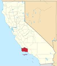
Location in the state of California
|
|||
| Country | United States | ||
| State | California | ||
| Region | California Central Coast | ||
| Incorporated | February 18, 1850 | ||
| Named for | The city of Santa Barbara, which was named for Saint Barbara | ||
| County seat | Santa Barbara | ||
| Largest city | Santa Maria (population) Santa Barbara (area) |
||
| Government | |||
| • Type | Council–CEO | ||
| • Body | Board of Supervisors | ||
| Area | |||
| • Total | 3,789 sq mi (9,810 km2) | ||
| • Land | 2,735 sq mi (7,080 km2) | ||
| • Water | 1,054 sq mi (2,730 km2) | ||
| Highest elevation | 6,803 ft (2,074 m) | ||
| Population
(2020)
|
|||
| • Total | 448,229 | ||
| • Density | 163/sq mi (63/km2) | ||
| GDP | |||
| • Total | .081 billion (2022) | ||
| Time zone | UTC−8 (Pacific Time Zone) | ||
| • Summer (DST) | UTC−7 (Pacific Daylight Time) | ||
| Area code(s) | 661, 805/820 | ||
| Congressional district | 24th | ||
Santa Barbara County is a county in Southern California. Its official name is the County of Santa Barbara. In Spanish, it's called Condado de Santa Bárbara.
In 2020, about 448,229 people lived here. The main city, or county seat, is Santa Barbara. The biggest city by population is Santa Maria.
Most of Santa Barbara County is part of the California Central Coast. The county's economy relies on engineering, getting resources like oil, making wine, farming, and education. Jobs in software and tourism are also important, especially in the southern part of the county.
Contents
History of Santa Barbara County
The Santa Barbara County area was first settled by Native Americans. This happened at least 13,000 years ago. Evidence of early people has been found here. This includes a special stone tool and the remains of Arlington Springs Man. These were found on Santa Rosa Island.
For thousands of years, the Chumash tribe lived in this area. They were skilled hunter-gatherers. They lived along the coast and in the valleys. They left behind amazing rock art in many places. One famous spot is Painted Cave.
European Exploration and Missions
Europeans first met the Chumash in 1542. Three Spanish ships explored the area. They were led by Juan Rodríguez Cabrillo. The Santa Barbara Channel got its name in 1602. Spanish explorer Sebastián Vizcaíno sailed along the California coast. His ships entered the channel on December 4th. This was the feast day of Santa Barbara.
The first land trip to explore California happened in 1769. It was led by Gaspar de Portolà. They explored the coast on their way to Monterey Bay. Later, the DeAnza expeditions also followed this path.
The Presidio of Santa Barbara was built in 1782. A presidio was a Spanish fort. Mission Santa Barbara was built in 1786. Both are in what is now the city of Santa Barbara. The fort and mission kept the name Santa Barbara. This was a common way to name places after the 21 California Missions. Other missions in Santa Barbara County are in Santa Ynez and Lompoc.
European contact had a very sad effect on the Chumash people. Many diseases spread, which greatly reduced their population. However, the Chumash people survived. Thousands of Chumash descendants still live in the Santa Barbara area. A special tribal homeland was created in 1901. It is called the Santa Ynez Reservation.
In the 1830s, Mexico took over the mission lands. These lands were then divided into large ranchos. These were given mostly to important local citizens. The state of California later approved 36 of these land grants in Santa Barbara County.
Santa Barbara County was one of the first 27 counties in California. It was formed in 1850 when California became a state. Part of the county was later used to create Ventura County in 1873.
Geography of Santa Barbara County
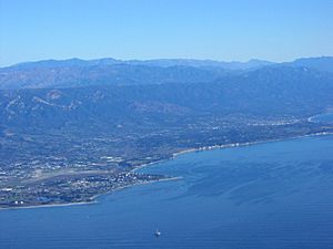
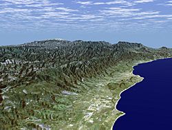
Santa Barbara County covers about 3,789 square miles. About 2,735 square miles are land. The rest, 1,054 square miles, is water. Four of the Channel Islands are in Santa Barbara County. These are San Miguel Island, Santa Cruz Island, Santa Rosa Island, and Santa Barbara Island. They make up most of the Channel Islands National Park.
The county has mountains in the middle. It also has flat coastal areas on the west and south. Most people live on the southern coastal plain. This area is called the "south coast." It includes the cities of Santa Barbara, Goleta, and Carpinteria. It also has areas like Hope Ranch and Montecito.
North of the Santa Ynez Mountains is the Santa Ynez Valley. Here you find towns like Solvang and Lompoc. The Vandenberg Space Force Base is also here. The Santa Ynez River flows through this valley to the sea. Further north are the cities of Santa Maria and Guadalupe. Santa Maria became the largest city in the county in 2006.
The main mountain ranges are the Santa Ynez Mountains in the south. The San Rafael Mountains and Sierra Madre Mountains are in the middle and northeast. Much of the mountains are part of the Los Padres National Forest. The highest point is Big Pine Mountain, at 6,820 feet.
North of the mountains is the dry Cuyama Valley. This area has few people. Oil production, ranching, and farming are common here.
Channel Islands Wildlife
The four Channel Islands in Santa Barbara County have special wildlife. They have native plants like the island oak and Torrey Pine. All four islands have the deer mouse. Three of them have the island fox. Two islands have the island spotted skunk. The San Miguel Island skunk used to live there but is now extinct.
Climate and Weather Events
Santa Barbara County has a mild warm-summer Mediterranean climate. This means it has warm, dry summers and mild, wet winters. Along the coast, summer temperatures rarely go above 100°F. Winter temperatures rarely drop below freezing. Inland, summer temperatures can be much hotter. In the mountains, it can often freeze in winter. Most rain falls in the winter. Summers are usually very dry.
The dry, warm summers often lead to a high risk of wildfires in the fall. For example, the huge Thomas Fire started in December 2017. It spread quickly into southern Santa Barbara County. This fire was one of the largest in California at the time. Heavy rain followed in January, causing big mudslides. The community of Montecito was hit very hard.
Air Quality
Air quality in the county is generally good. This is because of the winds coming off the Pacific Ocean. The county meets federal standards for clean air.
Neighboring Counties
- San Luis Obispo County (North)
- Kern County (Northeast)
- Ventura County (Southeast)
Protected Natural Areas
- Channel Islands National Park (part)
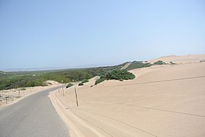
- Guadalupe-Nipomo Dunes National Wildlife Refuge (part)
- Los Padres National Forest (part)
- Burton Mesa Ecological Reserve
Population and People
| Historical population | |||
|---|---|---|---|
| Census | Pop. | %± | |
| 1850 | 1,185 | — | |
| 1860 | 3,543 | 199.0% | |
| 1870 | 7,784 | 119.7% | |
| 1880 | 9,513 | 22.2% | |
| 1890 | 15,754 | 65.6% | |
| 1900 | 18,934 | 20.2% | |
| 1910 | 27,738 | 46.5% | |
| 1920 | 41,097 | 48.2% | |
| 1930 | 65,167 | 58.6% | |
| 1940 | 70,555 | 8.3% | |
| 1950 | 98,220 | 39.2% | |
| 1960 | 168,962 | 72.0% | |
| 1970 | 264,324 | 56.4% | |
| 1980 | 298,694 | 13.0% | |
| 1990 | 369,608 | 23.7% | |
| 2000 | 399,347 | 8.0% | |
| 2010 | 423,895 | 6.1% | |
| 2020 | 448,220 | 5.7% | |
| 2023 (est.) | 441,257 | 4.1% | |
| U.S. Decennial Census 1790–1960 1900–1990 1990–2000 22010 2020 |
|||
Population in 2020
In 2020, Santa Barbara County had 448,229 people.
- About 41.22% were White (not Hispanic).
- About 46.98% were Hispanic or Latino (of any race).
- About 5.66% were Asian.
- About 3.66% were Mixed Race.
- About 1.44% were Black or African American.
- About 0.39% were Native American.
- About 0.12% were Pacific Islander.
- About 0.53% were other races.
The median age in 2000 was 33 years old. About 24.9% of the people were under 18. About 12.7% were 65 or older.
Economy and Jobs
Oil production started in Santa Barbara County in 1886. Large oil fields provided many jobs. They also supplied oil, gas, and asphalt. There have been concerns about the impact of oil drilling. In 1969, a very large oil spill happened. It covered beaches and Santa Barbara Harbor. This event helped start the modern environmental movement. Today, many big oil companies have left the area.
Tourism is a big part of the economy, especially in Santa Barbara and other coastal towns. Many jobs are in technology. This includes software development. The University of California, Santa Barbara helps encourage these jobs. Vandenberg Space Force Base is also very important. It launches satellites and provides many jobs in the northern part of the county.
Farming and Wine
Farming is a major industry in Santa Barbara County. Strawberries are the top crop. They bring in over $413 million. This is more than a third of all farm production. Wine grapes are usually the second most important crop. In 2022, cauliflower was number two because of the weather and its popularity.
Wine Country
The first wine grapes in Santa Barbara County were planted by missionaries. This happened in the late 1700s. Since the 1960s, Santa Barbara County has become a famous wine region. The movie Sideways (2004) helped make the area more popular. It especially highlighted its Pinot noir wines.
The region is also known for its Chardonnay wines. It is also gaining fame for Rhone types like Syrah and Viognier.
The vineyards are mixed with rolling hills and old oak trees. There are also oil fields and cattle ranches. The county has over 115 wineries. They grow grapes on about 16,000 acres. Most vineyards are in specific wine areas. These include Santa Maria Valley AVA and Santa Ynez Valley AVA.
The Foxen Canyon Wine Trail has many wineries. These include Andrew Murray Vineyards and Fess Parker Winery.
Education in Santa Barbara County
Santa Barbara County has 20 independent school districts. The Santa Barbara County Education Office helps these districts. It also works with the California Department of Education. In 2013, about 67,701 students were in kindergarten through 12th grade.
There are also many private schools. The Los Angeles Archdiocese runs two Catholic high schools. They also run several elementary schools.
Arts and Culture
Santa Barbara County has many important historical sites. There are 41 listings on the National Register of Historic Places. There are also 16 California Historical Landmarks. The county itself lists 50 special landmarks.
The county has museums that show its rich history and art. The Santa Barbara Museum of Art has a large collection. It includes American, Asian, and European art. The Museum of Natural History has exhibits on local wildlife. It also has a modern planetarium. The Santa Barbara Historical Museum shares insights into the city's past. It has many old records and items.
Getting Around
Main Roads
 U.S. Route 101
 State Route 1
 State Route 33
 State Route 135
 State Route 144
 State Route 154
 State Route 166
 State Route 192
 State Route 217
 State Route 246
Public Transport
You can travel in Santa Barbara County by Amtrak trains. You can also use Greyhound buses. The southern part of the county has the Santa Barbara Metropolitan Transit District bus service. In the North County, cities like Lompoc and Santa Maria have their own bus services.
Airports
- Santa Barbara Municipal Airport is near Goleta.
- Santa Maria Public Airport is southwest of Downtown Santa Maria.
- Lompoc Airport is on the north side of Lompoc.
- Santa Ynez Airport is southeast of Santa Ynez.
You can find commercial flights at Santa Barbara Airport and Santa Maria Public Airport.
Communities in Santa Barbara County
Cities
- Buellton
- Carpinteria
- Goleta
- Guadalupe
- Lompoc
- Santa Barbara (county seat)
- Santa Maria (largest city)
- Solvang
Unincorporated Communities
These are places that are not officially cities.
- Ballard
- Casmalia
- Cuyama
- Eastern Goleta Valley
- Garey
- Gaviota
- Hope Ranch
- Isla Vista
- Los Alamos
- Los Olivos
- Mission Canyon
- Mission Hills
- Montecito
- New Cuyama
- Orcutt
- Painted Cave
- Santa Ynez
- Sisquoc
- Summerland
- Surf
- Toro Canyon
- UC Santa Barbara
- Vandenberg Space Force Base
- Vandenberg Village
- Ventucopa
Population Ranking of Communities (2020)
This table shows the population of cities and towns in Santa Barbara County.
† county seat
| Rank | City/Town/etc. | Type | Population (2020 Census) |
|---|---|---|---|
| 1 | Santa Maria | City | 109,707 |
| 2 | † Santa Barbara | City | 88,665 |
| 3 | Lompoc | City | 44,444 |
| 4 | Goleta | City | 32,690 |
| 5 | Orcutt | CDP | 32,034 |
| 6 | Isla Vista | CDP | 15,500 |
| 7 | Carpinteria | City | 13,264 |
| 8 | Montecito | CDP | 8,638 |
| 9 | Guadalupe | City | 8,057 |
| 10 | Vandenberg Village | CDP | 7,308 |
| 11 | Solvang | City | 6,126 |
| 12 | Buellton | City | 5,161 |
| 13 | Santa Ynez | CDP | 4,505 |
| 14 | Mission Hills | CDP | 3,571 |
| 15 | Vandenberg SFB | CDP | 3,559 |
| 16 | Mission Canyon | CDP | 2,540 |
| 17 | Los Alamos | CDP | 1,839 |
| 18 | Toro Canyon | CDP | 1,835 |
| 19 | Summerland | CDP | 1,222 |
| 20 | Los Olivos | CDP | 1,202 |
| 21 | Ballard | CDP | 768 |
| 22 | New Cuyama | CDP | 542 |
| 23 | Santa Ynez Reservation | AIAN | 264 |
| 24 | Sisquoc | CDP | 191 |
| 25 | Casmalia | CDP | 147 |
| 26 | Garey | CDP | 72 |
| 27 | Cuyama | CDP | 37 |
Images for kids
See also
 In Spanish: Condado de Santa Bárbara para niños
 | Janet Taylor Pickett |
 | Synthia Saint James |
 | Howardena Pindell |
 | Faith Ringgold |


