Goleta, California facts for kids
Quick facts for kids
Goleta, California
|
|||
|---|---|---|---|
| City of Goleta | |||
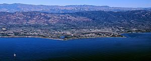
Aerial photo of the Goleta area from offshore
|
|||
|
|||
| Nickname(s):
The Good Land
|
|||
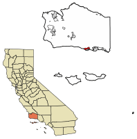
Location of Goleta in Santa Barbara County, California
|
|||
| Country | United States | ||
| State | California | ||
| County | Santa Barbara | ||
| Incorporated | February 1, 2002 | ||
| Government | |||
| • Type | Council–Manager | ||
| Area | |||
| • Total | 7.93 sq mi (20.53 km2) | ||
| • Land | 7.85 sq mi (20.34 km2) | ||
| • Water | 0.07 sq mi (0.19 km2) 0.91% | ||
| Elevation | 20 ft (6 m) | ||
| Population
(2020)
|
|||
| • Total | 32,690 | ||
| • Density | 4,122/sq mi (1,592.3/km2) | ||
| Time zone | UTC−8 (Pacific Time Zone) | ||
| • Summer (DST) | UTC−7 (PDT) | ||
| ZIP Codes |
93111, 93116–93118, 93160, 93199
|
||
| Area code | 805 | ||
| FIPS code | 06-30378 | ||
| GNIS feature ID | 1660687, 2015546 | ||
Goleta (pronounced gə-LEE-tə) is a city in southern Santa Barbara County, California, United States. Its name comes from a Spanish word for "schooner," which is a type of sailing ship. Goleta became an official city in 2002. Before that, it was the largest populated area in the county that wasn't officially a city.
In 2020, Goleta had a population of 32,690 people. It is well-known for being very close to the campus of the University of California, Santa Barbara (UCSB).
Contents
History of Goleta
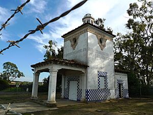
Early History and Native People
For thousands of years, the area where Goleta is now was home to the Chumash people. The Spanish called them Canaliños because they lived along the coast near the Channel Islands. One of their biggest villages, S'axpilil, was located north of the Goleta Slough, close to where the Santa Barbara Airport is today.
The first European to visit the Goleta area was Spanish explorer Juan Rodríguez Cabrillo in 1542. He spent time around the Channel Islands. Later, in the 1980s, a 16th-century cannon was found on the beach. This led to a theory that Sir Francis Drake might have sailed into the Goleta Slough in 1579.
In 1602, another Spanish expedition led by Sebastian Vizcaino visited the California Coast. He named the channel Santa Barbara. Spanish ships likely stopped in the area sometimes over the next 167 years, but no permanent towns were built.
Spanish Expeditions and Settlements
The first land expedition to California, led by Gaspar de Portolà, explored the area in 1769. They found a very large lagoon that covered much of what is now Goleta. There were at least five native towns in the area. The biggest town was on an island in the middle of the lagoon. The Spanish called these "towns of the island." This island was later called Mescalitan Island. It was flattened in 1941 to help build the military airfield that is now Santa Barbara Airport.
In 1774, another Spanish expedition led by Juan Bautista de Anza came to the Santa Barbara area. Soon after, the road along the coast became El Camino Real. This road connected the Spanish missions. In 1782, the Presidio of Santa Barbara (a military fort) and the Santa Barbara Mission were founded. The Goleta area became part of their control.
Around this time, a sailing ship called a goleta (Spanish for schooner) was wrecked at the mouth of the lagoon. It stayed visible for many years, giving the area its current name. After Mexico became independent from Spain in 1821, the mission lands were divided into large ranches. The Goleta area became part of two ranches: Rancho La Goleta and Rancho Dos Pueblos.
19th and 20th Centuries: Growth and Change
In the late 1800s and early 1900s, the Goleta Valley was mostly farmland, famous for growing lemons. Some areas, like the Ellwood Mesa, also developed for oil and natural gas extraction.
In the 1920s, people started using parts of the Goleta Slough for landing airplanes. The need for an airport became very clear after a Japanese submarine attacked the Ellwood Oil Field in 1942 during World War II. This was one of the few direct attacks on the U.S. mainland during the war. The Marine Corps then helped finish building the airport.
After the war, the construction of Lake Cachuma provided water, which led to a housing boom. Research and aerospace companies also moved into the area. In 1954, the University of California, Santa Barbara (UCSB) moved to part of the former Marine base. Goleta changed from a farming area to a center for high-tech companies. Today, it is still known for its technology firms and is a place where many people live who work in nearby Santa Barbara.
Becoming a City
Goleta officially became a city in 2002. This happened after several tries. Some areas near Goleta, like "Noleta" (north of Goleta) and the student community of Isla Vista, were not included in the new city boundaries.
Geography of Goleta
Goleta is located about 8 miles (13 km) west of the city of Santa Barbara. It sits along the coast, where the coastline runs from east to west. The University of California campus and the community of Isla Vista are very close by.
The city covers about 7.9 square miles (20.5 square kilometers). A small part of this area, about 0.07 square miles (0.19 square kilometers), is covered by water.
Land and Mountains
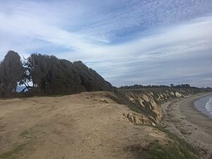
The Goleta Valley is a flat coastal area, about 3 miles (5 km) wide. It lies between the Santa Ynez Mountains and the Pacific Ocean. The land here is made up of soil, sand, and old river and ocean deposits. The area has been lifted up quickly over time, which you can see in its coastal cliffs and narrow beaches.
The Santa Ynez Mountains are a beautiful backdrop to Goleta. They are made of many layers of rock that have been pushed up quickly over millions of years. This gives them their rugged look. These mountains can also have landslides.
Wildlife in Goleta
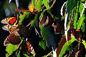
Goleta is home to various animals. You might see Bobcats in the area. Coyotes sometimes hunt small pets. Skunks are common and can spray a strong smell. Raccoons and Opossums also live in neighborhoods.
One special sight is the Monarch butterflies. They spend the winter in eucalyptus groves on the Ellwood Mesa. While rare, Bears and mountain lions live in the hills and mountains around Goleta.
Climate
Goleta has a mediterranean climate. This means it has mild, wet winters and warm, dry summers. Winds from the Pacific Ocean keep temperatures moderate.
Even though it's a coastal town, Goleta can have some extreme temperatures. The hottest temperature ever recorded was 109°F (43°C), and the coldest was 20°F (-7°C). Chilly days and very warm nights are unusual.
| Climate data for Santa Barbara Municipal Airport (1991–2020 normals, extremes since 1941) | |||||||||||||
|---|---|---|---|---|---|---|---|---|---|---|---|---|---|
| Month | Jan | Feb | Mar | Apr | May | Jun | Jul | Aug | Sep | Oct | Nov | Dec | Year |
| Record high °F (°C) | 87 (31) |
87 (31) |
94 (34) |
96 (36) |
101 (38) |
109 (43) |
109 (43) |
105 (41) |
104 (40) |
103 (39) |
97 (36) |
89 (32) |
109 (43) |
| Mean maximum °F (°C) | 78 (26) |
77 (25) |
80 (27) |
83 (28) |
83 (28) |
83 (28) |
86 (30) |
83 (28) |
90 (32) |
89 (32) |
84 (29) |
76 (24) |
95 (35) |
| Mean daily maximum °F (°C) | 64.2 (17.9) |
63.8 (17.7) |
65.9 (18.8) |
67.8 (19.9) |
69.2 (20.7) |
70.3 (21.3) |
73.3 (22.9) |
74.5 (23.6) |
74.3 (23.5) |
73.4 (23.0) |
69.2 (20.7) |
64.3 (17.9) |
69.2 (20.7) |
| Daily mean °F (°C) | 52.8 (11.6) |
53.7 (12.1) |
56.1 (13.4) |
58.0 (14.4) |
60.3 (15.7) |
62.4 (16.9) |
65.7 (18.7) |
66.2 (19.0) |
65.0 (18.3) |
62.1 (16.7) |
56.7 (13.7) |
52.3 (11.3) |
59.3 (15.2) |
| Mean daily minimum °F (°C) | 41.3 (5.2) |
43.6 (6.4) |
46.2 (7.9) |
48.1 (8.9) |
51.3 (10.7) |
54.5 (12.5) |
58.1 (14.5) |
58.0 (14.4) |
55.7 (13.2) |
50.9 (10.5) |
44.3 (6.8) |
40.4 (4.7) |
49.4 (9.7) |
| Mean minimum °F (°C) | 32 (0) |
35 (2) |
38 (3) |
41 (5) |
45 (7) |
49 (9) |
52 (11) |
52 (11) |
48 (9) |
43 (6) |
35 (2) |
31 (−1) |
30 (−1) |
| Record low °F (°C) | 24 (−4) |
25 (−4) |
30 (−1) |
33 (1) |
38 (3) |
41 (5) |
45 (7) |
43 (6) |
42 (6) |
31 (−1) |
30 (−1) |
20 (−7) |
20 (−7) |
| Average precipitation inches (mm) | 3.84 (98) |
3.86 (98) |
3.10 (79) |
0.91 (23) |
0.42 (11) |
0.11 (2.8) |
0.02 (0.51) |
0.01 (0.25) |
0.07 (1.8) |
0.73 (19) |
1.27 (32) |
2.91 (74) |
17.25 (438) |
| Source: NOAA | |||||||||||||
Population and People
| Historical population | |||
|---|---|---|---|
| Census | Pop. | %± | |
| 2000 | 55,204 | — | |
| 2010 | 29,888 | −45.9% | |
| 2020 | 32,690 | 9.4% | |
| U.S. Decennial Census 1860–1870 1880-1890 1900 1910 1920 1930 1940 1950 1960 1970 1980 1990 2000 2010 |
|||
Goleta was first counted as a "census designated place" in the 2000 U.S. Census. After it became a city in 2002, its population was counted as a city.
2020 Census Information
The 2020 United States census showed that Goleta had a population of 32,690 people. Most people (99.3%) lived in homes.
The population was made up of different groups:
- 52.0% White
- 1.6% African American
- 1.5% Native American
- 12.1% Asian
- 0.1% Pacific Islander
- 15.8% from other races
- 17.0% from two or more races
People of Hispanic or Latino background made up 35.3% of the population.
About 19.1% of the population was under 18 years old. The average age in Goleta was 38.2 years. There were slightly more males than females.
In 2023, it was estimated that 22.5% of the people in Goleta were born outside the U.S. Most people (65.1%) spoke only English at home. About 22.3% spoke Spanish. Many adults (89.7%) had finished high school, and almost half (48.3%) had a bachelor's degree or higher.
Economy
The University of California, Santa Barbara (UCSB) is a major part of Goleta's economy. It provides many jobs and supports many businesses that serve students and staff.
Several high-tech companies are located in Goleta because of its closeness to the university. These include companies like Raytheon, Lockheed Martin, Northrop Grumman, and FLIR.
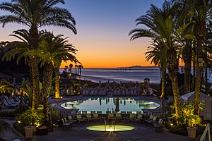
Deckers Outdoor Corporation, which owns popular shoe brands like UGG Australia and Teva, is also based in Goleta. The Bacara Resort, a large hotel at the edge of the city, also employs many people.
Energy Goals
Goleta has big goals for clean energy. In 2017, the city decided to get 100% of its electricity from renewable sources by 2030. This includes electricity for city buildings and for the whole community.
By 2025, the city aims for at least 50% of its own electricity to come from renewable sources. Goleta is working on installing solar panels at City Hall and exploring more electric vehicle charging stations.
Parks and Recreation
Goleta has many great parks and outdoor areas. These include Stow Park, Girsh Park, and Jonny D. Wallis Neighborhood Park.
Lake Los Carneros and the Coronado Butterfly Preserve are also popular. The preserve is the largest place where Monarch butterflies spend the winter. It offers access to the Ellwood Mesa Open Space, which has bluffs overlooking the Pacific Ocean and beach access.
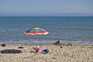
Goleta Beach County Park is just outside the city limits and is a favorite spot for locals. Historic places like the Stow House and the South Coast Railroad Museum offer a look into the past.
Government
Goleta is governed by a City Council. Until 2018, the five council members took turns being mayor for one-year terms. In November 2018, residents voted directly for a mayor for the first time. Paula Perotte was elected to a two-year term. In November 2020, voters approved changing the mayor's term to four years.
The City Council also acts as the planning agency for the city. Meetings for the City Council, planning commission, and design review board are shown on a local TV channel and are available on the city's website.
Education
Most students in Goleta attend schools in the Goleta Union School District for elementary grades and the Santa Barbara Unified School District for secondary grades. There are also several smaller private schools.
Schools in Goleta
Elementary Schools
- Brandon School
- El Camino School
- Ellwood School
- Foothill School
- Goleta Family School
- Hollister School
- Isla Vista School
- Kellogg School
- La Patera School
- Mountain View School
- Santa Barbara Charter School
- South Coast Montessori School of Santa Barbara
Secondary Schools
- Goleta Valley Junior High
- Dos Pueblos High School
Transportation
Goleta has several ways to get around. The Santa Barbara Metropolitan Transit District operates bus lines throughout the city. The main road is U.S. 101. Other important streets include Hollister Avenue, Cathedral Oaks Road, and Fairview Avenue.
For travel between cities, Amtrak trains stop at the Goleta Amtrak Station.
The Santa Barbara Airport is right next to Goleta. It serves the greater Santa Barbara area with several airlines connecting to larger airports.
Major Highways
 U.S. Route 101
 State Route 217
Notable People
Many interesting people have connections to Goleta:
- Carl Barks, a famous comics artist who created characters like Scrooge McDuck.
- Danny Duffy, a professional baseball player for the Kansas City Royals.
- Burnett Guffey, an Oscar-winning cinematographer.
- Jean Louise Hodgkins and Vera B. Skubic, who built historic houses in the area.
- Lagwagon, a melodic punk band.
- Kent McClard, who runs Ebullition Records and used to publish HeartattaCk, a punk magazine.
- Larry Moriarty, a former American football player.
- Katy Perry, a popular pop singer.
- Derrick Plourde, a drummer and artist.
- Kim Wilson, a blues singer and musician.
See also
 In Spanish: Goleta (California) para niños
- Campus Point State Marine Conservation Area
- Dos Pueblos High School
- Goleta Depot
- Goleta Slough
- Goleta Union School District
- History of Santa Barbara, California
- Isla Vista, California
- Santa Barbara, California
- South Coast Railroad Museum
 | Janet Taylor Pickett |
 | Synthia Saint James |
 | Howardena Pindell |
 | Faith Ringgold |


