Mission Canyon, California facts for kids
Quick facts for kids
Mission Canyon
|
|
|---|---|

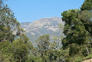
View of the Santa Ynez Mountains from a southernmost point of Mission Canyon (at the intersection of Mountain Dr. & Mission Ridge Rd.)
|
|

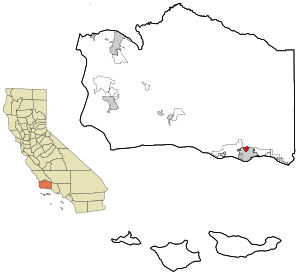
Location in Santa Barbara County and the state of California
|
|
| Country | |
| State | |
| County | Santa Barbara |
| Area | |
| • Total | 1.547 sq mi (4.008 km2) |
| • Land | 1.517 sq mi (3.930 km2) |
| • Water | 0.030 sq mi (0.078 km2) 1.94% |
| Elevation | 633 ft (193 m) |
| Population | |
| • Total | 2,381 |
| • Density | 1,539.1/sq mi (594.06/km2) |
| Time zone | UTC-8 (Pacific) |
| • Summer (DST) | UTC-7 (PDT) |
| ZIP code |
93105
|
| Area code | 805 |
| FIPS code | 06-48147 |
| GNIS feature ID | 1853400 |
Mission Canyon is a community located near Santa Barbara, California. It's known as a census-designated place, which means it's an area counted by the census but isn't officially a city. In 2010, about 2,381 people lived there.
This area is just north of Santa Barbara, nestled in the mountains. It gets its name from the historic Mission Santa Barbara, which is located between the canyon and the city center. The canyon itself is quite impressive, with tall peaks like La Cumbre Peak (about 1,216 meters high) and Arlington Peak (about 993 meters high). You'll see rugged sandstone rocks and lots of chaparral plants covering the hillsides.
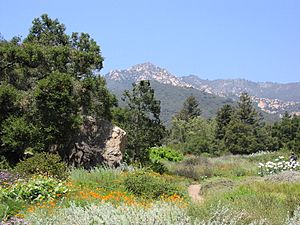
A main road, State Route 192, runs through the southern part of Mission Canyon. Another important road, Tunnel Road, leads to popular hiking trails. These trails go into the Los Padres National Forest in the Santa Ynez Mountains. The famous Santa Barbara Botanic Garden is also found here.
Contents
Exploring Mission Canyon's Geography
Mission Canyon is located on the southern slopes of the Santa Ynez Mountains. It covers about 1,122 acres. Most of the land is used for homes, but there are also areas for recreation, open spaces, and some farms. You won't find many shops or factories here.
Important places in Mission Canyon include the Santa Barbara Botanic Garden, Rocky Nook County Park, and the Santa Barbara Woman's Club. The Santa Barbara County Fire Department also has a fire station here. The land changes from flat areas in the south to steeper slopes in the north. Elevations range from about 91 meters to over 305 meters above sea level.
The United States Census Bureau says that Mission Canyon has a total area of about 3.9 square kilometers of land. A very small part, about 0.078 square kilometers, is water.
Mission Canyon's Climate
Mission Canyon has a pleasant climate. Summers are warm and dry, but they don't get too hot. The average monthly temperature never goes above 22 degrees Celsius. This type of weather is called a warm-summer Mediterranean climate. On climate maps, it's known as "Csb."
Who Lives in Mission Canyon?
This section shares information about the people who live in Mission Canyon. This data comes from official counts called censuses.
Population in 2010
The 2010 United States Census showed that 2,381 people lived in Mission Canyon. Most residents, about 92.1%, were White. Other groups included African American (0.6%), Native American (0.7%), Asian (1.7%), and Pacific Islander (0.5%). About 8.3% of the population identified as Hispanic or Latino.
Almost everyone, 99.6% of the people, lived in homes. There were 1,020 households in total. About 22.5% of these homes had children under 18 living there. Many households (53.6%) were married couples.
The average household had 2.33 people. The average family size was 2.70 people. The population was spread out by age. About 15.5% were under 18, and 20.2% were 65 or older. The average age was 51.3 years.
Most homes (76.7%) were owned by the people living in them. The rest (23.3%) were rented.
Population in 2000
In the census of 2000, Mission Canyon had 2,610 residents. The racial makeup was similar to 2010, with 93.64% White residents. About 6.63% of the population was Hispanic or Latino.
There were 1,065 households. About 23.5% of these had children under 18. The average household size was 2.44 people, and the average family size was 2.73 people.
The median age in 2000 was 45 years. This means half the people were younger than 45, and half were older.
The median income for a household was $79,338. For families, it was $103,442. The per capita income (income per person) was $43,422. A small number of families (1.0%) and people (6.8%) lived below the poverty line.
See also
 In Spanish: Mission Canyon (California) para niños
 | May Edward Chinn |
 | Rebecca Cole |
 | Alexa Canady |
 | Dorothy Lavinia Brown |


