
Montecito, California facts for kids
Quick facts for kids
Montecito, California
|
|
|---|---|
.jpg) .jpg)  .jpg) _(cropped).jpg) Clockwise: view of Montecito and the Pacific Ocean from the Santa Ynez Mountains; Our Lady of Mount Carmel Church; Lotusland; Butterfly Beach; Casa del Herrero
|
|

Location in Santa Barbara County and the state of California
|
|

Montecito, California
Location in southern California

Montecito, California
Location in California

Montecito, California
Location in the United States
|
|
| Country | United States |
| State | California |
| County | Santa Barbara |
| Area | |
| • Total | 9.265 sq mi (23.994 km2) |
| • Land | 9.259 sq mi (23.979 km2) |
| • Water | 0.006 sq mi (0.014 km2) 0.06% |
| Elevation | 180 ft (55 m) |
| Population | |
| • Total | 8,638 |
| • Density | 932.33/sq mi (360.007/km2) |
| Time zone | UTC−8 (Pacific) |
| • Summer (DST) | UTC−7 (PDT) |
| ZIP Codes |
93108, 93150
|
| Area code | 805 and 820 |
| FIPS code | 06-48844 |
| GNIS feature IDs | 1661052, 2408861 |
Montecito is a special town in Santa Barbara County, California. Its name means 'little mountain' in Spanish. It's an unincorporated area, which means it doesn't have its own city government. Instead, it's managed by the county.
Montecito is located on the Central Coast of California. It sits between the Santa Ynez Mountains and the Pacific Ocean. Montecito is famous for being a place where many celebrities live. It's a very wealthy town, with homes costing a lot of money. In 2024, the average home price was $7.5 million. About 8,638 people live there as of 2022.
Contents
History of Montecito
_(3953273520).jpg)
.jpg)
The area where Montecito is today has a long history. For over 10,000 years, the Chumash Indians lived here. In the 18th century, Spanish explorers arrived. They built the Santa Barbara Presidio and Mission Santa Barbara nearby.
In the mid-1800s, the area was known for bandits. These robbers would hide in the canyons and oak trees. They would attack people traveling along the coast. By the late 1860s, the bandits were gone. Italian settlers then moved to Montecito. They found the area reminded them of Italy. They built farms and gardens, just like the ones they had left behind.
Around the late 1800s, rich tourists from other parts of the U.S. started buying land here. Montecito was close to Santa Barbara for services. But it was also private and quiet. The weather was nice, and there were hot springs nearby. People thought these springs were good for health. Land was also affordable back then.
A hotel called the Montecito Hot Springs Hotel was built. It was near the biggest hot springs. This hotel burned down in 1920. A smaller place, the Hot Springs Club, replaced it later.
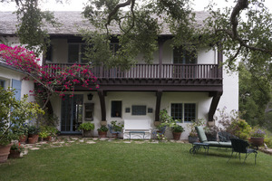
Two famous architects worked in Montecito. George Washington Smith designed many homes here. He helped make the Spanish Colonial Revival style popular. Lutah Maria Riggs also worked for Smith. She later started her own architecture firm.
Montecito has faced challenges from nature. Between 2017 and 2018, people had to leave their homes five times. This was due to events like the Thomas Fire. There were also serious 2018 Southern California mudflows and floods. The mudflows caused 20 deaths and many injuries. To help prevent future disasters, FEMA gave money in 2020. This money will help build a larger debris basin. It will control mud and debris from San Ysidro Creek.
Geography and Climate
.jpg)
Montecito is a census-designated place (CDP). It covers about 9.3 square miles (23.99 square kilometers). Most of this area is land, with a tiny bit of water.
Montecito's Climate
Montecito has a warm Mediterranean climate. This type of climate is common in coastal Southern California. Ocean breezes keep temperatures mild. Winters are warmer, and summers are cooler than inland areas. This gentle climate makes Montecito a great place for growing plants. Many people who study plants enjoy working here.
| Climate data for Montecito, California | |||||||||||||
|---|---|---|---|---|---|---|---|---|---|---|---|---|---|
| Month | Jan | Feb | Mar | Apr | May | Jun | Jul | Aug | Sep | Oct | Nov | Dec | Year |
| Record high °F (°C) | 88 (31) |
88 (31) |
92 (33) |
100 (38) |
101 (38) |
109 (43) |
109 (43) |
102 (39) |
107 (42) |
103 (39) |
97 (36) |
83 (28) |
109 (43) |
| Mean daily maximum °F (°C) | 64 (18) |
65 (18) |
66 (19) |
70 (21) |
70 (21) |
74 (23) |
77 (25) |
78 (26) |
77 (25) |
75 (24) |
70 (21) |
65 (18) |
71 (22) |
| Mean daily minimum °F (°C) | 43 (6) |
45 (7) |
47 (8) |
49 (9) |
52 (11) |
55 (13) |
58 (14) |
59 (15) |
57 (14) |
53 (12) |
47 (8) |
43 (6) |
51 (11) |
| Record low °F (°C) | 24 (−4) |
25 (−4) |
32 (0) |
36 (2) |
38 (3) |
42 (6) |
48 (9) |
47 (8) |
43 (6) |
36 (2) |
30 (−1) |
20 (−7) |
20 (−7) |
| Average precipitation inches (mm) | 3.80 (97) |
4.34 (110) |
3.34 (85) |
0.72 (18) |
0.30 (7.6) |
0.08 (2.0) |
0.02 (0.51) |
0.04 (1.0) |
0.29 (7.4) |
0.53 (13) |
1.37 (35) |
2.36 (60) |
17.19 (437) |
People of Montecito

As of July 2022, about 8,638 people live in Montecito. The U.S. Census Bureau collects this information.
Population in 2010
In 2010, Montecito had 8,965 residents. Most people (92.2%) were White. About 2.4% were Asian, and 0.6% were African American. About 6.7% of the population was Hispanic or Latino.
Most people (89.6%) lived in regular homes. The average household had 2.34 people. Many households (56.4%) were married couples. About 24.2% of homes had children under 18. The average age in Montecito was 50.0 years old.
Population in 2000
_(cropped).jpg)
In 2000, 10,000 people lived in Montecito. The population density was about 1,072 people per square mile. The racial makeup was similar to 2010. About 94.0% were White. Hispanic or Latino people made up 5.2% of the population.
The average household size was 2.41 people. About 25.7% of homes had children under 18. The median age was 46 years. The median income for a household was $110,669. This means half of the households earned more, and half earned less.
Fun Things to Do in Montecito
Montecito offers many outdoor activities. You can find hiking trails that lead into the backcountry.
If you visit in March and April, you might see something amazing. Gray whales migrate north from Mexico. They swim right through the Santa Barbara Channel. It's a great chance to see these huge animals!
Arts and Culture in Montecito
Montecito is home to several interesting places.
- The Music Academy of the West is a summer program. Young musicians come here to train. They also put on local performances.
- Lotusland is a huge botanical garden. It covers 37 acres. A Polish opera singer named Ganna Walska created it. It's now run as a nonprofit.
- El Fureidis is a private home. It was designed by Bertram Grosvenor Goodhue.
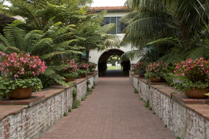
- Casa del Herrero is a beautiful Spanish Colonial Revival home. It has lovely gardens. George Washington Smith designed it.
- The Santa Barbara Biltmore is a famous hotel. It includes the Coral Casino Beach and Cabana Club.
- The Montecito Inn is a small hotel. It was built by the famous actor Charlie Chaplin.
- The Santa Barbara Vedanta Temple was designed by Lutah Maria Riggs.
- Our Lady of Mount Carmel Church is a local landmark.
- The home and studio of architect George Washington Smith are also here.
- The Rosewood Miramar Beach hotel is a beachfront hotel. It reopened in 2019 after a big renovation.
Education in Montecito
Children in Montecito attend elementary schools. These include Montecito Union Elementary School and Cold Spring Elementary School. Both schools teach students from kindergarten to 6th grade. Each school is part of its own small school district.
Montecito does not have public middle or high schools. Students who want to attend public schools go to Santa Barbara. They commute to Santa Barbara Junior High School. After that, they attend Santa Barbara High School.
Westmont College is a four-year college. It is located in the hills above Montecito.
Getting Around Montecito
Several important roads go through Montecito. These include East Valley Road, Mountain Drive, and Sycamore Canyon Road. They are all part of State Route 192.
The U.S. Route 101 freeway runs along the south side of town. This freeway connects Montecito to other cities. It also links to the rest of Southern California.
If you want to travel by train, the nearest Amtrak station is in Santa Barbara (SBA).
Famous People from Montecito
Many well-known people live or have lived in Montecito.
- Troy Aikman
- Amanda Chantal Bacon
- William Baldwin
- Drew Barrymore
- Orlando Bloom
- T. C. Boyle
- Jeff Bridges
- John Cleese
- Robert M. Colleary (1929–2012)
- Jimmy Connors
- Larry David
- Ellen DeGeneres
- Clark Gable
- Greta Garbo
- Tipper Gore
- Sue Grafton
- Ariana Grande
- Prince Harry, Duke of Sussex and Meghan, Duchess of Sussex
- Burl Ives
- Adam Levine
- Christopher Lloyd
- Rob Lowe
- Steve Martin
- Jack Mitchell
- Brad Paisley
- Jack Palance
- Gwyneth Paltrow
- Suzy Parker
- Katy Perry
- Priscilla Presley
- Ivan Reitman
- Zoe Saldana
- Ty Warner
- Ganna Walska (who built Lotusland)
- Owen Wilson
- Oprah Winfrey
Montecito in Movies and TV
Montecito has been featured in several films and TV shows:
- 20th Century Women: A 2016 movie directed by Mike Mills.
- It's Complicated: A 2009 movie by Nancy Myers.
- An American Family: A 1973 PBS documentary series. Many people call it America's "first reality TV show." It followed the Loud family, who lived on Mountain Drive in Montecito. This story was later made into a fictional HBO drama in 2011 called Cinema Verite.
See also
 In Spanish: Montecito para niños
