Carpinteria, California facts for kids
Quick facts for kids
Carpinteria, California
|
|||
|---|---|---|---|
|
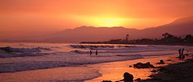
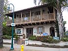
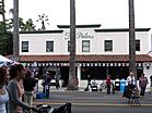
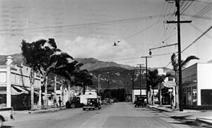
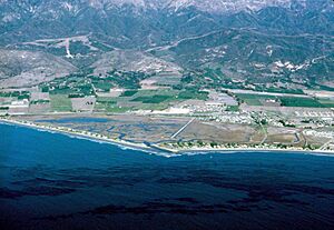
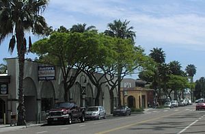
Top: Carpinteria State Beach; bottom: downtown.
|
|||
|
|||
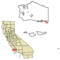
Location of Carpinteria in Santa Barbara County, California.
|
|||
| Country | United States | ||
| State | California | ||
| County | Santa Barbara | ||
| Incorporated | September 28, 1965 | ||
| Named for | The carpentry shops in the former Chumash settlement of Mishopshno ("Correspondence") | ||
| Area | |||
| • Total | 9.27 sq mi (24.02 km2) | ||
| • Land | 2.59 sq mi (6.70 km2) | ||
| • Water | 6.68 sq mi (17.31 km2) 72.11% | ||
| Elevation | 33 ft (10 m) | ||
| Population
(2020)
|
|||
| • Total | 13,264 | ||
| • Density | 5,125.19/sq mi (1,978.51/km2) | ||
| Time zone | UTC-8 (Pacific) | ||
| • Summer (DST) | UTC-7 (PDT) | ||
| ZIP codes |
93013-93014
|
||
| Area code | 805 | ||
| FIPS code | 06-11446 | ||
| GNIS feature IDs | 1652684, 2409990 | ||
| GATV | Channel 18 | ||
Carpinteria (pronounced "car-pin-tuh-REE-uh") is a small city by the sea in Santa Barbara County, California. Its name comes from the Spanish word Carpintería, which means "Carpentry shop."
This city is part of the Central Coast region of California. In 2020, about 13,264 people lived there. Carpinteria is well-known for its great surfing spots. Since 1912, it has proudly used the slogan "World's Safest Beach."
Contents
History of Carpinteria
Long ago, before Europeans arrived, the Chumash lived in a village called Šujtu where Carpinteria is now.
In 1769, Spanish explorers led by Portolá traveled along the coast. They found a large Chumash village near where the Carpinteria Pier stands today. The explorers noticed the Chumash people building canoes. They used natural tar, called asphalt, to seal their boats. Because of these "carpentry shops," the Spanish soldiers named the area "La Carpinteria."
You can still see natural tar seeps along the beach cliffs at Tar Pits Park. The oil platforms you might see from the shore are part of the Carpinteria Offshore Oil Field.
Exploring Carpinteria's Geography
Carpinteria is mostly located on a flat area between the Santa Ynez Mountains and the Pacific Ocean. The city covers about 2.6 square miles of land. A large part of its total area, about 6.7 square miles, is water.
North of the city, you'll find rolling hills and then the Santa Ynez Mountains. These mountains, covered in chaparral plants and cool sandstone rocks, make a beautiful background for the town. The air quality here is usually very good.
Wildlife and Nature
From December to May, you might spot seals and sea lions at the rookery (a breeding place) in the Carpinteria Bluffs. Sometimes, you can even see a gray whale swimming by.
The tidepools are full of amazing sea creatures. Look for starfish, sea anemones, crabs, snails, octopuses, and sea urchins.
Bird watchers love the Carpinteria Salt Marsh Reserve. This special area was created in 1977 to protect local birds and is managed by the University of California.
Did you know that the largest known Torrey pine tree in the world, called the Wardholme Torrey Pine, is right in downtown Carpinteria?
Carpinteria's Climate
Carpinteria has a pleasant climate. Summers are warm and dry, but not too hot. The average monthly temperatures usually stay below 71.6°F (22°C). This type of weather is known as a warm-summer Mediterranean climate.
| Climate data for Carpenteria, California | |||||||||||||
|---|---|---|---|---|---|---|---|---|---|---|---|---|---|
| Month | Jan | Feb | Mar | Apr | May | Jun | Jul | Aug | Sep | Oct | Nov | Dec | Year |
| Mean daily maximum °F (°C) | 62.9 (17.2) |
63.9 (17.7) |
64.6 (18.1) |
67.3 (19.6) |
69.0 (20.6) |
70.4 (21.3) |
73.2 (22.9) |
73.8 (23.2) |
73.6 (23.1) |
71.7 (22.1) |
67.8 (19.9) |
63.3 (17.4) |
68.5 (20.3) |
| Mean daily minimum °F (°C) | 43.2 (6.2) |
45.1 (7.3) |
47.3 (8.5) |
49.3 (9.6) |
52.4 (11.3) |
55.2 (12.9) |
58.0 (14.4) |
58.2 (14.6) |
57.1 (13.9) |
53.0 (11.7) |
47.1 (8.4) |
43.2 (6.2) |
50.8 (10.4) |
| Average precipitation inches (mm) | 4.70 (119) |
4.34 (110) |
3.29 (84) |
1.04 (26) |
0.46 (12) |
0.14 (3.6) |
0.05 (1.3) |
0.03 (0.76) |
0.09 (2.3) |
0.81 (21) |
1.22 (31) |
2.81 (71) |
18.98 (482) |
People of Carpinteria
| Historical population | |||
|---|---|---|---|
| Census | Pop. | %± | |
| 1950 | 2,864 | — | |
| 1960 | 4,998 | 74.5% | |
| 1970 | 6,982 | 39.7% | |
| 1980 | 10,835 | 55.2% | |
| 1990 | 13,747 | 26.9% | |
| 2000 | 14,194 | 3.3% | |
| 2010 | 13,040 | −8.1% | |
| 2020 | 13,264 | 1.7% | |
| 2023 (est.) | 12,711 | −2.5% | |
| U.S. Decennial Census | |||
In 2010, Carpinteria had a population of 13,040 people. About 71.7% of the people were White. Many residents, about 48.7%, were of Hispanic or Latino background.
The city had 4,759 households. About 31.7% of these households had children under 18. The average household had about 2.74 people.
In 2000, the median income for a household was $47,729. This means half of the households earned more than this amount, and half earned less. The median income for families was $54,849.
Carpinteria's Economy
Carpinteria is home to some interesting companies. ProCore Technologies, which makes software for managing construction projects, has its main office here.
Every year since 1987, Carpinteria hosts the California Avocado Festival. This popular event happens on the first weekend of October. Over 80,000 people come to enjoy avocado products and goods made by local artists. The city also has the Carpinteria Arts Center.
Just outside the city, you'll find the Santa Barbara Polo Club. It's one of the most important horseback riding polo fields in the country.
Pete's Living, a company that sells organic produce, is also based in Carpinteria.
Major Employers
Here are some of the biggest employers in Carpinteria:
- Procore Technologies
- Agilent
- Carpinteria Unified School District
- NuSil Technology
- Gigavac
- Bega US
- AGIA, Inc.
- Continental Auto Systems
- Plan Member
Education in Carpinteria
The Carpinteria Unified School District serves the city of Carpinteria. It also includes the nearby community of Summerland.
The district has:
- One high school: Carpinteria High School
- One middle school: Carpinteria Middle School
- Four public elementary schools, including an alternative school
- Two alternative high schools: Rincon High School and Foothill Alternative High
Other schools in the area include:
- Howard Carden School (private, pre-K to 8th grade)
- Carpinteria Christian School (K-8)
- Cate School (private preparatory school)
- Pacifica Graduate Institute (a graduate school offering master's and PhD programs)
Getting Around Carpinteria
U.S. Route 101 is a major highway that goes through Carpinteria. It connects the city to places like Los Angeles and Santa Barbara.
State Route 150 and State Route 192 also pass through parts of Carpinteria. They offer connections to other nearby towns.
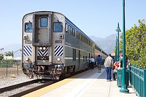
The Carpinteria Amtrak Station is served by Amtrak's Pacific Surfliner train. This train travels between San Luis Obispo in the north and Los Angeles and San Diego in the south.
Local bus service in Carpinteria is provided by the MTD. You can also find commuter bus services to Ventura and Los Angeles.
Famous People from Carpinteria
Many well-known people have lived in or have connections to Carpinteria:
- Ichak Adizes, a business expert
- David Binney, a musician
- Maxwell Caulfield, an actor
- Kevin Costner, a famous actor
- Warren Christopher, a former U.S. Secretary of State
- Ellen DeGeneres, a comedian and talk show host
- Susan Flannery, an actress
- Chris Gocong, a football player
- Jesse James, an actor
- Mila Kunis, an actress
- Ashton Kutcher, an actor
- Dennis Miller, a comedian
- Alan Thicke, an actor and TV host
- Robert Zemeckis, a film director
See also
 In Spanish: Carpintería (California) para niños
 | Emma Amos |
 | Edward Mitchell Bannister |
 | Larry D. Alexander |
 | Ernie Barnes |


