Santa Barbara Island facts for kids
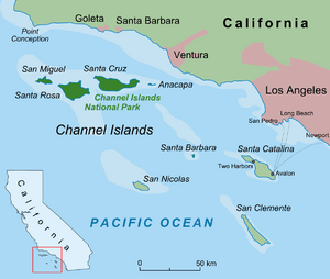
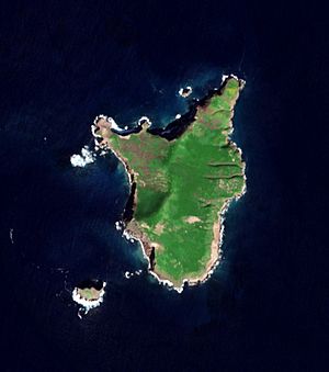
Santa Barbara Island (in Spanish: Isla de Santa Bárbara; in Tongva: Tchunashngna) is a small island. It is part of the Channel Islands group in Southern California. This island is a protected area within Channel Islands National Park. Its ocean environment is also part of the Channel Islands National Marine Sanctuary.
Contents
Island Location and Size
This island is about 38 miles (61 km) away from the Palos Verdes Peninsula coast. This area is in Los Angeles County, Southern California. It is near Ventura County and west of Greater Los Angeles.
Santa Barbara Island is the smallest of the eight Channel Islands. It covers about 1 square mile (640 acres). It is also the most southern island in the Channel Islands National Park. The highest point on the island is Signal Hill, which is 634 feet (193 meters) tall.
Even though it is closer to Ventura County and Los Angeles County, the island belongs to Santa Barbara County. It is the only one of the four southern Channel Islands that is part of the Channel Islands National Park. The park also includes all four northern islands. The island has no people living on it.
Because it is so small, you usually cannot see it from the mainland. You can only see it on very clear days, usually in winter. It also appears as a dark shape against the sky during sunset.
Island Formation and Rocks
Santa Barbara Island is not a volcano. However, it is mostly made of volcanic rocks called basalt. These rocks formed during the Miocene time period. They are mixed with ocean sediments.
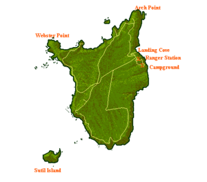
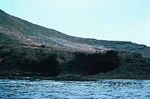
The island's steep cliffs show that it is one of the younger Channel Islands. It has at least six marine terraces. These are flat areas that show the land has moved up and down many times. Arch Point, on the northeast side, is a 130-foot (40 m) arch. It was formed by ocean waves wearing away weaker rock.
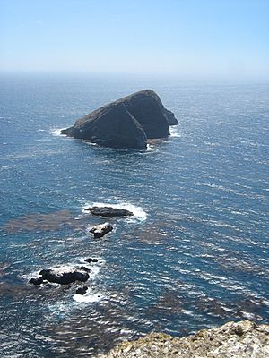
Near the island, there are two named rocks in the ocean. Sutil Island is off the southwest end and is 12 acres (4.9 hectares) big. Shag Rock is off the northern shore and is 1 acre (0.40 hectares) in size.
Island History
Native American groups, likely the Chumash and Tongva, lived on Santa Barbara Island at different times for thousands of years. Scientists have found old sites on the island that are up to 4,000 years old. The island might have been a stopping point for travelers going between the mainland and other Channel Islands.
Spanish explorer Sebastián Vizcaíno named the island. He saw it on December 4, 1602. This day is a special day in the Christian calendar for Saint Barbara. The U.S. National Geodetic Survey mapped the island in the 1850s.
Fishermen and seal hunters lived on the island without permission for a while. One of them was H. Bay Webster. Later, the government rented the island to J.G. Howland in 1909 for five years. Alvin Hyder then took over the next five-year lease. From 1916, the Hyder brothers, Alvin, Clarence, and Cleve, lived there with their families. They raised sheep until 1922. The last people to rent the island before it became a national monument in 1938 were Arthur McLelland and Harry Cupit, from 1929 to 1932.
In 1852, Charles Melville Scammon hunted northern elephant seals and sea lions on Santa Barbara Island. In 1934, a large ship called the California stayed near the island for a week. It processed blue, fin, and sperm whales caught by its smaller whale-hunting boats.
The United States Lighthouse Board put a beacon (a light for ships) on the northwest side of the island in 1928. A second beacon was added to the southwest corner in 1934. The United States Coast Guard later took over their care. In 1980, they replaced the northwest tower with a steel tower that uses solar power. From 1942 to 1946, the United States Navy built a Coastal Lookout Station on the island. In the 1960s, they built a photo-tracking station. However, they left the island by the mid-1960s.
Island Wildlife
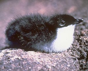
Santa Barbara Island is home to many animals. It has a large area where sea lions gather. It also has many places where seabirds build their nests. It is home to the biggest breeding group of Scripps's murrelet, a seabird that is considered threatened. This bird is vulnerable because most of its breeding happens on this small, isolated island.
Fourteen types of birds nest on the island every year. These include the horned lark, orange-crowned warbler, and house finch. Other birds found here are the brown pelican, storm petrels, Guadalupe murrelet, and cormorants. You can find sea lions, harbor seals, and northern elephant seals along the shoreline.
Island Plants
The Santa Barbara Island live-forever (Dudleya traskiae) is a special succulent plant. It grows only on this island. A type of St. Catherine's lace buckwheat (Eriogonum giganteum), called Eriogonum giganteum var. compactum, is also unique to Santa Barbara Island. It is very rare there.
See also
In Spanish: Isla Santa Bárbara (California) para niños
 | George Robert Carruthers |
 | Patricia Bath |
 | Jan Ernst Matzeliger |
 | Alexander Miles |


