
Lemoore, California facts for kids
Quick facts for kids
Lemoore, California
|
|
|---|---|
| City of Lemoore | |

Location of Lemoore in Kings County, California.
|
|

Lemoore, California
Location in the United States
|
|
| Country | |
| State | |
| County | |
| Incorporated | July 4, 1900 |
| Government | |
| • Type | Council-Manager |
| Area | |
| • Total | 8.81 sq mi (22.83 km2) |
| • Land | 8.81 sq mi (22.83 km2) |
| • Water | 0.00 sq mi (0.00 km2) 0% |
| Elevation | 230 ft (70 m) |
| Population
(2020)
|
|
| • Total | 27,038 |
| • Estimate
(2019)
|
26,725 |
| • Density | 3,069.0/sq mi (1,184.32/km2) |
| Time zone | UTC−8 (Pacific (PST)) |
| • Summer (DST) | UTC−7 (PDT) |
| ZIP codes |
93245, 93246
|
| Area code(s) | 559 |
| FIPS code | 06-41152 |
| GNIS feature IDs | 1660905, 2410819 |
Lemoore is a city in Kings County, California, United States. It was once known as La Tache and Lee Moore's. Lemoore is about 7.5 miles (12 km) west of Hanford. It sits at an elevation of 230 feet (70 meters).
Lemoore is part of the Hanford-Corcoran Metropolitan area. In 2010, its population was 24,531. By 2019, it was estimated to be 26,725 people. The city is also home to Naval Air Station Lemoore. This is a large base for F-18 and F-35 fighter jets.
Contents
History of Lemoore
Dr. Lovern Lee Moore first settled in this area in April 1871. At that time, it was part of western Tulare County, California. His home was near the northern edge of Tulare Lake. This lake was once one of the largest freshwater bodies in the US.
The land was very rich and good for farming. Rivers like the Kings River brought fertile soil from the Sierras. Water was easy to find by digging shallow wells. Farmers mainly raised sheep and grew grains.
Building a Community
Early settlers were quite isolated. They had to travel far to get mail or supplies. Dr. Lee Moore had a vision for a new community. He wanted to bring the farm families together. He hoped to get a post office and a local business center. He also wanted to attract the railroad.
In 1872, Dr. Moore planned a 10-acre (4-hectare) area for homes and businesses. He named streets after other pioneer families. Land was sold at auctions, with lots costing between $75 and $150. One business lot sold for $600, which was a very high price back then.
New homes and businesses started to appear. However, the community still needed a school and a post office.
Naming the Town
Dr. Moore asked the U.S. Post Office Department for a post office in 1872. His request was approved in 1873. It was common to name towns after their founders. The post office opened in 1875.
The U.S. Post Office did not like the name "Latache." So, around the 1920s, they named the new post office "Lemoore." This name came from combining "Lee Moore" and dropping one "e." That is how the community got its name.
In 1873, Mr. Armstrong gave 2 acres (0.8 hectares) of land for the first school. It was a simple wooden building. It was finished and opened with a country dance in December 1873.
The Railroad Arrives
The railroad came to what is now Kings County in 1877. At first, Grangeville was the biggest town. But the railroad decided to bypass Grangeville and go through Hanford instead. Lemoore had grown a lot by then. Dr. Moore's early planning likely helped attract the railroad.
The train line was built through Lemoore in 1877. It ran next to Front Street, which is now called E Street. This changed where businesses were located in town. E Street and D Street became the main business areas.
Dr. Lee Moore passed away on September 11, 1898. He had helped thousands of new residents settle in the Lemoore area.
Growth and Challenges
By 1883, Lemoore had a flour mill. It was an important place for shipping wheat and wool. Later, it became a center for fruit. However, many fires slowed its early growth.
Many early settlers were educated people. Lemoore became known for its literary and musical achievements. There was even a long-lasting literary society.
In 1893, Tulare County was divided into two areas by the state. Western Tulare County became Kings County. There was a competition between Hanford and Lemoore to become the county seat. Hanford had more people and two railroad lines, so it won. The County Courthouse was built in Hanford.
Lemoore officially became an incorporated city on July 4, 1900. This meant it would be governed by an elected City Council. People in Lemoore have always been very interested in local politics.
In 1928, a 9-hole golf course was designed and opened. In 1991, the city updated it to an 18-hole course.
Military Presence
In 1941, the Lemoore Army Air Field opened. It was an Army Air Forces training field. The U.S. government bought or leased land for the Lemoore Basic Flying School.
In 1961, the Army Air Field became Naval Air Station Lemoore. This is a Naval Aviation base located 7 miles (11 km) west of Lemoore. Since 1961, it has grown to be the largest Master Jet Base in the Navy. NAS Lemoore is home to five carrier air wings. These wings mainly fly F-18 and F-35 jets.
Geography and Climate
Lemoore is located in an area that was once near the giant Tulare Lake. Maps from 1892 show that the highest water level of the lake touched Lemoore's southwest corner. Today, Lemoore Naval Air Station would have been on the west side of the lake's northern tip.
Tulare Lake was very important to the region's economy. It supported a large fishing industry. It also had a steam-powered ferry that served several towns. As the lake's water levels went down, new farmland became available. The lake no longer exists today because its water sources were diverted.
Near Lemoore, there are large water control systems. These systems manage the flow of water from the Kings River. For example, in flood years, the Kings River can be sent west. This prevents Tulare Lake from refilling and flooding the area.
Other towns built near the old Tulare Lake shoreline include Kettleman City and Alpaugh. You can still see the lines of the old lake shores in satellite images.
Climate
Lemoore has a semi-arid climate. This means it is generally dry with hot summers and mild winters.
Population and People
| Historical population | |||
|---|---|---|---|
| Census | Pop. | %± | |
| 1880 | 463 | — | |
| 1890 | 651 | 40.6% | |
| 1910 | 1,000 | — | |
| 1920 | 1,355 | 35.5% | |
| 1930 | 1,399 | 3.2% | |
| 1940 | 1,711 | 22.3% | |
| 1950 | 2,153 | 25.8% | |
| 1960 | 2,561 | 19.0% | |
| 1970 | 4,219 | 64.7% | |
| 1980 | 8,832 | 109.3% | |
| 1990 | 13,622 | 54.2% | |
| 2000 | 19,712 | 44.7% | |
| 2010 | 24,531 | 24.4% | |
| 2019 (est.) | 26,725 | 8.9% | |
| U.S. Decennial Census | |||
2010 Census Information
In 2010, Lemoore had a population of 24,531 people. Most of the people (99.9%) lived in homes. The population density was about 2,880 people per square mile (1,112 per km²).
The city is home to a diverse group of people. About 56.8% of residents were White. About 6.4% were African American, and 8.2% were Asian. Native Americans made up 1.4% of the population. People of Hispanic or Latino background made up 40.0% of the population.
There were 8,196 households in Lemoore. About 46.2% of these households had children under 18. The average household had about 3 people. The average family had about 3.4 people.
The population included many young people. About 30.8% were under 18 years old. About 12.4% were between 18 and 24. The median age in Lemoore was 28.6 years.
In 2018, it was estimated that 17.2% of the population lived below the poverty line. This means they had a lower income than what is needed for basic living.
2000 Census Information
In 2000, Lemoore had 21,900 people. The population density was about 2,332 people per square mile (900 per km²).
The racial makeup was 59.29% White, 7.28% African American, and 8.37% Asian. Hispanic or Latino people made up 30.50% of the population.
About 48.0% of households had children under 18. The average household size was 3.06 people. The average family size was 3.46 people.
The population was spread out by age. About 34.6% were under 18. The median age was 28 years.
In 2010, the average income for a household was $40,314. For a family, it was $44,006. About 13.4% of the population lived below the poverty line. The unemployment rate in November 2016 was 8.3%.
Economy
Lemoore has several major employers. These include:
- Naval Air Station Lemoore
- Tachi Palace (a casino and resort)
- Leprino Foods (a dairy company)
- Olam International (a food and agriculture company)
Transportation
Amtrak Thruway bus service connects Lemoore to other cities. Bus route 18 stops at 300 E Street daily. It connects to Visalia to the east and Santa Maria to the west.
Education
Lemoore has several school districts serving its students.
Elementary and Junior High Schools
The Lemoore Union Elementary School District provides education for kindergarten through eighth grade.
- Cinnamon Elementary
- P.W. Engvall Elementary
- Lemoore Elementary
- Meadow Lane Elementary
- Liberty Middle School
- University Charter School
The Central Union School District serves areas outside the city limits.
- Akers Elementary (at NAS Lemoore)
- Neutra Elementary (at NAS Lemoore), designed by architect Richard J. Neutra
- Central Union Elementary School
- Stratford Elementary School
The Island Union Elementary School District serves the northwest area of Lemoore.
- Island Elementary School (kindergarten through eighth grade)
High Schools
The Lemoore Union High School District provides public secondary education.
- Lemoore Union High School
- Donald C. Jamison High School
- Lemoore Middle College High School
- Gundacker Community Day School
- Yokuts High School (at the Santa Rosa Rancheria)
Higher Education
West Hills College Lemoore is a community college in Lemoore.
Private Schools
- Kings Christian School (pre-kindergarten through high school)
- Mary Immaculate Queen School (kindergarten through eighth grade)
Media
Lemoore used to have a local newspaper called The Lemoore Advance, but it no longer exists.
KGAR, 93.3 FM, is a low-power FM radio station. It is run by Lemoore High School students on the school campus.
Notable People
Many interesting people have connections to Lemoore:
- David Ausberry – a professional football player for the Oakland Raiders.
- Michael A. Baker – a retired captain in the U.S. Navy and former NASA astronaut. He graduated from Lemoore Union High School in 1971.
- Eric Fox – a former outfielder for the Oakland Athletics baseball team.
- Lorenzo Neal – a former NFL fullback. He played for Lemoore High School and was a state champion wrestler.
- Chris Pendleton – a wrestler who won two NCAA National Wrestling Championships.
- Steve Perry – the lead singer of the band Journey. He moved to Lemoore as a teenager and developed his musical skills here.
- Daniel Rhoads – an early California pioneer and rancher. He helped rescue the Donner Party. His historic building, El Adobe de los Robles Rancho, is north of Lemoore.
- Tommie Smith – a sprinter who ran track at Lemoore High School. He set a world record in the 200m at the 1968 Summer Olympics. He is famous for his Black Power salute during the medal ceremony.
- Zilpha Keatley Snyder – a noted author of books for children and young adults. She was born in Lemoore and wrote 43 books. Three of her books won Newbery Honor awards.
Images for kids
-
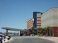
Tachi Palace Casino

See also
 In Spanish: Lemoore para niños
