Buena Vista Lake facts for kids
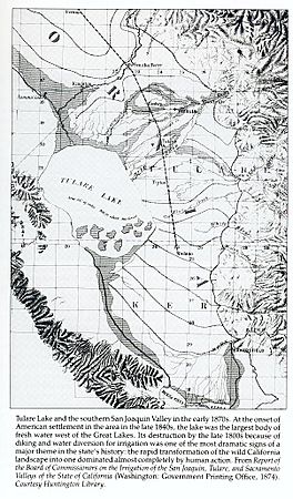
Buena Vista Lake was once a large freshwater lake in Kern County, California. It was located in the southern part of the San Joaquin Valley. This lake was an important part of the Tulare Lake basin.
Quick facts for kids Buena Vista Lake |
|
|---|---|
 |
|
| Location | San Joaquin Valley Kern County, California |
| Coordinates | 35°11′31″N 119°17′40″W / 35.19191°N 119.294557°W |
| Type | dry lake |
| Primary inflows | Kern River Connecting Slough |
| Basin countries | United States |
| Surface area | 60 to 150 square miles (160 to 390 km2) |
| Average depth | 3.3 m (11 ft) |
| Surface elevation | 88 m (289 ft) |
Contents
What Was Buena Vista Lake?
Buena Vista Lake was the second biggest lake in the Tulare Lake basin. It was a freshwater lake. The lake got its water from the Kern River. The Kern River flowed southwest through the area that is now Bakersfield, California. Its water reached Buena Vista Lake through different channels. Some water also went into Kern Lake first. Then it flowed into Buena Vista Lake through a channel called Connecting Slough.
How Were the Lakes Connected?
When Buena Vista Lake had too much water, it would overflow. First, the extra water would flow back into Kern Lake. This made Kern Lake and Buena Vista Lake become one very large lake. If this bigger lake still had too much water, it would flow out. The water would go through the Buena Vista Slough and the Kern River channel. It would pass through marshland and Goose Lake. Finally, it would reach Tulare Lake.
What's There Now?
Today, Buena Vista Lake is no longer a large lake. Instead, you can find two smaller lakes in its old lakebed. These are Lake Webb and Lake Evans. They are located on what used to be the northern shore of Buena Vista Lake.
The Tulamniu Indian Site
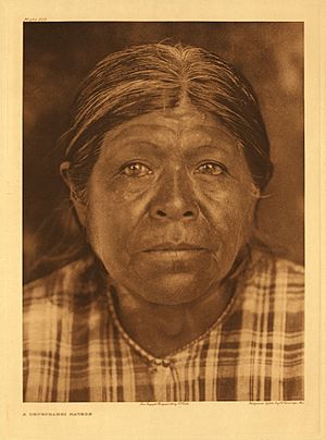
On the southern shores of Buena Vista Lake, there was once a village. This was the home of the Tulamniu Indians. They spoke a language called Buena Vista Yokuts. This important historical place is now a California Historical Landmark. Its official number is 374.
A Special Historical Landmark
The California Historical Landmark sign tells us more about this site: NO. 374 TULAMNIU INDIAN SITE - The old Yokuts village of Tulamniu was named Buena Vista by Spanish Commander Fages in 1772. Fr. Zalvidea again recorded the site in 1806. This village was occupied for several centuries, and in 1933-34 its site was excavated by the Smithsonian Institution.
This means that the Tulamniu village was very old. Spanish explorers first wrote about it in 1772. It was a home for people for hundreds of years. In the 1930s, scientists from the Smithsonian Institution studied the site. They dug there to learn more about the ancient village.
 | Toni Morrison |
 | Barack Obama |
 | Martin Luther King Jr. |
 | Ralph Bunche |


