Arvin, California facts for kids
Quick facts for kids
Arvin, California
|
|||
|---|---|---|---|
| City of Arvin | |||
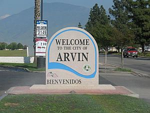
"Welcome to Arvin" sign
|
|||
|
|||
| Mottoes:
"A Garden in the Sun", "The Best Place on Earth"
|
|||
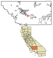
Location of Arvin in Kern County, California.
|
|||
| Country | United States | ||
| State | California | ||
| County | Kern | ||
| Incorporated | December 21, 1960 | ||
| Named for | Arvin Richardson | ||
| Area | |||
| • Total | 4.82 sq mi (12.48 km2) | ||
| • Land | 4.82 sq mi (12.48 km2) | ||
| • Water | 0.00 sq mi (0.00 km2) 0% | ||
| Elevation | 449 ft (137 m) | ||
| Population
(2020)
|
|||
| • Total | 19,495 | ||
| • Density | 4,045.45/sq mi (1,561.84/km2) | ||
| Time zone | UTC-8 (Pacific) | ||
| • Summer (DST) | UTC-7 (PDT) | ||
| ZIP code |
93203
|
||
| Area code | 661 | ||
| FIPS code | 06-02924 | ||
| GNIS feature IDs | 1652666, 2409738 | ||
Arvin is a city in Kern County, California, United States. It is located about 15 miles (24 km) southeast of Bakersfield. The city sits at an elevation of 449 feet (137 meters) above sea level.
In 2007, the EPA noted that Arvin had some of the highest levels of smog in the U.S. Smog is a type of air pollution. The city's air quality often went beyond safe limits.
Wired phone numbers in Arvin usually start with (661) 854-xxxx or (661) 855-xxxx. The main ZIP code for the area is 93203.
Contents
History of Arvin
Property sales for lots in what is now Arvin began in 1906. The Arvin Post Office opened in 1914. The community officially became a city in 1960.
How Arvin Got Its Name
The city was named after Arvin Richardson. He was the son of one of the first families to settle in the area from San Bernardino. Birdie Heard helped get the post office added in 1914. She suggested names like Bear Mountain, Walnut, and Arvin. Officials in Washington, D.C., chose Arvin because no other place in California had that name.
Birdie Heard was also the city's first postmaster. She first ran the post office from her living room. Later, it moved to the general store owned by the Staples family. This store also served as the area's first informal library. An official branch of the Kern County Library system was set up in 1927.
Key Developments and Events
The Mountain View Oil Field was found under Arvin and nearby areas in 1933. It grew a lot in the 1930s. Many oil wells still surround the town today.
In the 1930s and 1940s, the area east of Arvin became popular for gliding and soaring. These events were so important that the National Soaring Museum recognized them as a National Landmark of Soaring in 2000.
The local newspaper, Arvin Tiller, started in 1939. Arvin High School was built in 1949. The city faced a major challenge on July 21, 1952. A large earthquake, the M7.3 1952 Kern County earthquake, almost destroyed Arvin. The city also had damage from a dust storm on December 20, 1977.
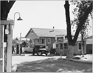
The Arvin Migratory Labor Camp opened in 1937. It was the first farm labor camp run by the U.S. government. This camp was part of the New Deal programs. These programs helped people during the Great Depression. The camp was seen as a great example of its kind.
Geography and Climate
Arvin covers a total area of about 4.9 square miles (12.7 square kilometers). All of this area is land.
Arvin's Climate
Arvin has a semi-arid climate. This means it is generally dry with hot summers and mild winters. It doesn't get much rain.
| Climate data for Arvin, California | |||||||||||||
|---|---|---|---|---|---|---|---|---|---|---|---|---|---|
| Month | Jan | Feb | Mar | Apr | May | Jun | Jul | Aug | Sep | Oct | Nov | Dec | Year |
| Record high °F (°C) | 80 (27) |
87 (31) |
93 (34) |
101 (38) |
110 (43) |
114 (46) |
118 (48) |
114 (46) |
115 (46) |
103 (39) |
91 (33) |
79 (26) |
118 (48) |
| Mean maximum °F (°C) | 70 (21) |
77 (25) |
84 (29) |
90 (32) |
99 (37) |
106 (41) |
109 (43) |
108 (42) |
105 (41) |
95 (35) |
80 (27) |
70 (21) |
110 (43) |
| Mean daily maximum °F (°C) | 59.8 (15.4) |
66.6 (19.2) |
71.9 (22.2) |
77.6 (25.3) |
86.9 (30.5) |
95.2 (35.1) |
100.1 (37.8) |
100.1 (37.8) |
95.1 (35.1) |
82.3 (27.9) |
68.8 (20.4) |
58.6 (14.8) |
80.2 (26.8) |
| Daily mean °F (°C) | 49.2 (9.6) |
54.8 (12.7) |
58.0 (14.4) |
63.1 (17.3) |
71.1 (21.7) |
78.6 (25.9) |
84.8 (29.3) |
83.5 (28.6) |
77.9 (25.5) |
67.8 (19.9) |
56.5 (13.6) |
48.4 (9.1) |
66.1 (19.0) |
| Mean daily minimum °F (°C) | 38.6 (3.7) |
42.3 (5.7) |
46.1 (7.8) |
50.5 (10.3) |
57.8 (14.3) |
64.3 (17.9) |
69.6 (20.9) |
68.8 (20.4) |
62.7 (17.1) |
53.5 (11.9) |
44.1 (6.7) |
38.1 (3.4) |
53.0 (11.7) |
| Mean minimum °F (°C) | 28.0 (−2.2) |
30.7 (−0.7) |
34.6 (1.4) |
38.5 (3.6) |
45.3 (7.4) |
51.6 (10.9) |
59.8 (15.4) |
58.7 (14.8) |
51.1 (10.6) |
41.3 (5.2) |
31.9 (−0.1) |
27.3 (−2.6) |
25.5 (−3.6) |
| Record low °F (°C) | 17 (−8) |
21 (−6) |
24 (−4) |
30 (−1) |
35 (2) |
38 (3) |
44 (7) |
47 (8) |
41 (5) |
29 (−2) |
24 (−4) |
11 (−12) |
11 (−12) |
| Average precipitation inches (mm) | 1.27 (32) |
1.30 (33) |
1.38 (35) |
0.60 (15) |
0.29 (7.4) |
0.06 (1.5) |
0.01 (0.25) |
0.00 (0.00) |
0.06 (1.5) |
0.29 (7.4) |
0.57 (14) |
1.18 (30) |
7.01 (177.05) |
| Source: NOAA | |||||||||||||
Population and People
| Historical population | |||
|---|---|---|---|
| Census | Pop. | %± | |
| 1940 | 4,042 | — | |
| 1950 | 5,007 | 23.9% | |
| 1970 | 5,199 | — | |
| 1980 | 6,863 | 32.0% | |
| 1990 | 9,286 | 35.3% | |
| 2000 | 12,956 | 39.5% | |
| 2010 | 19,304 | 49.0% | |
| 2020 | 19,495 | 1.0% | |
| US Census | |||
Arvin has grown quite a bit over the years. In 2010, the population was 19,304 people. This was a big jump from 12,956 people in 2000. By 2020, the population was 19,495.
Who Lives in Arvin?
In 2010, most people in Arvin were of Hispanic or Latino background, making up about 92.7% of the population. The city is a mix of different cultures and backgrounds.
- About 53.1% of residents identified as White.
- Around 1.0% were African American.
- About 1.2% were Native American.
- Around 0.8% were Asian.
- About 39.7% were from other races.
- About 4.2% were from two or more races.
The average age in Arvin in 2010 was 24.0 years old. Many young people and families live in the city.
Economy of Arvin
Arvin's economy mainly depends on agriculture. This means that many jobs are related to farming. Because of this, the number of people working can change with the seasons. For example, in March 2011, nearly 42% of Arvin's residents were out of work. This was the highest rate in Kern County at that time.
Education in Arvin
Students in Arvin are served by two main school districts. These are the Arvin Union School District and the Kern High School District. Other nearby districts also serve some students.
Arvin Union School District
This district serves students from preschool up to eighth grade. It includes several schools:
- Sierra Vista Elementary School
- Bear Mountain Elementary School
- El Camino Real Elementary School
- Haven Drive Middle School
- Arvin State Preschool
Sierra Vista and Haven Drive are the oldest schools in Arvin. The district also helps the community with the Arvin Family Resource Center.
Kern High School District
The Kern High School District serves students in grades 9 through 12. It operates Arvin High School. This high school also welcomes students from the surrounding rural areas and the nearby town of Lamont.
See also
 In Spanish: Arvin para niños
 | Madam C. J. Walker |
 | Janet Emerson Bashen |
 | Annie Turnbo Malone |
 | Maggie L. Walker |


