Firebaugh, California facts for kids
Quick facts for kids
Firebaugh, California
|
|||
|---|---|---|---|
| City of Firebaugh | |||
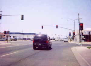
Northbound N St. (Highway 33) at 13th Street in 2006.
|
|||
|
|||
| Motto(s):
"The Jewel of the San Joaquin!"
|
|||
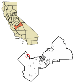
Location of Firebaugh in Fresno County, California.
|
|||
| Country | United States | ||
| State | California | ||
| County | Fresno | ||
| Incorporated | September 17, 1914 | ||
| Named for | Andrew D. Firebaugh | ||
| Area | |||
| • Total | 3.57 sq mi (9.25 km2) | ||
| • Land | 3.52 sq mi (9.11 km2) | ||
| • Water | 0.06 sq mi (0.14 km2) 1.62% | ||
| Elevation | 151 ft (46 m) | ||
| Population
(2020)
|
|||
| • Total | 8,096 | ||
| • Density | 2,268/sq mi (875.2/km2) | ||
| Time zone | UTC-8 (PST) | ||
| • Summer (DST) | UTC-7 (PDT) | ||
| ZIP code |
93622
|
||
| Area code(s) | 559 | ||
| FIPS code | 06-24134 | ||
| GNIS feature IDs | 277514, 2410507 | ||
Firebaugh (fai-YER-bau) is a city located in Fresno County, California, in the United States. It's about 38 miles (61 km) west of the city of Fresno, right by the San Joaquin River.
Highway 33 and a train track called the San Joaquin Valley Railroad go right through the center of Firebaugh. You'll often see a tall water tank in the downtown area with the city's name painted on it.
Firebaugh is about 151 feet (46 meters) above sea level. In 2010, the city had 7,549 people living there. This was more than the 5,743 people counted in 2000.
Every year, Firebaugh hosts a fun event called the Cantaloupe Round-Up Festival in Dunkle Park. This festival celebrates the time when cantaloupes are ready to be picked, usually in late July. It's a great way to help local businesses.
Contents
History of Firebaugh
The city of Firebaugh used to be called Firebaugh's Ferry. It got its name from Andrew D. Firebaugh, who was an important businessman in the area. He was born in Virginia in 1823.
During the California Gold Rush, Andrew Firebaugh ran a famous ferry boat. This boat helped people cross the San Joaquin River. In 1857, he built a toll road for wagons. This new road replaced an older horse trail. The trail went from what is now Bell Station over Pacheco Pass.
Firebaugh was also a stop on the Butterfield Overland Stage route. This was a famous stagecoach service. The Firebaugh's Ferry post office was open from 1860 to 1862. Later, the Firebaugh post office opened in 1865.
In the 1880s, the land around Firebaugh was part of a huge ranch. This ranch belonged to the Miller and Lux Company. They had a very large cattle farm that stretched from what is now Dos Palos to Mendota.
Firebaugh officially became a city in 1914.
Geography and Climate
According to the United States Census Bureau, Firebaugh covers a total area of about 3.5 square miles (9.1 square kilometers). Most of this area is land. Only a small part, about 0.1 square miles (0.14 square kilometers), is water.
Local Climate
Firebaugh has a semi-arid climate. This means it gets very little rain. On climate maps, this type of weather is often shown as "BSk".
Population and People
| Historical population | |||
|---|---|---|---|
| Census | Pop. | %± | |
| 1930 | 506 | — | |
| 1940 | 704 | 39.1% | |
| 1950 | 821 | 16.6% | |
| 1960 | 2,070 | 152.1% | |
| 1970 | 2,517 | 21.6% | |
| 1980 | 3,740 | 48.6% | |
| 1990 | 4,429 | 18.4% | |
| 2000 | 5,743 | 29.7% | |
| 2010 | 7,549 | 31.4% | |
| 2019 (est.) | 8,296 | 9.9% | |
| U.S. Decennial Census | |||
Population in 2010
In 2010, Firebaugh had a population of 7,549 people. Most of these people, 99.8%, lived in homes. Only a very small number lived in group housing.
The city was made up of different groups of people. About 62.5% were White, 0.9% were African American, and 1.5% were Native American. About 31.4% were from other races. A large part of the population, 91.2%, identified as Hispanic or Latino.
There were 1,920 households in Firebaugh. Many of these households, 62.9%, had children under 18 living in them. The average household had about 3.93 people. The average family had about 4.17 people.
The median age in Firebaugh was 26.4 years old. This means half the people were younger than 26.4 and half were older. About 36% of the population was under 18 years old.
Population in 2000
In 2000, Firebaugh had 5,743 people living in 1,418 households. The average household had 4.01 people, and the average family had 4.28 people.
About 39.3% of the population was under 18 years old. The median age was 25 years. This means Firebaugh had a relatively young population.
The median income for a household was $31,533. For families, the median income was $33,018. The income per person in the city was $9,290. About 22.5% of the population lived below the poverty line.
Education in Firebaugh
Students in Firebaugh attend schools in the Firebaugh-Las Deltas Unified School District. This district has schools for all ages. There is a preschool, a primary school, an elementary school, and a middle school called Firebaugh Middle.
For high school, students go to Firebaugh High School. There is also an alternative school called El Puente High School. Firebaugh High School is known for offering many Regional Occupational Program classes. These classes help students learn job skills. The school also has good results on AP exams. The sports teams at Firebaugh High are called the "Eagles".
Famous People from Firebaugh
- Josh Allen – He is a professional NFL quarterback who plays for the Buffalo Bills.
- Traci Des Jardins – She is a very famous chef and owns several restaurants.
- Richard Yniguez – He is an actor.
See also
 In Spanish: Firebaugh para niños
 | May Edward Chinn |
 | Rebecca Cole |
 | Alexa Canady |
 | Dorothy Lavinia Brown |


