Lava Butte facts for kids
Quick facts for kids Lava Butte |
|
|---|---|
 |
|
| Highest point | |
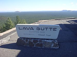
| Elevation | 5,023 ft (1,531 m) NAVD 88 |
| Prominence | 509 ft (155 m) |
| Geography | |
| Topo map | USGS Lava Butte |
| Geology | |
| Age of rock | About 7,000 years |
| Mountain type | Cinder cone |
| Last eruption | About 7,000 years ago |
| Climbing | |
| Easiest route | Road |
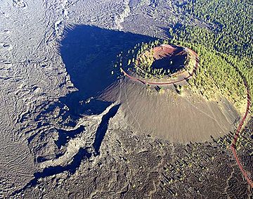
Lava Butte is a cool cinder cone volcano in central Oregon, United States. It's located right next to U.S. Route 97, between the towns of Bend, Oregon and Sunriver, Oregon. This cinder cone is part of a group of smaller volcanoes found on the side of Newberry Volcano. Newberry is a huge shield volcano that rises up to the southeast.
Lava Butte has a crater at its top. This crater is about 60 feet (18 meters) deep on its south side. From the 5,020-foot (1,530-meter) summit on the north side, it's about 160 feet (49 meters) deep. Lava Butte is a special part of the Newberry National Volcanic Monument.
How Lava Butte Was Formed
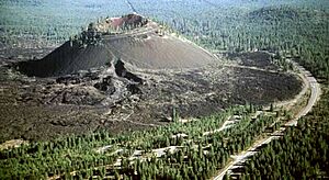
Like other cinder cones nearby, Lava Butte only erupted once. Geologists believe this happened about 7,000 years ago. The eruption started when a crack in the ground opened up. Hot cinders, which are small pieces of volcanic rock, shot out. These cinders piled up to form the cone we see today.
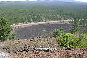
Next, a river of hot basalt lava flowed from the bottom of the volcano. This lava covered a huge area to the west. Even today, not many plants grow on this dark lava. The lava flows reached the Deschutes River, about 2.5 miles (4 kilometers) away. The lava buried the river's old path under more than 100 feet (30 meters) of rock. This blocked the river, creating a lake called Lake Benham. Eventually, the river flowed over the lava dam and carved its way through it. This drained the lake and formed the beautiful Benham Falls.
Scientists guess that most of the melted rock (magma) came out as lava flows. About 9% became the scoria that built the cone. A small amount, about 1%, turned into volcanic ash. This ash formed a thin layer that spread to the north.
People and Lava Butte
We don't know much about the very early history of Lava Butte. But we can guess that Native American people saw the eruption. They likely explored this new, tall landmark later on. White settlers who arrived in the 1800s also noticed the impressive butte.
In 1903, I.C. Russell was the first geologist to study Lava Butte. He thought it had erupted only 150 years before. Another scientist, Dr. Howel Williams, thought it was much older, but still guessed wrong at 1,000 years old. In September 1914, something funny happened. The Bend Chamber of Commerce made Lava Butte "erupt" for real! They did this to surprise a group visiting from Portland.
In 1925, a USGS geologist named Harold Stearns studied the Newberry area. He discovered a system of cracks in the ground. These cracks stretched from Lava Butte all the way to East Lake inside Newberry Caldera.
After 1901, the Great Northern Railway built train tracks through the area. The construction workers built the railway right through the rough, rocky lava flow from Lava Butte.
Lava Butte was also used for its valuable materials. In June 1926, a quarry was opened on the east side of Lava Butte. A quarry is a place where rock is dug out of the ground. The rock from here was used to pave the first highway between The Dalles and California. This road later became U.S. Route 97. In November 1929, cinders from Lava Butte were sent to Longview, Washington. They were used to help build the Longview Bridge over the Columbia River.
A United States Forest Service fire lookout tower was built on the top of Lava Butte in 1931. This tower helps spot forest fires. In early 1933, a steep, single-lane road was built. It spiraled up to the summit. Later, in June 1946, this road was made wider for two lanes. Two small parking lots were also built at the top. The road was paved in July 1950. The original lookout tower was replaced with a bigger one in 1957. It was made even larger in 1962 to include a small visitor center and museum on the first floor. In 1998, a new lookout tower was built. It looked like the original one from 1931.
In July 1966, twenty-two astronauts came to Central Oregon to train for the upcoming Moon landings. They trained at places like Lava Butte, Lava River Cave, and Newberry Crater. In May 1967, the U.S. Forest Service created the Lava Butte Geological Area. This area, covering 8,983 acres (3,635 hectares), was made to protect the cinder cone. There were plans to add fun activities and educational displays.
Construction of the Lava Lands Visitor Center began in April 1969. It is located just south of the cone. The center was officially opened in September 1975. In November 1990, the Newberry National Volcanic Monument was created. This monument includes Newberry Crater, the Lava Cast Forest Geological Area, Lava River Cave, and the Lava Butte Geological Area.
Today, from early May to mid-October, a shuttle bus takes visitors up Red Cinder Road. It goes from the Lava Lands Visitor Center to the lookout on Lava Butte. You can also hike up Red Cinder Road all year round. There's a beautiful rim trail around the top of Lava Butte that is about 0.35 miles (0.56 kilometers) long.
Images for kids
 | Valerie Thomas |
 | Frederick McKinley Jones |
 | George Edward Alcorn Jr. |
 | Thomas Mensah |


