
Niobrara River facts for kids
Quick facts for kids Niobrara River |
|
|---|---|

Niobrara River at the Nebraska Highway 7 crossing
|
|

Map of the Niobrara River (light blue)
|
|
| Native name | Ní Ubthátha khe |
| Country | United States |
| State | Wyoming, Nebraska |
| Cities | Niobrara, NE, Anncar, NE, Valentine, NE, Agate, NE, Van Tassell, WY, Lusk, WY |
| Physical characteristics | |
| Main source | Niobrara County, near Manville, Wyoming 5,500 ft (1,700 m) 42°49′15″N 104°38′50″W / 42.82083°N 104.64722°W |
| River mouth | Missouri River Knox County, near Niobrara, Nebraska 1,211 ft (369 m) 42°45′58″N 98°02′50″W / 42.76611°N 98.04722°W |
| Length | 568 mi (914 km) |
| Basin features | |
| Basin size | 11,580 sq mi (30,000 km2) |
| Tributaries |
|
The Niobrara River is a long river in the United States. It flows for about 568 miles (914 km) through the states of Wyoming and Nebraska. Its name comes from the Ponca language, Ní Ubthátha khe, which means "water spread out horizontally" or "The Wide-Spreading Water." The Niobrara River eventually flows into the much larger Missouri River.
This river is special because it flows through a very dry area called the Great Plains. Even though it's long, it doesn't carry as much water as some other rivers of its size. The river's water comes from the northern part of the Nebraska Sandhills, a small area of South Dakota, and eastern Wyoming.
Contents
River's Journey: Where it Flows
The Niobrara River starts in the High Plains of southern Niobrara County, Wyoming. At first, it's an intermittent stream, meaning it doesn't always flow with water. It then moves southeast into northwestern Nebraska.
Path Through Nebraska
The river continues southeast through the Pine Ridge area of Sioux County. It flows past Agate Fossil Beds National Monument, where many ancient animal fossils have been found. It also goes through Box Butte Reservoir.
As it moves east across northern Nebraska, the Niobrara River stays near the northern edge of the Sandhills. It flows past the town of Valentine. The Snake River joins the Niobrara about 13 miles (21 km) southwest of Valentine. Further east, the Keya Paha River also joins it. Finally, the Niobrara River meets the Missouri River in northern Knox County, near the town of Niobrara. The total area drained by the Niobrara River is about 11,580 square miles (30,000 km²).
How Much Water?
Even though the Niobrara River flows through a dry area, it has a steady flow of water. This is because about 70 percent of its water comes from the Ogallala Aquifer. This is a huge underground layer of water that seeps into the river. The other 30 percent comes from rain and snow.
The river's water levels are usually highest in the spring and early summer, from February to April. They are lowest in late summer and early fall, around August and September.
River History and Protection
The lower part of the Niobrara valley has been the traditional home of the Ponca Native American tribe for a very long time. For many years, between 1861 and 1882, a section of the Niobrara River formed the border between Nebraska and the Dakota Territory.
Niobrara National Scenic River
Since 1991, a 76-mile (122 km) part of the Niobrara River in central Nebraska has been named the Niobrara National Scenic River. This special designation helps protect the river's clean water, unique geology, fossils, wildlife, beautiful scenery, and places for recreation.
Most of the land along this scenic river is privately owned. The government works with landowners and visitors to protect the river while making sure people can still enjoy it. For example, the U.S. Fish and Wildlife Service manages 9 miles of the river that flows through the Fort Niobrara National Wildlife Refuge. They focus on keeping it wild and protecting wildlife. The National Park Service manages the other 67 miles, helping to protect the river and educate visitors.
Changes to the River: Dams
Over the years, some dams have been built on the Niobrara River and its branches. These dams help manage water, often for farming.
_2.JPG)
Box Butte Dam
The Box Butte Dam was finished in 1946. It is the only major dam directly on the Niobrara River. This dam helps water flow to about 11,670 acres (4,720 ha) of farmland.
Other Dams
The Snake River, which flows into the Niobrara, has the Merritt Dam. This dam helps water about 34,540 acres (13,980 ha) of land near Valentine, Nebraska.
The Cornell Dam was built in 1915 to make electricity. It stopped making power in 1985. Even though it's not used anymore, the dam is still there. People have studied if it should be removed, but there are concerns about releasing old sediment that has built up behind it.
Spencer Dam was the last dam on the Niobrara River that made electricity. It was built in 1927. In 2019, this dam was broken by severe flooding.
River Names in Native Languages
The Niobrara River has different names in other Native American languages:
- In the Cheyenne language, it is called Hisse Yovi Yoe, which means "surprise river."
- In Pawnee, it is Kíckatariʾ.
- In Lakota, it is Wakpá Tȟáŋka.
Images for kids
-
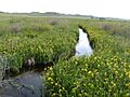
Niobrara River flowing through Agate Fossil Beds National Monument, near its headwaters.

In Spanish: Río Niobrara para niños
