Keya Paha River facts for kids
Quick facts for kids Keya Paha River |
|
|---|---|

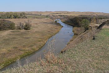
Keya Paha River near Nebraska-South Dakota border
|
|

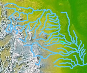
Keya Paha River in light green at right center
|
|
| Country | United States |
| State | South Dakota, Nebraska |
| Physical characteristics | |
| Main source | Todd County, South Dakota 43°13′38″N 100°23′18″W / 43.22722°N 100.38833°W |
| River mouth | Niobrara River in Boyd County, Nebraska 42°53′54″N 98°59′6″W / 42.89833°N 98.98500°W |
| Length | 127 mi (204 km) |
| Basin features | |
| Basin size | 1,710 sq mi (4,400 km2) |
The Keya Paha River (pronounced KIP-ə-haw) is a cool waterway that flows for about 127 miles (204 km) through two states in the United States: South Dakota and Nebraska. It's known for having better water quality than many other rivers in South Dakota.
Contents
What's in a Name? The River's Meaning
The name Keya Paha comes from the Dakota language. It means "turtle hill." This name specifically refers to a place called Turtle Butte. The river's name was later given to Keya Paha County, Nebraska, which the river flows through.
Where the River Starts and Ends
The Keya Paha River begins in Todd County, South Dakota, in the south-central part of South Dakota. It starts where two smaller streams, Antelope Creek and Rock Creek, join together near a town called Hidden Timber.
From there, the river generally flows southeast. It travels through Todd and Tripp counties in South Dakota. Then, it continues into Keya Paha and Boyd counties in Nebraska. The river's journey ends when it meets the Niobrara River. This meeting point is about 7 miles (11 km) west of Butte, Nebraska. The Keya Paha River flows all year round, except when it freezes over in winter.
A River's Role in History: Changing Borders
The Keya Paha River played a part in shaping state borders long ago. In 1861, the river formed part of the boundary between the Nebraska Territory and the Dakota Territory. The border followed the Keya Paha River from the 43rd parallel (an imaginary line of latitude) to where it joined the Niobrara River. Then, it followed the Niobrara River to the Missouri River.
This border arrangement lasted until 1882. At that time, the boundary was changed to follow the 43rd parallel all the way to the Missouri River. This change added parts of Keya Paha and Boyd counties to Nebraska.
Understanding River Flow: Discharge Data
Scientists measure how much water flows in a river. This measurement is called "discharge." At a special measuring station south of Naper in Boyd County, the Keya Paha River's average discharge was about 138.6 cubic feet per second (3.9 cubic meters per second).
- The highest average flow for a year was recorded in 1962, at 389.4 cubic feet per second (11.0 cubic meters per second).
- The lowest average flow for a year was in 1976, at 44.5 cubic feet per second (1.3 cubic meters per second).
- The most water ever recorded flowing at once was on July 1, 1962, when it reached 9,280 cubic feet per second (263 cubic meters per second)!
- Interestingly, from July 22 to July 30, 1976, the river's flow was recorded as zero. This means it dried up completely for a short time during that period.
 | Percy Lavon Julian |
 | Katherine Johnson |
 | George Washington Carver |
 | Annie Easley |

