Manville, Wyoming facts for kids
Quick facts for kids
Manville, Wyoming
|
|
|---|---|
 |
|

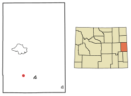
Location of Manville in Niobrara County, Wyoming
|
|
| Country | United States |
| State | Wyoming |
| County | Niobrara |
| Area | |
| • Total | 0.27 sq mi (0.70 km2) |
| • Land | 0.27 sq mi (0.70 km2) |
| • Water | 0.00 sq mi (0.00 km2) |
| Elevation | 5,253 ft (1,601 m) |
| Population
(2010)
|
|
| • Total | 95 |
| • Estimate
(2019)
|
87 |
| • Density | 319.85/sq mi (123.60/km2) |
| Time zone | UTC-7 (Mountain (MST)) |
| • Summer (DST) | UTC-6 (MDT) |
| ZIP code |
82227
|
| Area code(s) | 307 |
| FIPS code | 56-50270 |
| GNIS feature ID | 1591206 |
| Website | https://www.townofmanville.com/ |
Manville is a small town located in Niobrara County, Wyoming, United States. In 2010, the town had a population of 95 people. It is a quiet community in the eastern part of Wyoming.
Contents
History of Manville
Manville got its name from H. S. Manville, who was a cattleman in the area. The town's post office first opened in 1887. This means people have been living and sending mail from Manville for over 130 years!
Geography of Manville
Manville is located at 42°46′46″N 104°36′59″W / 42.77944°N 104.61639°W. It is in the state of Wyoming.
The town covers a total area of about 0.27 square miles (0.70 square kilometers). All of this area is land. There are no large lakes or rivers within the town's boundaries.
Population and People
Manville's population has changed quite a bit over the years. Here's a look at how many people have lived there during different census counts:
| Historical population | |||
|---|---|---|---|
| Census | Pop. | %± | |
| 1920 | 584 | — | |
| 1930 | 201 | −65.6% | |
| 1940 | 240 | 19.4% | |
| 1950 | 154 | −35.8% | |
| 1960 | 124 | −19.5% | |
| 1970 | 92 | −25.8% | |
| 1980 | 94 | 2.2% | |
| 1990 | 97 | 3.2% | |
| 2000 | 101 | 4.1% | |
| 2010 | 95 | −5.9% | |
| 2019 (est.) | 87 | −8.4% | |
| U.S. Decennial Census | |||
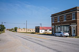
Manville in 2010
According to the census from 2010, there were 95 people living in Manville. These people made up 48 households and 30 families. The town had about 352 people per square mile.
Most of the people in Manville were White (96.8%). A small number were Native American (1.1%) or from two or more races (2.1%). About 5.3% of the population identified as Hispanic or Latino.
Out of the 48 households, 25% had children under 18 living with them. More than half (54.2%) were married couples. About 33.3% of all households were made up of people living alone. Nearly a quarter (22.9%) had someone living alone who was 65 years old or older.
The average age of people in Manville was 55.2 years. About 17.9% of residents were under 18. Many residents, 38.9%, were 65 years old or older. The town had slightly more males (54.7%) than females (45.3%).
Education in Manville
Public schools in Manville are part of the Niobrara County School District #1. Students attend Lusk Elementary/Middle School for grades Kindergarten through 6th grade. For older students, grades 7-12, they go to Niobrara County High School.
See also
 In Spanish: Manville (Wyoming) para niños
 | Aaron Henry |
 | T. R. M. Howard |
 | Jesse Jackson |

