Matanzas Inlet facts for kids
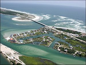
The Matanzas Inlet is a natural waterway in Florida. It connects the big Atlantic Ocean to the southern part of the Matanzas River. This inlet is like a natural gate between two narrow strips of land called barrier islands and the mainland. It's located about 14 miles (23 km) south of the city of St. Augustine, in the southern part of St. Johns County.
Unlike some other inlets, Matanzas Inlet does not have special walls called jetties built to keep it in place. This means the inlet's shape and location can change over time. It shifts around naturally due to ocean currents and storms.
Contents
History of Matanzas Inlet
Early Maps and Shifting Sands
Old maps from the 1700s show how much Matanzas Inlet has moved. These maps were made by Spanish engineers. They show that the inlet today is hundreds of yards south of where it used to be. This natural shifting is a common feature of inlets without human-made structures.
Protecting a Key Waterway
In 1740, a British army from Georgia tried to block this inlet. It was a very important waterway for boats traveling between St. Augustine and Havana, Cuba. To protect this vital passage, the Spanish built a fort. In 1742, they finished a stone tower. This tower was made of a special rock called coquina. It was about 50 feet (15 m) tall and 30 feet (9.1 m) wide. Today, this historic fort is known as Fort Matanzas National Monument. It stands as a reminder of the inlet's strategic importance.
Why it's Called Matanzas
French Settlers and Spanish Arrival
The name "Matanzas" has a dramatic history. In 1564, a French explorer named René Goulaine de Laudonnière started a settlement called Fort Caroline. This fort was near what is now Jacksonville. It was a safe place for French Protestant settlers called Huguenots.
Spain saw this French settlement as an invasion of their land. So, in 1565, Pedro Menéndez de Avilés founded St. Augustine for Spain. He quickly planned to attack Fort Caroline by land. At the same time, the French sailed from Fort Caroline to attack St. Augustine by sea.
A Storm and a Sad Story
A big storm hit the French fleet, causing many ships to wreck. They crashed on the coast south of St. Augustine. Meanwhile, the Spanish captured Fort Caroline. They spared only the women and children.
Later, the Spanish found the main group of French survivors from the shipwrecks. This event led to a tragic outcome. The location where this happened became known as Matanzas. In Spanish, "Matanzas" means "slaughters" or "massacres." This name reflects the sad events that took place there long ago.
 | May Edward Chinn |
 | Rebecca Cole |
 | Alexa Canady |
 | Dorothy Lavinia Brown |


