Colorado National Monument facts for kids
Quick facts for kids Colorado National Monument |
|
|---|---|
 |
|
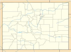
| Location | Mesa County, Colorado, United States |
| Nearest city | Grand Junction, CO |
| Area | 20,533 acres (83.09 km2) |
| Established | May 24, 1911 |
| Visitors | 375,035 (in 2017) |
| Governing body | National Park Service |
| Website | Colorado National Monument |
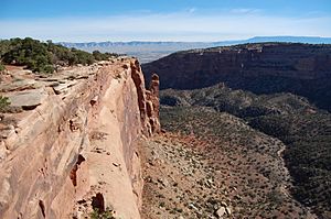
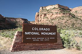
The Colorado National Monument is a special place managed by the National Park Service. It's located near Grand Junction, Colorado. Imagine deep canyons with steep walls carved into colorful sandstone and ancient rocks. This area is a high desert on the Colorado Plateau, covered with pinyon and juniper trees.
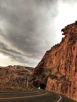
You can find lots of cool animals here, like red-tailed hawks, golden eagles, ravens, jays, desert bighorn sheep, and coyotes. Visitors love to hike, ride horses, bike on the roads, and take scenic drives. There's also a visitor center with a museum and gift shop. You'll find amazing views from the trails and from Rim Rock Drive, which winds along the top of the plateau. Nearby are the Book Cliffs and the huge Grand Mesa, the world's largest flat-topped mountain.
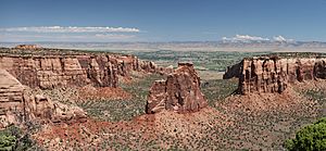
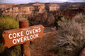
The most famous part of the monument is Monument Canyon. It stretches across the park and features incredible rock formations. Look for Independence Monument, the Kissing Couple, and the Coke Ovens. The monument covers about 20,500 acres, which is a very large area!
Contents
How the Park Started
The story of Colorado National Monument begins with a man named John Otto. He moved to Grand Junction in the early 1900s. Before he arrived, many people thought the canyons were impossible to explore. But John Otto started building trails on the plateau and down into the canyons.
People soon heard about his amazing work. The local Chamber of Commerce sent a group to see for themselves. They were so impressed by Otto's trails and the beautiful scenery that the local newspaper started asking for the area to become a National Park.
A bill was sent to the U.S. Congress and Senate. But things were moving slowly. To make sure the canyons were protected, President William Howard Taft stepped in. He had visited the area and used a special law called the Antiquities Act. On May 24, 1911, he officially declared the canyons a national monument.
John Otto was hired as the first park ranger, earning just $1 a month! For the next 16 years, he kept building and taking care of the trails. He even lived in a tent in the park.
Later, a herd of bison lived in the park from 1925 to 1983. The park also became famous in the 1980s because of a big international bicycle race called the Coors Classic. The race through the park was known as "The Tour of the Moon" because of the stunning landscapes along Rim Rock Drive.
Over the years, people have often talked about making the Colorado National Monument a full national park.
Weather in the Monument
The Colorado National Monument is located in a high desert area. This means it has hot, dry summers and cold winters with some snow.
- In summer, temperatures can reach 90°F (32°C) for many days. Sometimes it even gets to 100°F (38°C).
- In winter, temperatures can stay below freezing for several days.
- The monument gets some rain, especially in spring and fall. Snow mostly falls in winter.
Exploring the Trails
The monument has many hiking trails for all skill levels. Be careful during summer storms, as they can cause flash floods. Also, Rattlesnakes live here, and the land can be rough. But most trails are well-maintained. In winter, you might even be able to cross-country ski on some trails, like the Liberty Cap Trail.
- Serpents Trail: This is a very popular trail that follows the path of the original road to the top of the monument. You can start from parking lots at both ends. It offers great views of the monument and the valley below.
- Devil's Kitchen: This is one of the shortest and most popular trails, about 1 mile long. It leads to a cool sandstone cave. The trailhead is near the park's eastern entrance.
- Liberty Cap Trail: This trail starts from the valley floor and climbs to the rim. Liberty Cap itself is an ancient sand dune with a beautiful view of the Grand Valley.
- Corkscrew Trail: This trail branches off Liberty Cap. It's about 3 miles long and goes around a small canyon and cliffs. It's the only loop trail in the monument.
- Monument Canyon Trail: This trail follows Monument Canyon for about 5 miles. You can hike it out and back. It gives you close-up views of Independence Monument and the Kissing Couple rock formation.
- No Thoroughfare Trail: This trail starts at the bottom of No Thoroughfare Canyon. It goes a few miles into the canyon, but it's a dead end. In spring, you might see small waterfalls here, but it's usually dry.
In 2017, Colorado National Monument was even named the best campsite in Colorado in a survey!
Historic Buildings
Many of the early buildings and facilities at Colorado National Monument were built a long time ago by groups like the Public Works Administration and the Civilian Conservation Corps. These buildings were designed in a special style called "National Park Service Rustic." Because of their unique design and history, several areas are now listed on the National Register of Historic Places.
For example, the entire Rim Rock Drive is a historic district. So are the Serpents Trail and the Devils Kitchen Picnic Shelter. In the Saddlehorn area, you'll find the Saddlehorn Caretaker's House and Garage, Saddlehorn Comfort Station, and the Saddlehorn Utility Area Historic District, all of which are historic. The Visitor Center complex is also important because it shows how parks were built in the 1960s.
Park Rocks and Landforms
The rocks in Colorado National Monument tell a long story about Earth's history. There are three main types of rocks and soil here:
- The oldest rocks are very ancient gneiss and schist. These are metamorphic rocks, meaning they changed over time due to heat and pressure.
- On top of these old rocks are layers of sedimentary rocks, like the Wingate Sandstone. These rocks were formed from sand and mud that settled over millions of years. They often form the tall cliffs you see.
- The youngest materials are loose deposits like sand and gravel, which have been moved by wind and water more recently.
The sedimentary rocks are folded into gentle curves called monoclines by several faults, which are cracks in the Earth's crust.
Images for kids
See also
 In Spanish: Monumento nacional de Colorado para niños
 | Bayard Rustin |
 | Jeannette Carter |
 | Jeremiah A. Brown |


