San Bernardino Mountains facts for kids
Quick facts for kids San Bernardino Mountains |
|
|---|---|
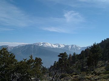
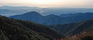
The San Bernardinos seen from near Sugarloaf Mountain
|
|
| Highest point | |
| Peak | San Gorgonio Mountain |
| Elevation | 11,503 ft (3,506 m) |
| Dimensions | |
| Length | 60 mi (97 km) |
| Width | 41 mi (66 km) |
| Area | 2,063 sq mi (5,340 km2) |
| Geography | |
| Country | United States |
| Settlements | Crestline, Lake Arrowhead, Running Springs and Big Bear Lake |
| Range coordinates | 34°12′N 117°00′W / 34.2°N 117°W |
| Parent range | Transverse Ranges |
| Geology | |
| Age of rock | Miocene and Quaternary |
| Type of rock | Fault-block and sedimentary |
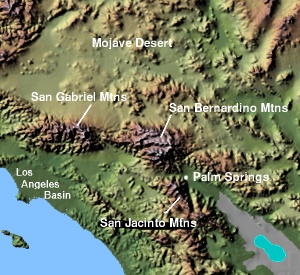
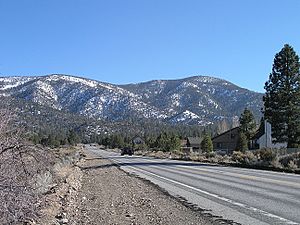
The San Bernardino Mountains are a tall and rugged mountain range. You can find them in Southern California, USA. They are located north and northeast of the city of San Bernardino. The range stretches across two California counties.
The highest point is San Gorgonio Mountain, which is 11,503 feet (3,506 m) tall. This makes it the tallest peak in all of Southern California! These mountains are a big area of wilderness. They are very popular for hiking and skiing.
These mountains started forming about eleven million years ago. This happened because of how the Earth's plates move along the San Andreas Fault. The mountains are still slowly getting taller today. Many local rivers start in these mountains. The area gets a lot more rain and snow than the deserts around it.
The San Bernardino Mountains have many different types of environments. This allows them to have a huge variety of plants and animals. For over 10,000 years, native people have lived in and around these mountains. They used the mountains as a place to hunt in the summer.
Spanish explorers first saw the San Bernardino Mountains in the late 1700s. They named the San Bernardino Valley at the base of the mountains. Not many Europeans settled here until 1860. That's when the biggest gold rush in Southern California began in these mountains. Many new settlers came because of the gold. They started using the mountains' rich wood and water resources.
People began building resorts in the mountains in the early 1900s. These resorts were often near new lakes built for water supply. Since then, many roads and water systems have been built. Today, four major state highways and the California Aqueduct cross the mountains. These projects have changed the local wildlife and plants.
Contents
Exploring the San Bernardino Mountains
The San Bernardino Mountains stretch for about 60 miles (97 km). They go from Cajon Pass in the northwest to San Gorgonio Pass in the southeast. Cajon Pass separates them from the San Gabriel Mountains. San Gorgonio Pass separates them from the San Jacinto Mountains. The Morongo Valley divides them from the Little San Bernardino Mountains.
The mountains cover about 2,100 square miles (5,400 km2). Most of the range is in San Bernardino County. A small part reaches into Riverside County. The mountains separate three main areas. These are the busy Inland Empire, the Coachella Valley, and the Mojave Desert. Most of the mountains are part of the San Bernardino National Forest.
Mountain Peaks and Valleys
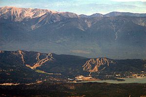
The mountains get steadily taller from their northwest end. Then, they are cut by the deep valley of Bear Creek. The northern part of the San Bernardinos is a large, high plateau. It has many big basins, like Big Bear Valley. Several large lakes that supply water are also found here.
South of the Big Bear area, the Santa Ana River cuts through the range. The mountains then rise sharply to San Gorgonio Mountain. There are eleven other peaks that are over 10,000 feet (3,000 m) tall. The mountains drop steeply into the Coachella Valley and San Gorgonio Pass. This pass is one of the deepest mountain passes in the United States. It is even deeper than the Grand Canyon by over 2,000 feet (610 m).
| Highest Peaks of the San Bernardino Mountains | |||||||||||||||||||||||||||||||||||||||
|
|||||||||||||||||||||||||||||||||||||||
Cities and Rivers in the Area
Many cities are located at the base of the San Bernardino Mountains. These include San Bernardino, Redlands, and Yucaipa to the south. Yucca Valley is to the east, and Hesperia is to the northwest.
There are also several towns within the mountains themselves. These include Big Bear Lake, Big Bear City, Crestline, Lake Arrowhead, and Running Springs. About 44,000 people live in these mountain cities. This number can increase ten times during busy tourist seasons.
Several streams and rivers also start in the mountains. The main river is the Santa Ana River. It flows west into the Pacific Ocean in Orange County. Other rivers include the Whitewater River, which flows southeast into the Salton Sea. The Mojave River flows north into the Mojave Desert.
Mountain Weather and Climate
The San Bernardino Mountains, along with the nearby San Gabriel and San Jacinto Mountains, are like a wet island. They are surrounded by the mostly dry coastal plain of Southern California. Some parts of the San Bernardino Mountains get over 40 inches of rain each year. This includes areas like Lake Arrowhead. This water is very important for the cities below.
Most of the rain and snow falls between November and March. Summers are usually dry, except for occasional thunderstorms in late summer. During colder winter storms, snow can fall above 3,000 feet. But it usually falls above 5,000 feet. Ski resorts, mostly in the Big Bear area, use this snowfall. It is the most reliable snow south of the Sierra Nevada Mountains.
How the Mountains Were Formed
The San Bernardinos are part of the Transverse Ranges of Southern California. This mountain chain was formed by huge forces between the Earth's plates. These plates are the North American and Pacific Plates, moving along the San Andreas Fault.
An early version of these mountains rose between eleven and five million years ago. But most of that older range has worn away. The mountains got their current shape about two million years ago. They are still slowly rising today. The rocks that make up the mountains are much older than the mountains themselves. They range from 18 million to 1.7 billion years old. The San Andreas Fault also created the two major mountain passes at each end of the range.
These mountains are shaped by several main fault blocks. The Big Bear block forms the large, high plateau in the northern part of the range. The southern parts are more rugged and broken up. These are formed by the San Gorgonio, Wilson Creek, and Yucaipa Ridge blocks. Because the San Bernardinos rise so steeply, they have been greatly shaped by erosion. This has carved out many river valleys. Rocks and dirt from the mountains settle on the valley floors below. These form huge alluvial fans. These deep soil deposits help create major groundwater basins.
A Look at History
Early People of the Mountains
Scientists have found signs that people have lived in the San Bernardino Valley for at least 10,000 to 12,000 years. Several Native American groups lived around the San Bernardino Mountains. These included the Tongva people to the southwest. The Cahuilla lived in the Coachella Valley. The Serrano and Chemehuevi peoples lived north and northeast of the mountains. Most of these tribes did not live in the mountains year-round.
Native peoples went into the mountains in the summer. They hunted deer and rabbits. They also gathered acorns, berries, and nuts. They sought shelter from the hot desert. They created well-used trade routes. Some of these routes were later used by Europeans. The Mojave Road crossed the San Bernardinos east of Cajon Pass. It allowed trade between people from the Inland Empire and the Mojave Desert. San Gorgonio Pass also allowed tribes from the coast and desert to interact. River canyons, especially the Mojave and Santa Ana, were main ways into the mountains. Many old sites have been found along Deep Creek, a branch of the Mojave River.
Explorers and First Settlers
In the 1600s and 1700s, Spanish explorers traveled through Southern California. They claimed the land for Spain. In 1769, Spain began building missions to control Alta California and teach Christianity. In 1772, Pedro Fages, a Spanish military governor, was the first European known to reach the San Bernardino Mountains. He was looking for army deserters. He explored the San Bernardinos, San Jacinto Mountains, and the Mojave Desert.
Over the next 50 years, others explored the area. Francisco Garcés was the first European to use the Mojave Road in 1776. José Maria de Zalvidea explored the Mojave River area in 1806. In 1810, Francisco Dumetz led a group to build a small church near what is now Redlands. On May 20, a special day for Bernardino of Siena, Dumetz named the San Bernardino Valley. This name was used for San Bernardino Peak by 1835. By 1849, it was used for the entire mountain range.
In 1819, the San Bernardino de Sena Estancia was built near modern San Bernardino. It was an outpost of Mission San Gabriel Arcángel. It was a cattle ranch. In 1820, a 12-mile (19 km)-long irrigation ditch was dug. Native Americans helped dig it. It brought water from Mill Creek to the ranch and farms. For the next twenty years, the Spanish, and then the Californios (under newly independent Mexico), farmed and raised cattle at the base of the mountains.
The high parts of the San Bernardinos were mostly unexplored until 1845. That year, Benjamin Davis Wilson led 22 men from a ranch near Riverside. They were trying to catch Mohave cattle thieves who had gone into the mountains. Wilson was the first European to see the Big Bear Valley. He named Bear Lake (now Baldwin Lake) because there were so many California grizzly bears there. His group caught and skinned over twenty bears. Later, they found and arrested the thieves. Wilson's trip opened the San Bernardinos for more exploration. It also stopped Native Americans from doing similar raids over the mountains.
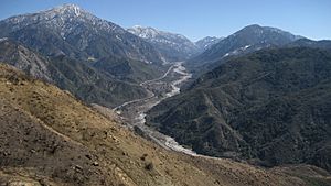
Starting in 1851, Mormon settlers came to the San Bernardino Valley. They bought and divided Rancho San Bernardino. They greatly improved farming by bringing many animals and fixing the irrigation system. To get wood for their homes, they started the first large-scale logging in the San Bernardino Mountains. This began in the Mill Creek valley. Luis Vignes built the first sawmill in the range between 1851 and 1853. By 1854, six sawmills were working in the mountains. Some were high up, three-quarters of a mile above San Bernardino. A winding road through Waterman Canyon led to them. Some mills used waterwheels, but most used steam power.
In 1860, prospectors William F. Holcomb and Ben Choteau found gold on Holcomb Creek. This started a huge rush of gold seekers to the San Bernardino Mountains. Mining towns like Belleville, Clapboard Town, and Union Town appeared very quickly. Belleville even had more people than San Bernardino for a short time. It almost became the county seat. Many mills and processing plants were built in Holcomb Valley. In 1873, Eli "Lucky" Baldwin built California's largest stamp mill there. Another big gold find happened that same year. But by the 1880s, the gold was running out. The mountains quickly became empty. Most miners settled in the San Bernardino Valley and the Mojave Desert. Many old mining structures, like chutes and cabins, can still be found today.
Lakes and Fun in the Mountains
In 1880, Frank Elwood Brown designed the first dam in the Big Bear Valley. This created Big Bear Lake. At the time, it was the world's largest artificial lake. It supplied water to citrus farms near San Bernardino. By 1910, a new dam was built, making the lake three times bigger.
The lake also greatly increased tourism in the San Bernardino Mountains. By the 1920s, lodges and visitor places were built around its shores. The old logging camp of Big Bear Lake grew to hold more tourists from all over Southern California.
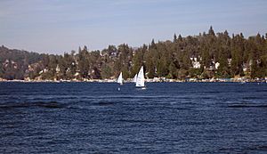
Lake Arrowhead was first planned in 1891. It was inspired by the success of Big Bear Lake. It was meant to be one of three lakes to send water from the mountains to the San Bernardino Valley. It would also power a 260 KW hydroelectric plant. The project was never fully finished. But Lake Arrowhead became a very popular fishing spot. In the early 1900s, John Baylis built the Pinecrest Resort there. Other resorts followed, like the Skyland Inn. Most early tourists came by stagecoach. Later, the old Mormon logging road was improved for cars.
Resorts also grew along rivers and in high mountain valleys. The Seven Oaks Camp opened on the Santa Ana River in 1890. Resorts also appeared at Crestline and Running Springs. Before the 1920s, snow was seen as a problem. It stopped recreation in winter. But more people started traveling in the mountains in winter. Lake Arrowhead became a popular winter spot by the 1930s.
Skiing became popular after a simple ski lift was built at Big Bear in 1938. By 1949, a 3,000-foot (910 m)-long chair lift was built. This greatly increased how many skiers the resorts could handle. Tommi Tyndall started ski schools at Big Bear and other mountains. He is known for bringing skiing to the San Bernardino Mountains. He also brought snowmaking technology. Without it, the ski industry would struggle in dry winters.
How People Use the Mountains Today
Getting Around the Mountains
In the early 1900s, roads in the San Bernardino Mountains were steep and narrow. People argued about cars. Some thought cars were fast and cheap. Others worried cars were dangerous and would crash with stagecoaches. In 1908, W.C. Vaughan drove up the Waterman Canyon road to Lake Arrowhead. Police chased him because of county rules. The next year, cars were banned. But in 1910, Jack Heyser drove a car on the narrow roads near Crestline. He showed that cars could safely travel in the mountains.
By 1911, cars mostly replaced horse-drawn carts. New toll roads were built for them. Some of the first roads were through Cajon Pass, City Creek Canyon (SR 330), and Mill Creek and Santa Ana Canyons (SR 38). The most famous road is California State Route 18. It is known as the Rim of the World Highway. It was opened on July 18, 1915. It winds for 107 miles (172 km) through the mountains. It goes from Crestline through Big Bear City and into the Mojave Desert. It offers amazing views of the San Bernardino Valley, Santa Ana Canyon, and Big Bear Lake.
Managing Water Resources
In the late 1950s, work began on the California Aqueduct. This huge system of canals and pipes brings water from Northern California to cities in the dry south. The East Branch of the aqueduct crosses the San Bernardino Mountains. It uses pumping stations, reservoirs, and power stations.
The aqueduct feeds Silverwood Lake. This large lake was created in 1973 by building a dam on the north side of the mountains. From Silverwood, water goes through the San Bernardino Tunnel. It drops down to the Devil Canyon Power Plant in the San Bernardino Valley. The huge drop in height helps generate up to 276 MW of power.
The streams in the San Bernardino Mountains can have flash floods. To prevent danger, many flood control dams have been built. The largest is Seven Oaks Dam on the Santa Ana River. It is the sixth highest dam in the United States. In 1969, the U.S. Army Corps of Engineers said the Santa Ana River was the biggest flood threat west of the Mississippi River. This was because it flowed through many developed areas. The dam was finished in 1999. It can hold back a very large flood that happens only once every 350 years. Many other dams, like Mojave Forks Dam on the Mojave River, help control floods and sediment in smaller areas.
Plants and Animals of the Mountains
The San Bernardino Mountains, along with the nearby San Gabriel and San Jacinto ranges, are called a sky island. This means they are high mountain regions where plants and animals are very different from those in the dry lands around them. The San Bernardinos have the largest forested area in Southern California. They are home to about 1,600 types of plants.
The lower hills have chaparral and evergreen oak trees. Higher up, you find forests of deciduous oak, yellow pine, Jeffrey pine, incense cedar, and several fir trees. These are found at elevations above 5,000 feet (1,500 m). Deeper in the mountains, streams fed by springs and lakes support trees like alders, willows, and cottonwoods.
About 440 types of wildlife live in these mountains. This includes many endangered species. Some examples are the San Bernardino flying squirrel, California Spotted Owl, Mountain yellow-legged frog, Southern rubber boa, and Andrew's marbled butterfly. The mountains once had many California grizzly bears. But hunting caused them to disappear by 1906. Today, Black bears live in the highlands. However, they are not originally from this area. They were brought from the Sierra Nevada mountains in the 1930s. This was partly to attract tourists.
See also
 In Spanish: Sierra de San Bernardino para niños
 | Calvin Brent |
 | Walter T. Bailey |
 | Martha Cassell Thompson |
 | Alberta Jeannette Cassell |


