
Riverside, California facts for kids
Quick facts for kids
Riverside
|
|||
|---|---|---|---|
|
|
|||
|
|||
| Motto(s):
City of Arts & Innovation
|
|||

Riverside
Location in California

Riverside
Location in the United States
|
|||
| Country | United States | ||
| State | California | ||
| County | Riverside | ||
| Incorporated | October 11, 1883 | ||
| Chartered | March 5, 1907 | ||
| Government | |||
| • Type | Council–manager | ||
| Area | |||
| • City | 81.54 sq mi (211.18 km2) | ||
| • Land | 81.23 sq mi (210.38 km2) | ||
| • Water | 0.31 sq mi (0.80 km2) | ||
| Elevation | 827 ft (252 m) | ||
| Population
(2020)
|
|||
| • City | 314,998 | ||
| • Estimate
(2021)
|
317,261 | ||
| • Rank | 59th in the United States 12th in California |
||
| • Density | 3,877.85/sq mi (1,497.28/km2) | ||
| • Urban | 2,276,703 (US: 19th) | ||
| • Urban density | 3,741.1/sq mi (1,444.4/km2) | ||
| • Metro | 4,599,839 (US: 13th) | ||
| Time zone | UTC−8 (Pacific) | ||
| • Summer (DST) | UTC−7 (PDT) | ||
| ZIP Codes |
92501–92509, 92513–92519, 92521–92522
|
||
| Area code | 951 | ||
| FIPS code | 06-62000 | ||
| GNIS feature IDs | 1661315, 2410965 | ||

.jpg)


.svg)

Riverside is a city in California, United States. It is the main city of Riverside County. The city is named Riverside because it is located next to the Santa Ana River. It is the largest city in the Inland Empire area.
Riverside is about 50 miles (80 km) southeast of downtown Los Angeles. It is also part of the larger Greater Los Angeles area. Riverside is the 59th most populated city in the United States. It is also the 12th most populated city in California. In 2020, about 314,998 people lived there.
Riverside was started in the early 1870s. It is known as the birthplace of California's citrus industry. The city is home to The Mission Inn, which is the largest building in the Mission Revival Style in the country. You can also find the Riverside National Cemetery here.
The University of California, Riverside is in the city's northeastern part. It has a sports complex. Other cool places in Riverside include the Fox Performing Arts Center. The Museum of Riverside shows local history. There is also the California Museum of Photography and the California Citrus State Historic Park. Don't forget Castle Park and the Parent Washington Navel Orange Tree. This tree is one of the very first navel orange trees in California.
Contents
History of Riverside
.jpg)
Long ago, in the late 1700s and early 1800s, Cahuilla and Serrano people lived in this area. Later, people like Bernardo Yorba and Juan Bandini started ranches here.
In the 1860s, Louis Prevost tried to start a silk farm, but it didn't work out. After this, John W. North bought some land. He created the Southern California Colony Association to help the area grow. In 1870, North put up posters to announce a new colony in California.
North was against alcohol and had founded Northfield, Minnesota. Riverside was also a city that did not allow alcohol at first. There were four bars when it was founded. But the city made the fees for licenses so high that the bars had to leave.
People from England and Canada invested in Riverside. They brought their traditions, like golf and polo. The first golf course and polo field in southern California were built here.
The Famous Orange Industry
.jpg)
The first orange trees were planted in 1871. The citrus industry that Riverside is known for began three years later, in 1874. This happened when Eliza Tibbets received three special navel orange trees. Her friend, William Saunders, a plant expert from Washington, D.C., sent them to her.
These trees came from Bahia, Brazil. The Bahia orange did not grow well in Florida. However, it grew amazingly well in southern California.
The three trees were planted on the Tibbets' land. One tree died after a cow stepped on it. The other two trees were moved to Sam McCoy's property for better care. Later, they were moved again. One was planted at the Mission Inn in 1903 by President Theodore Roosevelt. This tree died in 1922.
The other tree was planted at Magnolia and Arlington avenues. Eliza Tibbets was honored with a stone marker next to this tree. This tree still stands today, protected by a fence.
The trees grew very well in southern California's climate. The navel orange industry quickly became huge. Many farmers bought parts of these trees to grow more. This led to a new kind of "Gold Rush" in California. It was the start of the citrus industry.
You can learn about this history at the California Citrus State Historic Park. By 1882, California had over half a million citrus trees. Almost half of them were in Riverside. The city became very rich by 1895. This was thanks to special refrigerated railroad cars and new ways to water the crops.
Geography and Landmarks
Riverside is a large city, covering about 81.4 square miles (211 square kilometers). Most of this area is land. The downtown area is about 860 feet (252 meters) above sea level.
Natural Features and Scenery
Riverside has hills within its city limits, like Mount Rubidoux. This mountain is a famous landmark and a place for visitors. The city is surrounded by mountains, some of which get snow in winter. Many people also enjoy the beaches of Southern California. Riverside is about a 47-mile (75 km) drive to the Pacific Ocean. It is also close to Orange County and Los Angeles County.
Three other important hills in Riverside are Box Springs Mountain, Evans (Jurupa) Hill, and Tecolote Hill. These areas are kept as open spaces for nature. South of Riverside is Lake Mathews.
March Joint Air Reserve Base is next to Riverside on the east. It separates the city from Moreno Valley. March ARB started in 1918. It is the oldest Air Force base west of the Mississippi River that is still working.
At the entrance to Riverside from Highway 60 is Fairmount Park. This large park was designed by the same people who designed New York's Central Park. It has a pond with many kinds of birds.
Famous Buildings and Sites

Riverside is home to the historic Mission Inn. Another famous building is the Riverside County Historic Courthouse. It looks like the Petit Palais in Paris, France.
The Riverside Fox Theater is also here. The very first showing of the famous 1939 movie Gone with the Wind happened at this theater. The city bought and fixed up the theater. It was finished in 2009. Now, it is a performing arts theater with 1,600 seats. In 2010, singer Sheryl Crow performed at the newly opened Fox Theater.

Riverside also has the "World's Largest Paper Cup." It's actually made of concrete and is over three stories tall. This "Dixie Cup" landmark is on Iowa Street. It is in front of what used to be the Dixie Corporation's factory.
City Neighborhoods

Riverside has 28 official neighborhoods. Some of these are Airport, Alessandro Heights, Arlanza, Arlington, and Canyon Crest. Others include Casa Blanca, Downtown, Eastside, and Magnolia Center.
The "Eastside" area grew from a community of Mexican immigrant workers. They worked in the orange groves and other farms. This settlement was called La Placita and was there before the city was founded in 1843. Mexican communities also formed in the Casa Blanca area in the early 1900s.
Future Growth of Riverside
The city council has suggested adding nearby communities to Riverside. This would make the city bigger and add more people. One important area is Lake Hills/Victoria Grove. This would extend the city's southwestern borders to Lake Mathews.

Some areas that might be added are:
- Lake Hills/Victoria Grove
- University City
- Highgrove
- Woodcrest
Special Features of Riverside

Riverside is home to the University of California, Riverside. The UCR Botanical Gardens has 40 acres (16 hectares) of unique plants. It has 4 miles (6.4 km) of walking trails. The city is proud of its history with the navel orange. This fruit was brought to North America from Brazil in 1874. Riverside has the one surviving Parent Navel Orange Tree. All American West Coast navel orange trees came from this tree.
Riverside has three hospitals:
- Riverside Community Hospital
- Parkview Community Hospital Medical Center
- Kaiser Foundation Hospital – Riverside
The city also has the Riverside Public Library system with several branches.
Riverside has places for big meetings and events. The Riverside Convention Center was updated in 2014. It has a lot of indoor and outdoor space. The Riverside Marriott and Mission Inn also have event spaces. All three are close to each other in downtown Riverside.
Climate and Environment
Riverside has a semi-arid climate. This means it has hot, dry summers and mild, somewhat wet winters. Temperatures usually range from about 55°F (13°C) in December to 80°F (27°C) in August. It gets very hot, reaching 100°F (38°C) about 22 days a year. The highest temperature ever recorded was 118°F (48°C). It also gets cold enough to freeze, about 3 or 4 days a year. The lowest temperature ever was 18°F (-8°C).
Riverside gets about 9.39 inches (239 mm) of rain each year. Most of the rain falls between November and April. February is usually the wettest month.
| Climate data for Riverside, California (Riverside Municipal Airport) (1991–2020 normals, extremes 1893–present) | |||||||||||||
|---|---|---|---|---|---|---|---|---|---|---|---|---|---|
| Month | Jan | Feb | Mar | Apr | May | Jun | Jul | Aug | Sep | Oct | Nov | Dec | Year |
| Record high °F (°C) | 94 (34) |
94 (34) |
102 (39) |
105 (41) |
110 (43) |
118 (48) |
118 (48) |
113 (45) |
117 (47) |
109 (43) |
100 (38) |
94 (34) |
118 (48) |
| Mean maximum °F (°C) | 83.1 (28.4) |
83.3 (28.5) |
87.8 (31.0) |
94.2 (34.6) |
97.1 (36.2) |
101.3 (38.5) |
105.1 (40.6) |
106.6 (41.4) |
106.2 (41.2) |
99.8 (37.7) |
91.0 (32.8) |
82.6 (28.1) |
109.6 (43.1) |
| Mean daily maximum °F (°C) | 67.7 (19.8) |
67.9 (19.9) |
72.1 (22.3) |
75.9 (24.4) |
79.9 (26.6) |
86.7 (30.4) |
93.3 (34.1) |
94.9 (34.9) |
91.3 (32.9) |
82.7 (28.2) |
74.5 (23.6) |
66.8 (19.3) |
79.5 (26.4) |
| Daily mean °F (°C) | 55.6 (13.1) |
56.3 (13.5) |
59.5 (15.3) |
62.9 (17.2) |
67.6 (19.8) |
73.0 (22.8) |
78.6 (25.9) |
79.8 (26.6) |
76.6 (24.8) |
68.9 (20.5) |
61.0 (16.1) |
54.8 (12.7) |
66.2 (19.0) |
| Mean daily minimum °F (°C) | 43.6 (6.4) |
44.7 (7.1) |
46.9 (8.3) |
50.0 (10.0) |
55.3 (12.9) |
59.3 (15.2) |
63.9 (17.7) |
64.7 (18.2) |
61.9 (16.6) |
55.2 (12.9) |
47.4 (8.6) |
42.8 (6.0) |
53.0 (11.7) |
| Mean minimum °F (°C) | 34.0 (1.1) |
36.0 (2.2) |
38.8 (3.8) |
42.3 (5.7) |
48.3 (9.1) |
53.8 (12.1) |
58.6 (14.8) |
59.0 (15.0) |
54.5 (12.5) |
46.7 (8.2) |
38.0 (3.3) |
33.2 (0.7) |
31.5 (−0.3) |
| Record low °F (°C) | 18 (−8) |
24 (−4) |
25 (−4) |
29 (−2) |
33 (1) |
35 (2) |
41 (5) |
40 (4) |
37 (3) |
30 (−1) |
23 (−5) |
21 (−6) |
18 (−8) |
| Average precipitation inches (mm) | 2.29 (58) |
2.41 (61) |
1.21 (31) |
0.57 (14) |
0.20 (5.1) |
0.04 (1.0) |
0.12 (3.0) |
0.03 (0.76) |
0.11 (2.8) |
0.33 (8.4) |
0.57 (14) |
1.51 (38) |
9.39 (239) |
| Average precipitation days (≥ 0.01 in) | 4.8 | 6.9 | 5.2 | 3.9 | 1.6 | 0.2 | 0.7 | 0.5 | 0.5 | 2.3 | 3.6 | 5.1 | 35.3 |
| Source 1: NWS | |||||||||||||
| Source 2: NOAA | |||||||||||||
Riverside has faced issues with smog and air pollution. In 2003, the Riverside-San Bernardino-Ontario area was one of the most polluted regions in the U.S. The city has tried to reduce pollution. They added more public transportation like Metrolink. They also made their buses run on natural gas.
Over the years, smog has decreased. Local cities and counties worked with the South Coast Air Quality Management District. They put in place rules to make the air cleaner. However, in 2020, Riverside County was still rated as one of the worst for smog. Most of Riverside's smog comes from winds blowing pollution from the Los Angeles Basin. It also comes from cars and trucks, and from the Port of Los Angeles and Port of Long Beach.
Population and People

In 2020, Riverside had a population of 314,998 people. The city has grown a lot over the years.
- 1890: 4,683 people
- 1920: 19,341 people
- 1950: 46,764 people
- 1980: 170,591 people
- 2010: 303,871 people
- 2020: 314,998 people
The population density was about 3,877 people per square mile (1,497 per square kilometer).
Diversity in Riverside
Riverside is a very diverse city. In 2010, about 56.5% of the people were White. About 7% were African American, and 7.4% were Asian. About 49% of the people were Hispanic or Latino. This group includes people from many different backgrounds.
Most people in Riverside live in homes. A smaller number live in group housing or institutions. In 2010, there were about 91,932 households. About 42.4% of these had children under 18. The average household had about 3.18 people.
The median age in Riverside was 30 years old. This means half the people were younger than 30, and half were older.
Religious Life
Riverside has many different religions. There are Catholic, Eastern Orthodox, and Protestant churches. There are also Mormon churches, an Islamic mosque, a Jewish synagogue, and a Hindu temple. Several Buddhist temples are also in the city.
Many Seventh-day Adventists live in Riverside. This is because La Sierra University is here. Also, Loma Linda, which has a large Adventist community, is nearby. There is also a large Mormon population in the area.
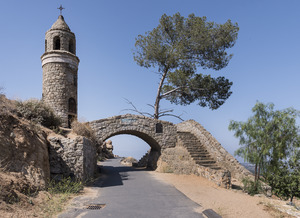
Special religious events happen on Mount Rubidoux. One is an annual Easter Sunrise service. This is the oldest continuous outdoor Easter service in the country. It has been held every year since 1909. In December, there is a procession from Our Lady of Guadalupe Shrine to the top of Mount Rubidoux. This event remembers Juan Diego's walk up Tepeyac hill in 1531.
In 2012, there was a discussion about the cross on Mount Rubidoux. It was on city land. To follow rules about church and state separation, the city sold the cross and the land under it to a private group.
Economy and Jobs

Riverside's economy mostly involves light industry. This means they make things like aircraft parts, car parts, and electronic equipment. They also make food products and medical devices. There are several industrial parks in the city for these businesses.
Since Riverside is the county seat, it also has many legal, accounting, and banking companies. The citrus industry still exists, but it is not as big as it used to be. This is because of city growth and less water.
Bourns, an electronics company, is based in Riverside.
Major Employers
Here are some of the biggest employers in Riverside:
- County of Riverside
- March Air Force Reserve
- University of California, Riverside
- Kaiser Permanente
- Riverside Unified School District
- Riverside Community Hospital
- City of Riverside
- Riverside Community College District
- Alvord Unified School District
- California Baptist University
Arts and Culture
Riverside has many museums and hosts fun events throughout the year.
Museums to Explore

- California Citrus State Historic Park Museum: Learn about the citrus industry.
- The Cheech Marin Center for Chicano Art, Culture & Industry: See Chicano art.
- March Field Air Museum: Discover old airplanes and military history.
- Mission Inn Museum: Learn about the famous Mission Inn.
- Riverside Art Museum: Enjoy various art exhibits.
- Museum of Riverside: Explore local history and nature.
- Sherman Indian Museum: Learn about Native American culture.
- University of California, Riverside California Museum of Photography: See amazing photos.
- Southern California Railway Museum: Explore old trains and railway history.
Festivals and Exciting Events
Many festivals happen in Riverside, especially downtown.
- Riverside Dickens Festival: In February, this festival celebrates literature. It has plays, music, and people dressed in old costumes.
- Riverside Airshow: In March, this event at the Riverside Municipal Airport draws many people. It features amazing aerial performances and aircraft displays.
- March Field Airfest: Every two years, this air show at March Air Reserve Base is one of the biggest events in the area. It features military and civilian aircraft.
- Riverside International Film Festival (RIFF): In April, this festival shows films from all over the world.
- Vintage Home Tour: In May, the Old Riverside Foundation opens historic homes to the public for one day.
- Ghost Walk: In October, the California Riverside Ballet hosts a walk around old buildings. Volunteers tell ghost stories about the city's history.
- Riverside Festival of Lights: This festival centers around The Mission Inn Hotel & Spa downtown. It starts the day after Thanksgiving. There are lights, fireworks, music, and ice skating.
- Festival of Trees: Also during Thanksgiving week, this event at the Riverside Convention Center raises money for children's hospital units. Decorated Christmas trees are displayed and auctioned.
Education in Riverside

Riverside has many schools and colleges for students of all ages.
Colleges and Universities

- California Baptist University
- La Sierra University
- National University (a branch campus)
- Riverside City College
- University of California, Riverside
High Schools
Riverside has two main school districts:
- Riverside Unified School District serves the eastern part of the city.
- High schools include: Arlington High School, Martin Luther King High School, John W. North High School, Riverside Polytechnic High School, Ramona High School, Riverside Virtual School, and Riverside STEM High School.
- Alvord Unified School District serves the western part of the city.
- High schools include: La Sierra High School, Norte Vista High School, and Hillcrest High School.
There are also special schools like the California School for the Deaf, Riverside (CSDR) for deaf and hard-of-hearing students. Sherman Indian High School is for Native American students.
Helping Students Succeed
In 2010, Riverside received a $3 million grant from the Bill and Melinda Gates Foundation. This led to the "Completion Counts" program. This program helps students in Riverside go to college and graduate. It is a partnership between the city, colleges, and school districts.
For example, Riverside City College now gives priority to high school graduates from the local districts. They also guarantee that students can finish an associate degree or transfer to a four-year university in two years. The program helps high schools and colleges work together. They make sure students are ready for college-level work.
Transportation in Riverside
.jpg)
Riverside has good transportation options for getting around.
Major Highways
Three main highways serve Riverside:
- I-215
- State Route 60
- State Route 91
These highways meet in northeastern Riverside at a large interchange that was rebuilt in 2007.
Train Services
.jpg)
The city has three Metrolink commuter train stations:
- Riverside-Downtown
- Riverside-La Sierra
- Riverside-Hunter Park/UCR
These trains help people travel to and from work or school. Amtrak's Southwest Chief train, which goes from Los Angeles to Chicago, also stops in Riverside.
Bus Services
Local bus service is provided by the Riverside Transit Agency. You can also find intercity bus services like Greyhound Lines and Amtrak California.
Airports
The closest airport for commercial flights is Ontario International Airport. It is in Ontario, California. Riverside also has its own airport, the Riverside Municipal Airport. This airport is mainly for private planes. It also hosts the yearly Riverside Air Show.
Notable People from Riverside
Many interesting people have come from Riverside. You can find a full list in the article List of people from Riverside, California.
Sister Cities Around the World

Riverside has "sister city" relationships with cities in other countries. This helps promote cultural exchange and friendship.
- Sendai, Japan
- Cuautla, Morelos, Mexico
- Ensenada, Mexico
- Jiangmen, China
- Gangnam, South Korea
- Hyderabad, India
- Obuasi, Ghana
- Erlangen, Germany
- Can Tho, Vietnam
The Sendai Committee is working on a special e-pal system. This system will let people from Sendai and Riverside send emails to each other, like pen pals. This helps people learn about each other's cultures. Riverside also has an economic partnership with the state of Oaxaca, Mexico.
Images for kids
-
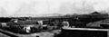
Riverside, 1876
-
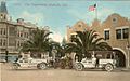
Riverside, 1910
-

A 360-degree panorama of Riverside, California, from Mount Rubidoux.

See also
 In Spanish: Riverside para niños
