Big Bear Lake facts for kids
Quick facts for kids Big Bear Lake |
|
|---|---|
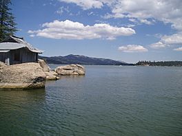
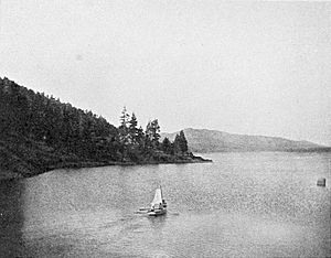
Looking east from China Island
|
|
| Location | San Bernardino Mountains, San Bernardino County, California |
| Coordinates | 34°14′31″N 116°58′37″W / 34.24194°N 116.97694°W |
| Lake type | Reservoir |
| Basin countries | United States |
| Max. length | 7 mi (11 km) |
| Max. width | 2.5 mi (4.0 km) |
| Surface area | 2,971 acres (1,202 ha) |
| Average depth | 35 ft (11 m) |
| Max. depth | 72 ft (22 m) |
| Water volume | 73,320 acre⋅ft (0.09044 km3) |
| Old Bear Valley Dam | |
|---|---|
| Built | 1884 |
| Architect | Frank Brown |
| Designated | February 5, 1960 |
| Reference no. | 725 |
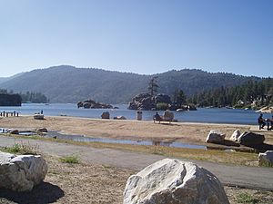
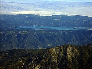
Big Bear Lake is a large reservoir (an artificial lake) located in the San Bernardino Mountains in San Bernardino County, California. It is in the state of California, United States. This lake gets all its water from melted snow. It does not have rivers flowing into it.
Big Bear Lake sits about 6,743 ft (2,055 m) above sea level. It is about 7 mi (11 km) long from east to west. At its widest point, it measures about 2.5 mi (4.0 km). However, most of the lake is about 1⁄2 mi (0.8 km) wide. The deepest part of the lake is about 72 ft (22 m) deep, near the dam.
Contents
History of Big Bear Lake
The area around Big Bear Lake was home to the Serrano Indian tribe for about 2,500 years. They called their land "Yuhaviat," which means "Pine Place." They lived in small villages near fresh water. They ate berries, nuts, and acorns. They also hunted animals in the valley. The Serrano people respected grizzly bears. They did not eat bear meat or wear their fur.
European Discovery and Gold Rush
European explorers first found the Big Bear Lake area when Benjamin Davis Wilson led a group looking for Native Americans. Wilson was a rancher and a local leader. He was asked to find Native Americans who were raiding ranches.
In 1845, Wilson and his group explored the area. They found a valley full of wildlife, especially bears. His group became a hunting party. They hunted many bears. Wilson named the grassy area "Bear Valley." He called a nearby shallow marsh "Big Bear Lake." This marsh is now called Baldwin Lake.
In 1859, gold was discovered in the valley. This started a gold rush in Southern California. A prospector named William F. Holcomb found gold in a quartz vein. This area became known as Holcomb Valley. It quickly became the most populated place in San Bernardino County.
Building the Dams
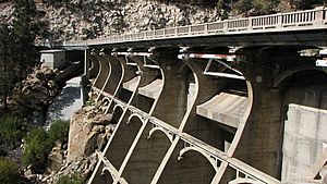
In 1884, a dam was built in Bear Valley. This dam was made of granite and created Big Bear Lake. It held water for farms in the Redlands area. This first dam was not big enough. So, in 1912, a new, taller dam was built about 300 ft (91 m) downstream. This new dam made the lake much larger. The old granite dam is still there, usually under about 20 ft (6.1 m) of water.
A highway bridge (SR 18) was built over the new dam in 1923. A new bypass bridge was built next to it in 2009. The old bridge on top of the dam was then removed. The lake's water level changes depending on how much snow melts each year.
Sadly, the grizzly bears in the San Bernardino Mountains were hunted too much. By 1906, all the local grizzly bears were gone.
Tourism started to grow when cars became popular and highways were built. Hollywood also discovered Big Bear. Many movies, especially Westerns, have been filmed in the area.
Geography of Big Bear Lake
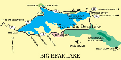
Big Bear Lake has a North Shore and a South Shore. Big Bear Boulevard runs along the South Shore. It is part of Highway 18. This road goes through different bays like Papoose Bay and Boulder Bay. It leads to the city of Big Bear Lake. The road then continues east to the ski resorts, Snow Summit and Bear Mountain. It also passes Stanfield Cutoff, a road that crosses the lake. Big Bear Boulevard then goes into Big Bear City.
North Shore is Highway 38. It starts at the Dam Junction of Highway 18. It goes east past old fishing camps. It then goes through the small town of Fawnskin. The road continues through forest lands. It passes the Big Bear Solar Observatory and the Big Bear Discovery Center. It also goes past the Serrano Campground and a public boat launch. North Shore Drive then goes into Big Bear City and Baldwin Lake.
You can reach Big Bear Lake by several highways. Highway 330 comes from San Bernardino. Highway 38 comes from Redlands. Highway 18 comes from Victorville or San Bernardino.
Climate at Big Bear Lake
The weather at Big Bear Lake changes a lot because it is high up in the mountains. July is the warmest month. The average temperature is about 64.7 °F (18.2 °C). January is the coolest month, with an average temperature of about 34.1 °F (1.2 °C). Temperatures can reach 90 °F (32 °C) or higher about twice a year. Freezing temperatures happen about 186 days a year. The highest temperature ever recorded was 94 °F (34 °C). The lowest was −25 °F (−32 °C).
Big Bear Lake gets more rain and snow than the lower areas of San Bernardino County. It averages about 21.15 in (537 mm) of precipitation each year. Heavy rain can happen even in summer during thunderstorms. Big Bear Lake has a Csb (Warm-summer Mediterranean) climate.
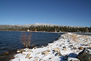
The area gets a lot of snow in winter because of its high elevation. The lake level gets about 72 in (180 cm) of snow each season. Higher ridges can get over 100 in (250 cm). Snow has fallen in every month except July and August.
Transportation
Big Bear Lake is about 100 miles (160 km) east of Los Angeles. It is surrounded by the San Bernardino National Forest. You can get there using three main highways:
- Highway 330 from San Bernardino.
- Highway 38 from Redlands.
- Highway 18 from Victorville (to the west) or San Bernardino (to the east).
You can also use public buses to travel to and from San Bernardino. Buses also run between the towns around the lake. This service is provided by Mountain Transit.
Activities at Big Bear Lake
Big Bear Lake is a great place for many outdoor activities. You can go fishing for trout, bluegill, crappie, catfish, and bass. Boating and water skiing are also popular. Swimming is not recommended because the water is very cold. Also, there are underwater obstacles near the shore. The lake is watched over by the BBMWD Lake Patrol.
Many people who live by the lake have their own docks. Visitors can rent boats from marinas on both sides of the lake. The Big Bear Municipal Water District has public boat launches. You can also try parasailing.
Experts have given advice about eating fish from Big Bear Lake. This is because small amounts of mercury and PCBs have been found in some fish. This advice helps people know how much fish is safe to eat.
Points of Interest
North Shore (west to east)
- Fawnskin (a small community)
- Big Bear Solar Observatory (a place where scientists study the sun)
- Big Bear Discovery Center (a center for learning about nature)
South Shore (west to east)
- Snow Summit (a ski resort in winter, and a place for mountain biking and scenic chairlift rides in summer)
- Bear Mountain (a ski and snowboard resort in winter, with a golf course in summer)
California Historical Landmark
There is a special sign at the Big Bear Dam. It is a California Historical Landmark. It says:
- NO. 725 OLD BEAR VALLEY DAM - In 1884, Frank Brown built a unique dam here. It was made of granite. This dam created Big Bear Lake. At the time, it was the world's largest man-made lake. Engineers thought the dam would not hold, but it did! They called it "The Eighth Wonder of the World." The old dam is usually underwater. This is because a new, taller dam was built 200 ft (61 m) west of it in 1912.
 | Janet Taylor Pickett |
 | Synthia Saint James |
 | Howardena Pindell |
 | Faith Ringgold |


