San Gorgonio Mountain facts for kids
Quick facts for kids San Gorgonio Mountain |
|
|---|---|
 |
|
| Highest point | |
| Elevation | 11,503 ft (3,506 m) NAVD 88 |
| Prominence | 8,294 ft (2,528 m) ↓ Soledad Pass |
| Isolation | 162.49 mi (261.50 km) → Charleston Peak |
| Listing |
|
| Naming | |
| English translation | Saint Gorgonius |
| Language of name | Spanish |
| Geography | |
| Location | San Bernardino County, California, U.S. |
| Parent range | San Bernardino Mountains |
| Topo map | USGS San Gorgonio Mountain |
| Climbing | |
| First ascent | 1872 by W. A. Goodyear and Mark Thomas |
| Easiest route | Strenuous Hike |
San Gorgonio Mountain, also called Mount San Gorgonio or Old Greyback, is the tallest mountain in Southern California. It stands at 11,503 feet (3,506 m) high. It is part of the Transverse Ranges mountain system.
This mountain is located in the San Bernardino Mountains. It's about 27 miles (43 km) east of the city of San Bernardino. The mountain is inside the San Gorgonio Wilderness. This area is part of the Sand to Snow National Monument. The San Bernardino National Forest helps manage it.
Spanish missionaries came to this area in the early 1600s. They named the peak after Saint Gorgonius.
San Gorgonio Mountain is one of the most important peaks in the United States. This is because it is very tall and separated from other higher peaks. For example, the Sierra Nevada mountains are much higher. But they are far away, across lower land. San Gorgonio Mountain is ranked 7th among peaks in the 48 connected states.
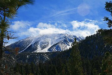
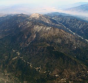
Like other tall peaks in the Transverse Ranges, San Gorgonio Mountain looks like a pyramid. It has a steep side facing north. The south side is a bit less steep. The mountain is very wide. Its top part is about one square mile (2 km2) in size.
Unlike its famous neighbor, San Jacinto Peak, San Gorgonio is not very rocky. From a distance, it looks like a very tall hill. This is how it got the nickname Old Greyback. In summer, it might not look special. But it is the only mountain in Southern California with a top far above the tree line. In winter, its bright white snow cap is easy to see. This makes the mountain stand out from many miles away. You can even see it from the top of Mount Whitney, which is 190 miles (306 km) away! This is the longest recorded view in the connected United States.
Contents
Exploring San Gorgonio Mountain
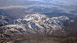
San Gorgonio Mountain is at the far eastern end of the Transverse Ranges. The mountain has been shaped by a lot of erosion. It looks like a plateau that has been cut into pieces.
Big Bear Lake, California is the biggest town close to San Gorgonio. It has two large ski resorts. It's also a popular summer spot for people from Southern California. They enjoy boating, swimming, and fishing in the lake.
How the Mountain Formed
The mountain's shape is due to strong thrust faults on its north side. These are cracks in the Earth's crust where rocks have pushed over each other. The south side of the mountain has river canyons. These are common in plateaus that have been worn down by water.
The mountain is mostly made of a large block of quartz monzonite. This rock sits on very old Precambrian gneissic rocks. The lowest parts of the mountain have deposits from glaciers and rivers.
Water on the Mountain
Three important Southern California rivers start on San Gorgonio Mountain. These are the Santa Ana River, the Whitewater River, and the San Gorgonio River.
Jenks Lake is on the north side of the mountain. It is one of the few lakes in Southern California that always has water.
San Gorgonio Mountain sits on the Great Basin Divide. This line separates streams that flow into the Basin and Range Province from rivers that flow into the Pacific Ocean.
Weather on the Mountain
Most of the mountain has a warm-summer Mediterranean climate. This means it has warm, dry summers and mild, wet winters. The very top of San Gorgonio has an Alpine climate. This means no month there has an average temperature higher than 10 °C (50 °F).
Hiking San Gorgonio Mountain
Hiking to the top of San Gorgonio Mountain is not technically hard. But it is a very tough walk. Several trails lead to the wide top of the mountain. The summit is a few hundred feet (100 m) above the tree line. Most routes are very tiring. They require climbing over 4,000 feet (1,200 m) in height.
The trail from the Fish Creek Trailhead is a bit easier. It has about 3,400 feet (1,000 m) of climbing. This is less than the routes from the South Fork and Vivian Creek trailheads. Hikers should always be careful. Some paths on this trail are not clearly marked.
Aircraft Incidents
San Gorgonio Mountain has been the site of several aircraft crashes.
On December 1, 1952, a Douglas C-47 Skytrain plane crashed. It hit the eastern side of the mountain at 11,000 feet (3,400 m) high. The plane was flying from Nebraska to California. It crashed at night during a storm. Thirteen people died in this accident.
About a month later, a Marine Corps Sikorsky H-19 helicopter also crashed. This happened while it was helping to recover victims from the C-47 crash. The three crew members of the helicopter survived. Much of the wreckage from both aircraft is still on the mountain. Hikers can reach it from the Fish Creek Trailhead or the South Fork Trailhead.
Later, in 1977, Frank Sinatra's mother, Dolly Sinatra, was in a plane crash here. In 1987, Dean Paul Martin, who was Dean Martin's son, also crashed on the mountain. He was an Air National Guard pilot. His McDonnell Douglas F-4 Phantom II jet disappeared in a snowstorm. The wreckage was found days later.
 | Selma Burke |
 | Pauline Powell Burns |
 | Frederick J. Brown |
 | Robert Blackburn |


