Mount Charleston facts for kids
Quick facts for kids Mount Charleston |
|
|---|---|

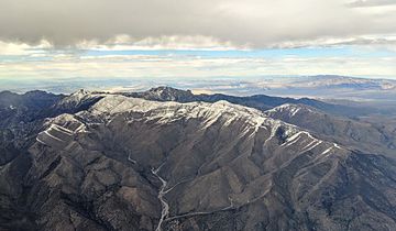
Mount Charleston, with Trout Canyon in the foreground, Charleston peak at left rear
|
|
| Highest point | |
| Elevation | 11,916 ft (3,632 m) |
| Parent peak | Mount Jefferson |
| Listing |
|
| Geography | |
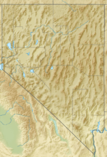
| Location | Clark County, Nevada, U.S. |
| Parent range | Spring Mountains |
| Topo map | USGS Charleston Peak |
| Climbing | |
| Easiest route | Trail hike, class 1 |

Mount Charleston, also called Charleston Peak, is the highest mountain in the Spring Mountains and Clark County, Nevada, United States. Its peak reaches 11,916 feet (3,632 m) high. In the Southern Paiute language, it's called Nuvagantu, which means "where snow sits." In the Shoshoni language, it's Nüpakatütün.
Mount Charleston is the eighth-highest mountain in Nevada. It stands out because it's far from other tall peaks. This makes it the most "topographically prominent" peak in Nevada. It is also the eighth-most-prominent peak in the contiguous United States. It's one of eight "ultra-prominent" peaks in Nevada. The mountain is about 35 miles (56 km) northwest of Las Vegas. It's part of the Mount Charleston Wilderness area. This area is within the Spring Mountains National Recreation Area of the Humboldt–Toiyabe National Forest.
Exploring Mount Charleston
Mount Charleston is a great place for people from Las Vegas and visitors to enjoy nature all year round. It has many hiking trails and a small ski area. There's also a hotel and a restaurant. The mountain is covered in snow for more than half the year. You can even see it from parts of the Las Vegas Strip if you look west.
The mountain offers nearly 200 campsites and over 150 picnic areas. Some of these spots are perfect for RVs. The small village of Mount Charleston, Nevada, is located at the base of the mountain to the east.
Nevada even has special license plates that show Mount Charleston. These plates help raise money to protect the natural environment around the mountain. The money goes to grants managed by the Nevada Division of State Lands. People believe the mountain was named after Charleston, South Carolina, by early settlers from the South.
Mountain Weather
Mount Charleston has a very different climate from nearby Las Vegas. Because it's so high, it's much cooler. It gets a lot of snow in winter, making it a popular spot for winter sports. Even in summer, the temperatures are much milder than in the desert below. This makes it a perfect escape from the heat.
A Secret Plane Crash
Near the top of Mount Charleston, you can find parts of a plane that crashed in 1955. This was a CIA C-54 Military Air Transport Service plane. It crashed on November 17, 1955, during a snowstorm.
The plane was flying from Burbank, California, to Groom Lake (Area 51). This area was then known as Watertown Strip. The people on board were working on the secret U-2 spy plane project. Fourteen men, including military staff, engineers, and technicians, were on the plane. Sadly, everyone on board passed away in the crash. You can still find some parts of the plane if you hike just off the main southern loop trail to the peak.
In 2015, the Silent Heroes of the Cold War Memorial was built at the Spring Mountains Visitor Gateway. This memorial honors those who died in the crash. It includes a propeller from the plane, which was found many years later, and a granite monument.
Hiking Adventures
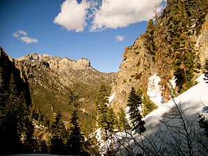
Charleston Peak is a very popular place for hikers. From the top, you can see amazing views. You might even spot the Sierra Nevada mountains, Death Valley, and the city of Las Vegas.
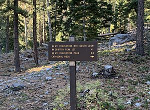
There are two main trails to the summit: the South Loop Trail and the North Loop Trail. Both trails are clearly marked and well-kept. You can hike one trail up and back, or you can combine them to make a big loop. Both options are challenging. They are usually over 16 miles long round trip. Hikers also climb more than 4,000 feet in elevation. A hike to the top often takes all day. The best time to hike is during the summer and fall when there is no snow.
 | May Edward Chinn |
 | Rebecca Cole |
 | Alexa Canady |
 | Dorothy Lavinia Brown |


