Mount Jefferson (Nevada) facts for kids
Quick facts for kids Mount Jefferson |
|
|---|---|

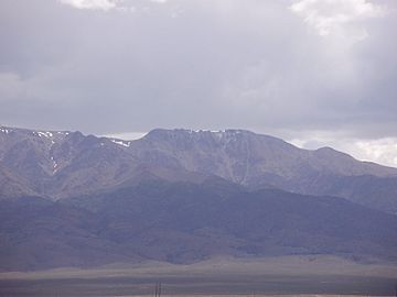
View of the South Summit of Mt. Jefferson from SR 376 near Round Mountain
|
|
| Highest point | |
| Elevation | 11,946 ft (3,641 m) NAVD 88 |
| Prominence | 5,861 ft (1,786 m) |
| Listing | |
| Geography | |
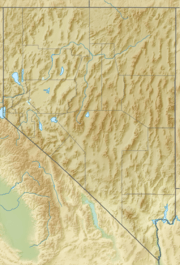
| Location | Nye County, Nevada, U.S. |
| Parent range | Toquima Range |
| Topo map | USGS Mount Jefferson |
| Climbing | |
| Easiest route | From Jefferson Summit near Meadow Canyon, a four-wheel drive road leads north to a trail which ascends directly to the Mount Jefferson South Summit, Hide class 1 |
Mount Jefferson is a very tall mountain in Nevada, United States. It is the highest point in both the Toquima Range and Nye County. This makes it an important landmark in the area.
It is also the sixth tallest mountain in the entire state of Nevada. Mount Jefferson stands out because it rises high above the land around it. This is called its 'topographic prominence'. It has a prominence of about 5,861 feet (1,786 meters). This makes it the most prominent peak in Nye County and the third most prominent in Nevada.
Location and Features
Mount Jefferson is located about 50 miles (80 km) northeast of Tonopah. It is part of the Alta Toquima Wilderness within the Humboldt-Toiyabe National Forest. Nearby small towns include Carvers and Round Mountain.
Three Summits
Mount Jefferson has three main peaks, or 'summits', that are close together. These summits are on a wide, flat area covered in subalpine tundra.
- The North Summit reaches about 11,820 feet (3,603 meters) high.
- The Middle Summit is about 11,692 feet (3,564 meters) high.
- The South Summit is the tallest, at about 11,949 feet (3,642 meters).
Ancient Glaciers
Long ago, during the Pleistocene Ice Age, large glaciers moved across the mountain. These glaciers carved out bowl-shaped hollows called 'cirques' on the eastern side of the mountain's top. These cirques are still visible today.
 | Charles R. Drew |
 | Benjamin Banneker |
 | Jane C. Wright |
 | Roger Arliner Young |


