Death Valley facts for kids
Death Valley is a famous desert valley in Eastern California, located in the northern Mojave Desert. It touches the Great Basin Desert. Many people believe it's the hottest place on Earth during summer. The Timbisha Native American tribe has lived here for at least a thousand years. They were once known as the Panamint Shoshone.
Death Valley is home to Badwater Basin, which is the lowest point in all of North America. It sits 282 feet (86 m) below sea level. This spot is about 84.6 miles (136.2 km) east of Mount Whitney. Mount Whitney is the highest point in the contiguous United States. On July 10, 1913, a temperature of 134 °F (56.7 °C) was recorded at Furnace Creek, California. This is still considered the highest air temperature ever recorded on Earth's surface. However, some experts today question if this reading was completely accurate.
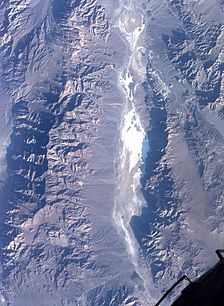
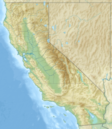
Most of Death Valley is in Inyo County, California, close to the border of California and Nevada. It's part of the Great Basin area, east of the Sierra Nevada mountains. The valley makes up a large part of Death Valley National Park. It's also a main feature of the Mojave and Colorado Deserts Biosphere Reserve. The valley stretches from north to south. It lies between the Amargosa Range to the east and the Panamint Range to the west. The Grapevine Mountains are to the north, and the Owlshead Mountains are to the south. Death Valley covers an area of about 3,000 sq mi (7,800 km2). The highest point in Death Valley National Park is Telescope Peak. It's in the Panamint Range and is 11,043 feet (3,366 m) high.
The valley got its name in the winter of 1849-1850. A group of European-American pioneers got lost here. They were trying to find a shortcut to the gold fields in California. Even though only one person from the group died, they all thought the valley would be their grave.
Contents
Geology: How Death Valley Was Formed
Death Valley is a graben. This means it's a block of land that has dropped down between two mountain ranges. It's at the southern end of a long geological trough called Walker Lane. This trough goes all the way north to Oregon. A system of strike slip faults cuts through the valley. These include the Death Valley Fault and the Furnace Creek Fault. The Garlock Fault also meets the Death Valley Fault. Water from Furnace Creek and the Amargosa River flows through parts of the valley. Eventually, this water disappears into the sand on the valley floor.
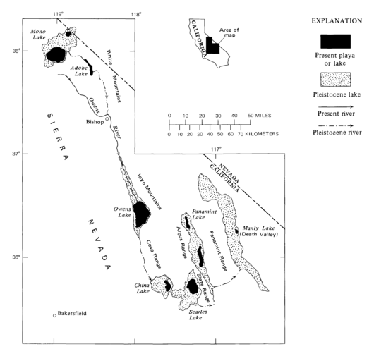
Death Valley also has salt pans. These are flat areas covered in salt. Scientists believe that during the middle of the Pleistocene era, about 10,000 to 12,000 years ago, a large inland lake formed here. This lake was called Lake Manly. It was almost 100 miles (160 km) long and 600 feet (180 m) deep. Lake Manly was the last in a chain of lakes. This chain started with Mono Lake in the north. It continued through basins down the Owens River Valley, through Searles and China Lakes, and the Panamint Valley.
As the area became a desert, the water in Lake Manly dried up. This left behind a lot of salts, like common sodium salts and borax. These salts were later mined by people from 1883 to 1907.
Climate: Why Death Valley is So Hot and Dry
Death Valley has a subtropical, hot desert climate. This means it has very long, extremely hot summers. Its winters are short and warm, and it gets very little rain.
The valley is super dry because it's in the rain shadow of four big mountain ranges. These include the Sierra Nevada and Panamint Range. When moisture from the Pacific Ocean moves inland, it has to go over these mountains. As the air goes up each mountain range, it cools down. The moisture then turns into rain or snow on the western slopes. By the time the air reaches Death Valley, most of its moisture is gone. This is why there's hardly any rain.
Many things make Death Valley extremely hot:
- Sun's Heat: The ground in the valley, made of soil, rocks, and sand, gets very hot from the sun. The air is clear and dry, and there aren't many plants. This is especially true in mid-summer when the sun is almost directly overhead.
- Trapped Warm Air: Warm air usually rises and cools. But in Death Valley, this warm air gets trapped by the tall, steep valley walls. It keeps getting reheated and pushed back down to the valley floor. The valley also runs north to south, which is sideways to the main west-to-east winds. This also helps trap the warm air.
- Warm Air from Other Places: Hot desert areas next to Death Valley, especially to the south and east, often heat up the air before it even reaches the valley.
- Warm Mountain Winds: When winds blow up and over mountains, they can get warmer. These dry, warm winds are called foehn winds. They get warmer partly because water vapor turns into clouds, releasing heat. Also, because Death Valley is so low (below sea level), the air gets compressed, which heats it up even more.
The extreme heat and dryness cause constant drought in Death Valley. They also stop many clouds from forming or passing through the valley. So, rain often evaporates before it even hits the ground.
The valley's depth and shape really affect its climate. It's a long, narrow basin that goes below sea level. It's surrounded by high, steep mountains. The clear, dry air and few plants let sunlight heat the desert surface intensely. Summer nights don't offer much relief. The lowest temperatures at night might only drop to the 82 to 98 °F (28 to 37 °C) range. Super-heated air masses blow through the valley, making the air temperature incredibly high.
The hottest air temperature ever recorded in Death Valley was 134 °F (56.7 °C). This happened on July 10, 1913, at Greenland Ranch (now Furnace Creek). As of 2022, this is the highest air temperature ever recorded on Earth's surface. During that heat wave, five days in a row reached 129 °F (54 °C) or higher. Some weather experts today question how accurate that 1913 measurement was. On June 30, 2013, a confirmed temperature of 129.2 °F (54.0 °C) was recorded. This temperature is tied with Mitribah, Kuwait, as the hottest reliably measured air temperature on Earth. A temperature of 130 °F (54.4 °C) was recorded on August 16, 2020, but it hasn't been officially confirmed yet. The valley recorded that same temperature again on July 9, 2021, but it's also not officially confirmed. The lowest temperature ever recorded in Death Valley was 15 °F (−9 °C). This happened at Greenland Ranch on January 2, 1913.
The highest ground surface temperature ever recorded in Death Valley was 201.0 °F (93.9 °C). This happened on July 15, 1972, at Furnace Creek. It's the only recorded surface temperature above 200 °F (93.3 °C).
In the summer of 2001, Death Valley had 154 days in a row with temperatures of at least 100 °F (38 °C). The summer of 1996 had 40 days over 120 °F (49 °C), and 105 days over 110 °F (43 °C). In 1917, there were 52 days when the temperature reached 120 °F (49 °C) or higher, with 43 of them happening one after another.
The highest overnight low temperature recorded in Death Valley is 110 °F (43 °C), from July 5, 1918. However, this number is debated. A more reliable record high low of 107 °F (42 °C) was recorded on July 12, 2012. This is one of the highest overnight lows ever. Also on July 12, 2012, the average temperature for a full 24 hours was 117.5 °F (47.5 °C). This makes it the world's warmest 24-hour temperature on record.
Four major mountain ranges are between Death Valley and the ocean. Each one makes the rain shadow effect stronger, leading to less rain. In 1929, 1953, and 1989, no rain was recorded for the entire year. The driest period on record was from 1931 to 1934. During those 40 months, only 0.64 inches (16 mm) of rain fell. The average yearly rainfall in Death Valley is 2.36 inches (60 mm). The Greenland Ranch station averaged 1.58 in (40 mm). The wettest month ever recorded was January 1995, when 2.59 inches (66 mm) fell. The wettest period was from mid-2004 to mid-2005. Nearly 6 inches (150 mm) of rain fell in total. This caused temporary lakes to form in the valley and led to amazing wildflower blooms. Snow that actually stayed on the ground has only been recorded once, in January 1922. Small flakes have been seen on other occasions.
Flooding: When Death Valley Gets Wet
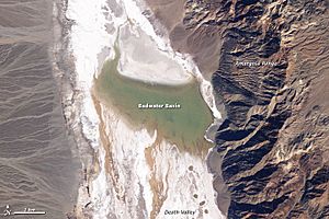
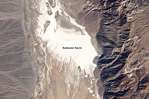
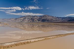
In 2005, Death Valley received four times its usual annual rainfall of 1.5 inches (38 mm). Just like it has done for hundreds of years, the lowest part of the valley filled with a wide, shallow lake. But because of the extreme heat and dryness, this temporary lake quickly started to evaporate.
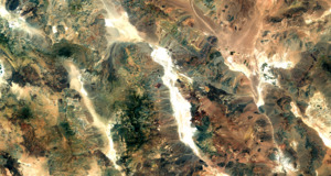
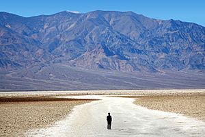
The two pictures you see show the short life of Death Valley's Lake Badwater. The top picture shows it formed in February 2005. The bottom picture shows it evaporated by February 2007. In 2005, a big pool of greenish water stretched almost all the way across the valley floor. By May 2005, the valley floor looked like its usual self again. It was the Badwater Basin, covered in salt-coated salt flats. Over time, this newly dissolved and re-formed salt will become darker.
The western edge of Death Valley has alluvial fans. These are fan-shaped deposits of sediment. During flash floods, rain from the steep mountains to the west rushes through narrow canyons. It picks up everything from fine clay to large rocks. When these powerful water flows reach the end of the canyons, they spread out and slow down. This creates many smaller channels. The lighter colored the fans are, the newer they are.
Ecology: Life in the Desert
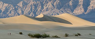
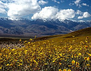
Even with the intense heat and little rain, Death Valley has a surprising amount of different plants and animals. Flowers, watered by melting snow, cover the desert floor every spring, sometimes lasting into June. You might see bighorn sheep, red-tailed hawks, and wild donkeys. Death Valley has over 600 springs and ponds. Salt Creek, a shallow, mile-long area in the middle of the valley, is home to Death Valley Pupfish. These isolated fish populations are left over from a time when the climate was much wetter.
Darwin Falls, on the western edge of Death Valley Monument, drops 100 feet (30 m) into a large pond. This pond is surrounded by willow and cottonwood trees. More than 80 types of birds have been seen around this pond.
Sometimes, a rare event called salt flowers or Efflorescence happens in Death Valley. This is when rain soaks into the soil and dissolves salt under the surface. When the water evaporates, the salt is left on top, making the ground look like it has a light dusting of snow.
History of Death Valley
Death Valley is the home of the Timbisha tribe of Native Americans. They have lived in the valley for at least the last thousand years. The Timbisha name for the valley, tümpisa, means "rock paint." This refers to the red ocher paint that can be made from a type of clay found in the valley. Some Timbisha families still live in the valley at Furnace Creek. There was another village in Grapevine Canyon, near where Scotty's Castle is now. It was called maahunu in the Timbisha language. We don't know exactly what it means, but hunu means 'canyon'.
The valley got its English name in 1849 during the California Gold Rush. Prospectors and others trying to cross the valley on their way to the gold fields called it Death Valley. This was after 13 pioneers from an early group of wagon trains died there. During the 1850s, people mined gold and silver in the valley. In the 1880s, borax was discovered. It was then pulled out of the valley by mule-drawn wagons.
Death Valley National Monument was created on February 11, 1933, by President Herbert Hoover. This put the area under federal protection. In 1994, the monument became Death Valley National Park. It was also made much larger to include Saline and Eureka Valleys.
Notable Attractions and Locations
- Badwater Basin
- China Ranch
- Dante's View
- Darwin Falls
- Devils Hole
- Father Crowley Viewpoint
- Furnace Creek
- Harmony Borax Works
- Hells Gate
- Myers Ranch
- Oasis at Death Valley
- Russell Camp
- New Ryan
- Upper and Lower Noonday Camp
- Racetrack Playa, a large dry lakebed within the Valley
- Sailing stones, famous moving stones of Death Valley
- Scotty's Castle
- Shoreline Butte
- Stovepipe Wells
- Tecopa
- Tecopa Hot Springs
- West Side Borax Camp
- Wilson Ranch
- Wildrose Ranger Station
- Zabriskie Point
See also
 In Spanish: Valle de la Muerte para niños
 | Kyle Baker |
 | Joseph Yoakum |
 | Laura Wheeler Waring |
 | Henry Ossawa Tanner |


