Places of interest in the Death Valley area facts for kids
Death Valley National Park in eastern California is full of amazing places to explore! This huge park has unique landscapes, from salty flats to tall mountains, and even mysterious moving rocks. Let's discover some of the most interesting spots.
Contents
- Exploring Death Valley's Wonders
- Aguereberry Point: A High Viewpoint
- Artist's Drive and Palette: Colorful Rocks
- Badwater Basin: North America's Lowest Point
- Charcoal Kilns: Historic Structures
- Dante's View: A Panoramic Vista
- Darwin Falls: A Desert Oasis
- Devil's Golf Course: A Spiky Salt Flat
- Eureka Valley and Sand Dunes: Singing Sands
- Furnace Creek: An Oasis in the Desert
- Hells Gate: A Scenic Stop
- Mesquite Flat Sand Dunes: Movie Stars
- Mesquite Spring: Ancient Art on Rocks
- Mosaic Canyon: Polished Marble Walls
- Natural Bridge Canyon: A Stone Archway
- Panamint Valley: A Long Desert Basin
- Racetrack Playa: Mysterious Moving Rocks
- Rainbow Canyon: Jet Training Spot
- Red Cathedral: A Striking Formation
- Salt Creek: Home of the Pupfish
- Saratoga Springs: A Desert Marsh
- Shoreline Butte: An Ancient Island
- Teakettle Junction: A Quirky Landmark
- Telescope Peak: Death Valley's Highest Point
- Titus Canyon: A Scenic Drive
- Ubehebe Crater: A Volcanic Blast
- Ventifact Ridge: Wind-Sculpted Rocks
- Images for kids
Exploring Death Valley's Wonders
Aguereberry Point: A High Viewpoint
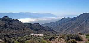
Aguereberry Point is a high spot in the Panamint Range mountains, inside Death Valley National Park in California. It's named after Jean Pierre "Pete" Aguereberry, a miner from France. He lived and worked at the nearby Eureka Mine from 1905 until he passed away in 1945.
From this viewpoint, which is 6,433 feet high, you can see amazing sights. Look around to see the Panamint Range stretching out, and Death Valley below to the east. You can also spot Furnace Creek and the salty flats of Badwater Basin. Far in the distance to the east, you might even see Mount Charleston in Nevada!
Artist's Drive and Palette: Colorful Rocks
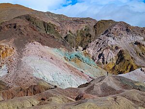
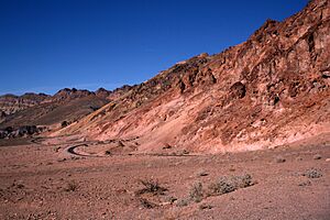
Artist's Drive is a scenic road that climbs up a large fan-shaped pile of rocks and dirt, called an alluvial fan. This fan was created by a deep canyon in the Black Mountains. Artist's Palette is a special area on the side of the Black Mountains known for its many rock colors.
These amazing colors come from different metals in the rocks that have changed over time. For example, iron makes red, pink, and yellow colors. Green comes from a type of mica that has broken down, and manganese creates purple. These colorful rocks show how powerful volcanic eruptions were in the Death Valley area long ago.
Badwater Basin: North America's Lowest Point
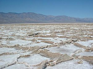
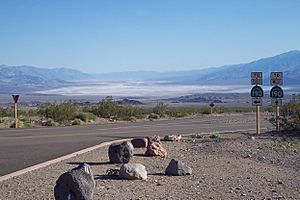
Badwater Basin is a huge, flat area covered in salt, right next to the Black Mountains. It's the lowest point in North America, sitting 279 feet below sea level! The vast white area is made almost entirely of pure table salt.
This salty flat formed when a large lake, about 30 feet deep, dried up 2,000 to 3,000 years ago. When it rains a lot, Badwater Basin can get covered with a thin layer of water. But this new lake doesn't last long because the area gets very little rain (about 1.9 inches per year) and has a super high evaporation rate (about 150 inches per year). This means even a 12-foot deep, 30-mile long lake would dry up in just one year! As the water evaporates, the salt dissolves and then forms clean, sparkling crystals again.
Charcoal Kilns: Historic Structures
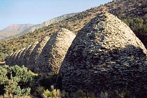
The Wildrose Charcoal Kilns were built in 1877 in the Panamint Range, high above Death Valley. These unique stone structures were used to turn pinyon pine and juniper wood into charcoal. This was done by slowly burning the wood with very little oxygen. The charcoal was then taken to mines about 25 miles away to help melt metal and get valuable ore.
Even though the mines were used until about 1900, it's not clear if the kilns were used after 1879. They were fixed up in 1971 by Navajo stonemasons from Arizona. The kilns were built here because pinyon pine and Utah juniper trees are very common in the upper Panamint Mountains.
Dante's View: A Panoramic Vista
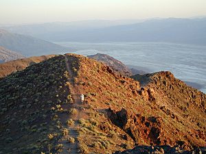
From Dante's View, you can see the central part of Death Valley from a high spot about 5,500 feet above sea level. From here, you can clearly see Badwater Basin, which is the lowest dry point in North America. You can also spot Telescope Peak, which is 11,331 feet above sea level. This huge difference in height between the lowest and highest points is one of the biggest in the United States!
Dante's View is located on the Black Mountains. These mountains, along with the Panamint Range across the valley, are part of a special geological feature. The valley itself is a "graben," which means a block of land that has dropped down, while the mountains on either side are "horsts," or blocks that have risen up. These formations happen when the Earth's surface is being pulled apart.
Darwin Falls: A Desert Oasis
Darwin Falls is a beautiful waterfall on the western edge of Death Valley National Park, near Panamint Springs, California. There are several waterfalls here, mainly divided into upper and lower sections with a small cave-like area in between. The small, narrow valley where the falls are found has rare green plants in the middle of the desert. It's also home to local animals like quail. The falls themselves support small areas filled with ferns.
Devil's Golf Course: A Spiky Salt Flat
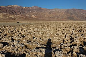
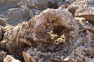
The Devil's Golf Course is a large, bumpy salt flat on the floor of Death Valley. It got its name from a 1934 park guide that said, "Only the devil could play golf" on its surface. This is because of the rough, spiky texture made by large salt crystal formations.
Long ago, a lake called Lake Manly covered this valley, about 30 feet deep. The salt you see at the Devil's Golf Course is made of minerals that were dissolved in the lake's water and left behind when the lake dried up. Since the Devil's Golf Course is a bit higher than Badwater Basin, it stays dry. This allows the wind and weather to shape the salt into these amazing, complicated formations.
Exploratory holes drilled in the 1930s showed that the salt and gravel beds here go down more than 1,000 feet! Later studies even suggest some areas are up to 9,000 feet deep. You can reach the Devil's Golf Course from Badwater Road by taking a 1.3-mile gravel road.
Eureka Valley and Sand Dunes: Singing Sands
Between the Last Chance Range and Saline Mountains is the graben Eureka Valley. Sand dunes cover 3 square miles of Eureka Valley. They rise 680 feet high, making them some of North America's tallest dunes. When sand moves down the dune face, it can make a booming sound, known as "singing sand." This happens because the sand grains are small, loose, and dry. Unique plants that live here include the Eureka Dune Grass and the Eureka Evening Primrose.
Furnace Creek: An Oasis in the Desert
Furnace Creek is a spring, an oasis, and a small village. It sits on top of a very neat, fan-shaped pile of rocks and dirt called an alluvial fan. The main visitor center for Death Valley National Park is here, along with the Oasis at Death Valley resort.
The springs and green oases here support many plants and attract a wide variety of animals. The highest temperature ever recorded in North America was at Furnace Creek Ranch: 134 °F (57 °C)!
Hells Gate: A Scenic Stop
Hells Gate is an interesting spot located in Death Valley National Park. It's where Daylight Pass Road and Beatty Road meet. There's a parking area here and paths for hiking.
Mesquite Flat Sand Dunes: Movie Stars
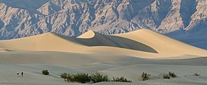
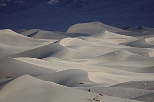
The Mesquite Flat Sand Dunes are at the northern end of the valley floor, almost completely surrounded by mountains. Because they are easy to reach from the road and Death Valley is close to Hollywood, these dunes have been used to film desert scenes for many movies, including some from the Star Wars series!
The largest dune is called Star Dune. It stays pretty stable because it's where different winds that shape the dunes come together. The sand at its top is about 130–140 feet deep. The sand for these dunes likely comes from the Cottonwood Mountains to the north and northwest. The tiny grains of quartz and feldspar that make up these wavy sand sculptures started as much larger pieces of rock.
Between many of the dunes, you can find creosote bushes and some mesquite plants growing on the sand and dried mud.
Mesquite Spring: Ancient Art on Rocks
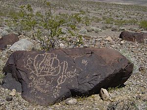
Mesquite Spring is in the northernmost part of Death Valley. This area has many cotton top cactuses, blister beetles, and cholla cactuses. On the fan-shaped pile of rocks above the springs, you can find petroglyphs (rock carvings) that are 2,000 to 3,000 years old! These were made by the ancient Mesquite Spring culture.
The petroglyphs here are possible because many rocks in this dry area have a dark coating called desert varnish. This special type of desert varnish takes 10,000 years to form just a tiny bit (1/100th of an inch)! It's created by a certain type of bacteria that gathers iron, manganese, and clay to make the varnish. Since the varnish forms at a steady rate, scientists can guess how old the petroglyphs are by looking at how much new varnish has formed over the carvings.
Mosaic Canyon: Polished Marble Walls
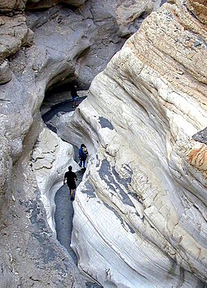
Mosaic Canyon is in the northwestern mountains of the valley. It's named after a type of rock called "breccia," which has angular blocks of dolomite mixed into a pebbly material. The entrance to Mosaic Canyon looks ordinary, but after walking just a quarter-mile, the canyon gets very narrow. It becomes a deep slot cut into the side of Tucki Mountain. Smooth, polished marble walls surround the trail as it winds through the canyon's curves.
The canyon follows faults that formed when the Earth's crust in the Death Valley area began stretching millions of years ago. Running water then wore away the weakened rock, slowly carving out Mosaic Canyon.
The polished marble walls of Mosaic Canyon are made from a rock called Noonday Dolomite and other Precambrian carbonate rocks. These rocks started as limestone that formed about 850-700 million years ago when the area was covered by a warm sea. Later, magnesium was added, changing the limestone into dolomite. This dolomite was then buried deep underground. Far below the surface, high pressure and heat changed the dolomite into the metamorphic rock called marble.
Natural Bridge Canyon: A Stone Archway
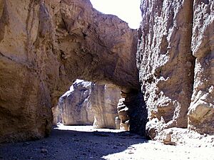
Natural Bridge Canyon is on the east side of the park and is one of the few canyons with an official hiking path. It's located about 4 miles south of the Artist's Drive scenic loop. The canyon has a natural stone bridge that you can reach after a fifteen-minute walk from the parking area.
Panamint Valley: A Long Desert Basin
Panamint Valley is a long basin that stretches for 65 miles between the Panamint Range to the east and the Argus and Slate ranges to the west. It's about 10 miles wide. This valley is an endorheic basin, meaning it can form a lake after heavy rain, but the water doesn't flow out to the ocean. The airspace above the valley is used by the U.S. military for training. The ghost town of Ballarat once had 400 residents around 1900 when mines were active in the area.
Racetrack Playa: Mysterious Moving Rocks
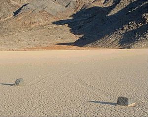
Racetrack Playa is a dry lakebed located in the northern part of the Panamint Mountains. It's famous for its rocks that mysteriously move across its surface! When it rains heavily, water flows down from nearby mountains onto the playa, forming a shallow, temporary lake. Most of these "sailing stones" come from a nearby hillside of dark dolomite at the south end of the playa.
Similar moving rock patterns have been seen in other dry lakebeds, but the number and length of the tracks on The Racetrack are special. The rocks on Racetrack Playa only move about once every two or three years, and most of their tracks last for just three or four years.
Rainbow Canyon: Jet Training Spot
Rainbow Canyon is a canyon near the western edge of the park. It's often used by the United States Military for fighter jet training. Photographers frequently visit the canyon rim to take pictures of jets flying below them!
Red Cathedral: A Striking Formation
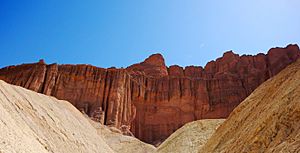
Red Cathedral is a striking geological formation made of steep cliffs. It's located between highways 178 and 190. The rocks here are red because of oxidized metals. You can see Red Cathedral from Zabriskie Point and the Golden Canyon trail.
Salt Creek: Home of the Pupfish
Much of Salt Creek is usually dry on the surface, covered by a bright layer of salt. This salt forms from many floods and then the water evaporating. Over time, the small amounts of minerals in the water build up to create this long salt flat. Another part of Salt Creek flows with salty water all year round. This is where the Death Valley pupfish lives, the last survivor of ancient Lake Manly!
Saratoga Springs: A Desert Marsh
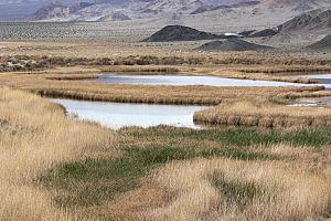
Saratoga Springs is a desert oasis in southern Death Valley National Park. This wetland is at the southern tip of the Ibex Hills, on the floor of Death Valley. Several springs overflow into pools, creating 6.6 acres of marshland, making it the third largest marsh in the park.
These pools are home to several unique species found nowhere else. These include the Saratoga Springs pupfish, the Amargosa tryonia snail, and the Death Valley June beetle. Plants like common reeds and saltgrass also grow here.
The springs were likely named in 1871 after the resort town of Saratoga Springs, New York. They were an important water source for the twenty-mule teams that hauled borax in the 1880s. Today, human entry into the wetland is not allowed to protect this sensitive habitat.
Shoreline Butte: An Ancient Island
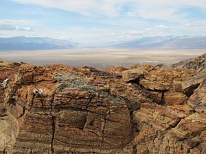
This desert butte (a flat-topped hill) was once an island in a huge lake that filled Death Valley many times during the Pleistocene ice ages. Scientists call all parts of this large body of water Lake Manly. You can see different horizontal lines on the northeast side of the butte. These are ancient shorelines from this lake!
It takes a long time for waves to carve out these terraces, so these benches show times when the lake level stayed steady long enough for waves to leave their mark on the rock. The highest shoreline is one of the main clues geologists use to guess how deep the lake once was in Death Valley. Shorelines of ancient Lake Manly are found in several parts of Death Valley, but they are clearest at Shoreline Butte.
Teakettle Junction: A Quirky Landmark
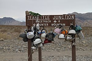
At the spot where the dirt road from Ubehebe Crater meets roads to the Racetrack Playa and Hunter Mountain, there's a sign that says "Teakettle Junction." No one knows exactly how it got its name, but it has become a tradition for visitors to attach teakettles to the sign with messages written on them! Park rangers sometimes remove some teakettles when there are too many.
Telescope Peak: Death Valley's Highest Point
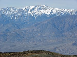
Telescope Peak is the highest point within Death Valley National Park. It was named because you can see for over one hundred miles in many directions from its top! From this desert mountain, you can look west to Mount Whitney and east to Charleston Peak. Its summit rises 11,331 feet above Badwater Basin, which is the lowest point in Death Valley at 282 feet below sea level.
Titus Canyon: A Scenic Drive
Titus Canyon is a narrow gorge in the Grapevine Mountains, near the eastern edge of Death Valley National Park. It features interesting rock formations, petroglyphs (ancient rock carvings), and various kinds of wildlife, including bighorn sheep. Along the road to the canyon, you'll find Leadfield, a ghost town from the 1920s.
Ubehebe Crater: A Volcanic Blast
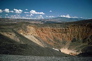
Ubehebe Crater is the largest of more than a dozen craters in the Ubehebe Craters field. It formed when groundwater exploded into steam because of hot magma underground. This left behind an empty pit, and the debris spread around the area. Over thousands of years, erosion has revealed colorful stripes on the crater walls that date back to the Miocene era. Visitors can hike on trails to the bottom or around the rim of the crater.
Ventifact Ridge: Wind-Sculpted Rocks
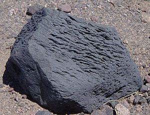
Ventifact Ridge is part of a basaltic lava flow. The rocks on this exposed ridge are famous for being shaped by wind erosion and are called ventifacts. The sharp edges on these rocks are called "Kanters," and the open grooves are called "flutes." Most of the holes in the basalt are bubbles that formed when gas escaped from the cooling lava. Some of these have been made bigger by sandblasting.
The winds on this ridge are very strong because they are concentrated and sped up at the top of the hill. These powerful winds pick up dust and sand, which literally sand-blast the exposed rock surfaces. The strong winds that cause this sandblasting come from both the north and the south.
Images for kids
 | Georgia Louise Harris Brown |
 | Julian Abele |
 | Norma Merrick Sklarek |
 | William Sidney Pittman |


