Mummy Mountain (Nevada) facts for kids
Quick facts for kids Mummy Mountain |
|
|---|---|

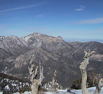
Mummy Mountain as seen from Griffith Peak in late January 2003
|
|
| Highest point | |
| Elevation | 11,533 ft (3,515 m) NAVD 88 |
| Prominence | 801 ft (244 m) |
| Geography | |
| Location | Clark County, Nevada, U.S. |
| Parent range | Spring Mountains |
| Topo map | USGS Charleston Peak |
| Climbing | |
| Easiest route | Scramble |
Mummy Mountain is a really cool and important peak in the Spring Mountains of Nevada, United States. It's the second tallest mountain in this range! It also ranks as the twentieth highest mountain in the entire state. This amazing mountain is found within the Mount Charleston Wilderness and the Humboldt-Toiyabe National Forest. These are special protected areas where nature is preserved.
Why the Name "Mummy Mountain"?
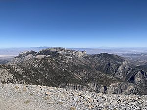
Mummy Mountain gets its interesting name because it looks a bit like a mummy. Or, it might look like an Egyptian sarcophagus (a stone coffin) when you see it from the side. The "head" part is at the north, near Lee Canyon. The main, rounded part of the mountain forms the "body." Then, a rise and some cliffs to the south look like the "feet," which people call "Mummy's Toe." This unique shape is easiest to spot from U.S. Route 95, which goes past the mountain to the east.
Reaching the Top
If you want to climb Mummy Mountain, the most common way to reach the top starts from the North Loop Trail or Trail Canyon. These trails lead towards Mount Charleston. You begin where the trail gets close to the ridge between Mummy Mountain and Mount Charleston.
After the first two switchbacks (zigzag turns in the trail), you'll find a steep, rocky slope. Climbing up this slope, which is called a scree slope, takes you to the top of the ridge. From there, a faint path leads east. This path goes to the base of the cliffs that form the summit. The route then turns north to a special rocky path, which leads to the wide, flat top of the mountain.
 | Tommie Smith |
 | Simone Manuel |
 | Shani Davis |
 | Simone Biles |
 | Alice Coachman |


