Mount Hood (California) facts for kids
Quick facts for kids Mount Hood |
|
|---|---|

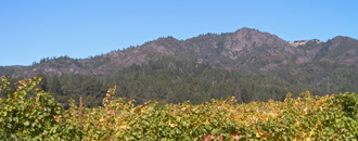
Mount Hood viewed from Sonoma Valley
|
|
| Highest point | |
| Elevation | 2,733 ft (833 m) NAVD 88 |
| Prominence | 1,970 ft (600 m) |
| Geography | |
| Location | Sonoma County, California, U.S. |
| Parent range | Mayacamas Mountains |
| Topo map | USGS Kenwood |
| Climbing | |
| Easiest route | Trail |
Mount Hood, also known as Hood Mountain, is a mountain in California. It's located near Santa Rosa, California and the Sonoma Valley. This mountain stands about 2,733 feet (833 meters) tall.
Its original name was Mount Wilikos. This was an ancient name meaning "willows." Most of the water flowing from Mount Hood helps form Sonoma Creek. You can see a large, rocky part on the mountain's upper half from State Route 12.
The mountain is home to different natural areas. These include oak forests, pygmy forests, chaparral, and areas along streams. Long ago, the Yuki people lived on Mount Hood's slopes. Most of Mount Hood is part of Hood Mountain Regional Park. This park is managed by Sonoma County.
Mount Hood is part of the Mayacamas Mountains. It is mostly in Sonoma County. A small part of the mountain is in Napa County. From Mount Hood, you can see the Pacific Ocean and San Francisco Bay. You can also get a great view east to the Sierra Nevada mountains.
Contents
Exploring Mount Hood's Surroundings

Mount Hood is easiest to reach using California State Route 12. This road runs through the Sonoma Valley. It connects the town of Sonoma to the city of Santa Rosa.
You can get good views of Mount Hood from the valley floor. Try looking from the village of Kenwood. You can also see it from where State Route 12 meets Pythian Road. The community of Oakmont in Santa Rosa also offers views. From these spots, you can see a rocky outcrop called Gunsight Point. This is near the peak of Mount Hood. Bald Mountain, in Sugarloaf Ridge State Park, is also visible nearby.
Mount Hood can also be seen from the Napa Valley. From the top of Mount Hood, you get wide views to the west. You can see Annadel State Park and Sonoma Mountain. On clear days, you can even see the Pacific Ocean far to the west. To the east, you can spot the Sierra Nevada Mountains.
Understanding Mount Hood's Landscape
The lower parts of Mount Hood have soils called Goulding-Toomes-Guenoc. These are well-drained loams and clay-loams. The upper parts have Kidd-Forward-Cohasset soils. These soils range from well-drained to very well-drained. They are often gravelly and stony.
Even though much of the land is steep, there isn't much erosion. This is mainly because few people have visited these areas over time. The plant cover has also stayed strong. Water from the northern slopes of Mount Hood forms Santa Rosa Creek. The central and eastern parts of the mountain feed into Sonoma Creek. Hood Creek and Graywood Creek are smaller streams that also flow into Sonoma Creek. Mount Hood gets about 30 inches (76.2 cm) of rain each year.
Mount Hood's Natural Habitats
Mount Hood has several different natural areas, or habitats. These include:
There are also special rocky areas on the upper western side. These are like a type of chaparral. They have small forest patches mixed in.

The mixed oak woodlands are common at lower elevations. Trees like coast live oak, Douglas fir, California buckeye, and bigleaf maple grow here. The plants under these trees are not very dense. This is especially true in deep ravines like those along Hood Creek. You might find toyon, poison oak, and hollyleaf cherry here. At middle elevations, there are also many tanbark oak and Pacific madrone trees.
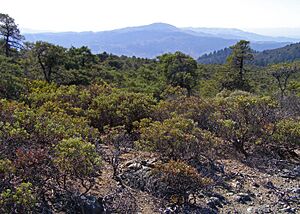
Chaparral areas have many types of manzanita plants. One special type is Arctostaphylos manzanita 'Mount Hood'. You'll also find a lot of poison oak and coyote brush. These plants grow in exposed, rocky areas with thin soil. The risk of fire is highest in these areas. You can see signs of past fires from about twenty years ago.
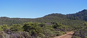
Mount Hood has large pygmy forest areas. These are on the west-facing slopes and flatter inner plateaus. The main trees here are Sargent cypress. There are also different Arctostaphylos species and coyote brush. The Sargent cypress trees were once thought to be Mendocino cypress. However, Mendocino cypress doesn't naturally grow in this area. The pygmy forest trees are usually 10 to 15 feet (3 to 5 meters) tall. These dense patches can be about half a mile to one and a half miles (one to two kilometers) wide.
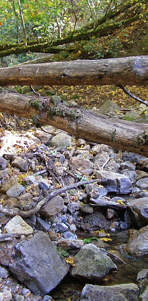
The riparian zones are found in deep, shady ravines. These steep woodlands have many California laurel trees. They also have ferns and toyons growing underneath. Streams like Sonoma Creek, Hood Creek, and Santa Rosa Creek usually flow all year. This is true except for their very highest parts (above 2,200 feet or 671 meters). Many birds live in the Mount Hood area. You can often see scrub jays, woodpeckers, and juncos, especially near the streams.
Animals like mountain lions, bobcats, and rattlesnakes live throughout the area. Rattlesnakes prefer sunny, rocky slopes that face west.
Hiking Adventures on Mount Hood
Trails that lead to the top of Mount Hood start from three different places:
- Along Adobe Canyon Road, inside Sugarloaf Ridge State Park. This is on the mountain's southeast side.
- At the end of Pythian Road, on the west side.
- At the end of Los Alamos Road, on the north side.
Trails from the first two starting points climb about 2,000 feet (610 meters) directly to the summit. Trails from the Los Alamos Road trailhead take a longer path. However, they involve about the same amount of climbing.
The Goodspeed/Nattkemper Trail starts from Adobe Canyon Road. It offers the most direct way to the summit and Gunsight Rock. From Gunsight Rock, you can see far to the south and west. From the Los Alamos Road trailhead, the Hood Mountain Trail goes down to and crosses Santa Rosa Creek. Then, it climbs up an easy fire road to the summit. This path goes through the pygmy forest on the mountain's northwest side.
The Summit Trail branches off the Hood Mountain Trail at about 1,400 feet (427 meters) up. This trail offers a more challenging hike to the summit. From the Pythian Road trailhead, the Lower and Upper Johnson Ridge trails climb directly to the Hood Mountain Trail and then to the summit. This trailhead also gives good access to the pygmy forest via the Panorama Ranch Trail.
There is no drinking water available in the Mount Hood area. The only exception is at the parking lot of the Pythian Road trailhead. You can camp overnight at two spots along the trails in the park. Dogs are allowed in the park if they are on a leash.
How Mount Hood Got Its Name
The mountain is named after William Hood. He was a settler from Scotland. He climbed the peak in 1846.
 | Shirley Ann Jackson |
 | Garett Morgan |
 | J. Ernest Wilkins Jr. |
 | Elijah McCoy |


