Yulupa Creek facts for kids
Quick facts for kids Yulupa Creek |
|
|---|---|

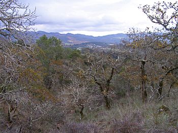
Headwaters area of Yulupa Creek in the northern Sonoma Mountains with distant view of Mayacamas Mountains.
|
|
| Country | United States |
| State | California |
| Region | Sonoma County |
| City | Santa Rosa, California |
| Physical characteristics | |
| Main source | Bennett Mountain 3 mi (5 km) west of Kenwood, California 1,080 ft (330 m) 38°23′59″N 122°35′39″W / 38.39972°N 122.59417°W |
| River mouth | Sonoma Creek 2 mi (3 km) northwest of Glen Ellen, California 295 ft (90 m) 38°22′45″N 122°33′10″W / 38.37917°N 122.55278°W |
| Length | 2.8 mi (4.5 km) |
| Basin features | |
| Basin size | 5 sq mi (13 km2) |
Yulupa Creek is a small, 2.8-mile-long (4.5 km) stream in Sonoma County, California. It flows year-round, making it a perennial stream. This creek starts in the northern Sonoma Mountains and flows southeast. It collects water from the eastern side of Bennett Mountain. Yulupa Creek is a tributary (a smaller stream that flows into a larger one) of Sonoma Creek. Eventually, Sonoma Creek flows into San Pablo Bay.
Contents
Where Yulupa Creek Flows
Yulupa Creek begins high up in the Sonoma Mountains. Its starting point is near the southwestern edge of Annadel State Park, close to Bennett Ridge Road.
From there, the creek flows downhill towards the southeast. After about 2 miles (3 km), it reaches Bennett Valley Road. The creek then follows this road eastward until it meets Warm Springs Road. At this point, Yulupa Creek joins Sonoma Creek.
The Yulupa Creek Watershed
The area of land that drains into Yulupa Creek is called its watershed. This watershed covers about five square miles. It's a very important area for fish, especially steelhead (Oncorhynchus mykiss).
Scientists have studied the creek and found that it's a good place for these fish to spawn (lay their eggs). Even though fish numbers have gone down over the years, the Yulupa Creek watershed is still considered "Critical Habitat" for steelhead and Chinook salmon (O. tshawytscha). This means it's a super important place for these fish to survive.
Land Use in the Watershed
Most of the land in the Yulupa Creek watershed is part of Annadel State Park. There are also some homes, but they are spread out. Many of these homes are large and expensive.
From the higher parts of the watershed, you can see amazing views. You can look north towards Hood Mountain and the southern Mayacamas Mountains. To the south, you can see Sonoma Valley and even San Francisco far away. Sonoma Mountain is visible to the southwest.
Most of this area is known as Kenwood, California. Kenwood is famous for its viticulture (grape growing for wine). However, only a small part of the Yulupa Creek watershed actually has grapevines.
Plants and Animals of Yulupa Creek
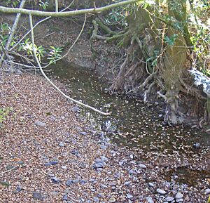
Yulupa Creek is not just important for steelhead and Chinook salmon. It's also a high-quality riparian zone. This means the area right next to the creek is healthy and full of life. It's even a known home for freshwater shrimp.
The land around the creek, called the upland watershed, is a California oak woodland. Much of this forest is untouched and has many different kinds of plants and animals, which is called biodiversity. These forests are some of the best examples of their kind.
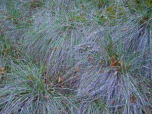
One special thing about these forests is the thick bunch grass growing underneath the trees. This shows that the land hasn't been heavily used for grazing animals or farming in the past.
Plant Communities
Besides the riparian habitat along the creek, other plant groups include:
- California oak woodland
- Douglas fir forest
- Chaparral (a type of shrubland)
- Grassland
- Marsh
The most common plant group is the oak woodland. The main trees that form the canopy (the top layer of the forest) are:
Sometimes, near swales (low, wet areas) and smaller creeks, you can find canyon live oak.
Underneath the trees, the main plants are native bunch grass, toyon, blackberry, and western poison-oak. In drier spots, you might see coyote brush.
Animal Life
Many animals live in and around Yulupa Creek. You can often spot:
Less often, you might see bigger animals like bobcats and mountain lions.
The area is also home to many different birds, including:
- Scrub jay
- Steller's jay
- Acorn woodpecker
- Black phoebe
- Junco
Near the creek and its smaller streams, you can find several amphibians, like the rough skinned newt (Taricha granulosa).
The Geology of Yulupa Creek
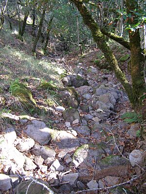
Many of the small streams that feed into Yulupa Creek dry up in the summer. This is because most of the yearly rainfall (about 30 in (76 cm)) happens between October and April. However, Ledson Marsh keeps some small pools of water for most of the year. Ledson Marsh has an outlet that flows into the north fork of Yulupa Creek.
Long ago, during the Miocene era, the area where Yulupa Creek is now was actually under the Pacific Ocean. Then, huge forces caused the land to lift up (called uplift) and volcanic eruptions happened. These events formed the mountains that are now the high parts of the Yulupa Creek watershed.
The land in the Yulupa Creek watershed ranges from about 430 to 1800 feet (130 to 550 meters) above sea level. The most common type of rock is Sandstone, which is left over from the ancient sea floor.
The slopes in the higher areas are often very steep, from 15 to 30 percent. In the lower parts of the creek, the land is flatter, with slopes of two to five percent.
One important type of soil in the upper parts of the creek's riparian zone is called Goulding cobbly clay loam. This soil has about 25 percent cobblestones and some basalt rocks. These rocks show the area's volcanic past in the Sonoma Mountains. The soil in the headwater area is usually 14 to 20 inches (35 to 50 centimeters) deep.
Another common soil type near Yulupa Creek is Laniger loam, which has rhyolite outcrops. Rhyolite is an igneous rock, meaning it formed from cooled lava, again showing the area's volcanic history.
Bridges Over Yulupa Creek
There are two main public roadway bridges that cross Yulupa Creek.
The first bridge is on Warm Springs Road. It's about 11.15 miles (17.94 km) north of State Route 116. This bridge is seven meters long and was built in 1930. It's a concrete culvert design.
The second bridge is further upstream on Bennett Valley Road. It's about 0.6 miles (1 km) west of Warm Springs Road. This bridge was built in 1970 and is made of concrete slabs. It spans 33 feet (10.1 meters) across the creek.
 | Precious Adams |
 | Lauren Anderson |
 | Janet Collins |


