
Mount Saint Helena facts for kids
Quick facts for kids Mount Saint Helena |
|
|---|---|

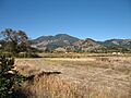
Mount Saint Helena, viewed from Northern Napa Valley
|
|
| Highest point | |
| Elevation | 4,342 ft (1,323 m) NAVD 88 |
| Prominence | 1,823 ft (556 m) |
| Listing | California county high points 44th |
| Geography | |

Mount Saint Helena
Location in California
|
|
| Parent range | Mayacamas Mountains |
| Topo map | USGS Mount Saint Helena |
Mount Saint Helena is a tall mountain in the Mayacamas Mountains in California. It sits where three counties meet: Napa, Sonoma, and Lake. The mountain is made of very old volcanic rocks, about 2.4 million years old. It's one of the few mountains in the San Francisco Bay Area that gets snow in winter.
The mountain has five peaks, which look a bit like an "M" shape. The highest point is called North Peak and is in Sonoma County. The second-highest peak is in Napa County. The Napa River actually starts on the southeast side of Mount Saint Helena.
History of Mount Saint Helena
Mount Saint Helena has a fiery past. Long ago, it had powerful volcanic eruptions. These eruptions created California's famous Petrified Forest. This forest is made of ancient trees that turned into stone over millions of years.
The mountain was first called Mount Mayacamas. But in 1841, Russian explorers climbed to the top. They left a special copper plate there. This plate had the name of Princess Helena de Gagarin. Her husband was a leader at Fort Ross, a Russian settlement nearby. That's how the mountain got its new name, Mount Saint Helena.
A famous writer, Robert Louis Stevenson, spent time on Mount Saint Helena. In 1880, he and his wife, Fanny, stayed in an old mining camp. Stevenson wrote about his experiences there in his book, The Silverado Squatters. Other writers like Ambrose Bierce and Ursula K. Le Guin have also featured the mountain in their stories.
You can reach the top of Mount Saint Helena by hiking. Trails start from Robert Louis Stevenson State Park. The main trail is about 6 miles long.
Views from the Summit

-
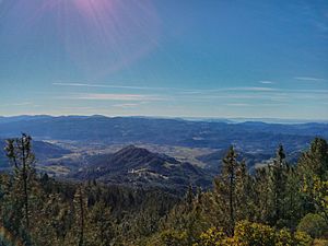
Calistoga viewed from Mount Saint Helena
-
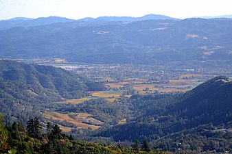
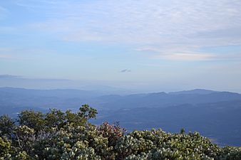
Northern Napa Valley viewed from Mount Saint Helena
-
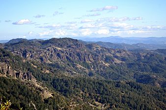
A view from the mountain
-
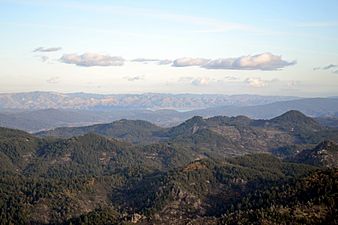
Another view
-
Another view
-
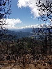
View after the 2017 fire
-
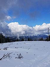
A snowy view


Images for kids
-
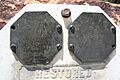
Replicas of a plaque left by Russians on Mount Saint Helena
-
Mount Saint Helena
-
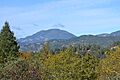
Another view of the mountain
-
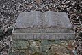
Robert Louis Stevenson monument in Robert Louis Stevenson State Park

.JPG)


