Mark West Creek facts for kids
Quick facts for kids Mark West Creek |
|
|---|---|

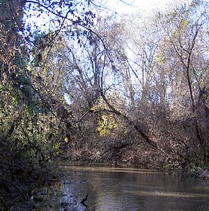
Mark West Creek between Windsor Creek and the Russian River
|
|
|
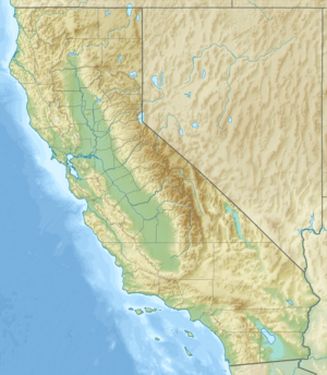
Location of the mouth of Mark West Creek in California
|
|
| Country | United States |
| State | California |
| Region | Sonoma County |
| Cities | Mark West, California, Mark West Springs, California |
| Physical characteristics | |
| Main source | Mayacamas Mountains 6 mi (10 km) west of St. Helena, California 1,922 ft (586 m) 38°31′3″N 122°33′47″W / 38.51750°N 122.56306°W |
| River mouth | Russian River north of Forestville, California 45 ft (14 m) 38°29′38″N 122°53′35″W / 38.49389°N 122.89306°W |
| Basin features | |
| Tributaries |
|
Mark West Creek is a stream in Sonoma County, California. It is about 29.9 miles (48.1 km) long. This creek starts high up in the Mayacamas Mountains.
Smaller streams, like Porter Creek and Hummingbird Creek, flow into Mark West Creek. These smaller streams also begin in the same mountain range. Eventually, the water from Mark West Creek joins the Laguna de Santa Rosa. From there, it flows into the larger Russian River. Groups like the Community Clean Water Institute work to check the water in Mark West Creek for anything that might make it dirty.
If you like adventure, a part of Mark West Creek is great for whitewater kayaking. This four-mile section is known for its exciting rapids.
Contents
Where Mark West Creek Flows
Mark West Creek begins about 6 miles (9.7 km) west of St. Helena, California. It starts near a road called St. Helena Road. The creek then flows west, following this road for a bit.
Journey Through Towns and Hills
The creek reaches Calistoga Road and then turns northeast. It flows through the town of Mark West Springs. After that, it heads south. Mark West Springs Road was built right next to the creek.
The creek passes by the Mayacama Golf Club. Then it turns west again. It comes out of the hills east of the Sonoma County Airport.
Path to the Russian River
The Northwestern Pacific Railroad and later U.S. Route 101 were built over the creek. This happens south of Airport Boulevard. The creek keeps flowing generally west.
It passes south of the airport. Then it joins the Laguna de Santa Rosa. This meeting point is east of Forestville. From there, the creek flows north. It meets Windsor Creek. Finally, it flows west and enters the Russian River. This last part is east of Steelhead Beach Regional Park.
How the Creek Connects
Near where it meets the Laguna de Santa Rosa, Mark West Creek has been moved in three different spots. This makes it look like Mark West Creek flows into the Laguna. But it's actually the other way around. Since 1988, the part of the creek between the Laguna and the Russian River has often been called part of the Laguna. The Laguna de Santa Rosa Foundation supports this way of naming it.
Mark West Creek's Drainage Area
The area that drains water into Mark West Creek is very large. It covers a big part of Sonoma County. This area stretches from Mount Saint Helena and Sonoma Mountain in the east. It goes all the way to Forestville in the west.
Cities in the Watershed
This large drainage area includes four cities. These are Santa Rosa, Rohnert Park, Sebastopol, and Cotati. It also includes the town of Windsor.
Neighboring Waterways
Other nearby areas that drain water include those of Green Valley Creek, the Petaluma River, Sonoma Creek, the Napa River, and the Russian River.
 | Sharif Bey |
 | Hale Woodruff |
 | Richmond Barthé |
 | Purvis Young |


