Arroyo Seco Creek facts for kids
Quick facts for kids Arroyo Seco Creek |
|
|---|---|

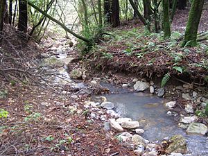
Middle reach of Arroyo Seco Creek
|
|
|
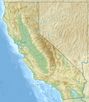
Location of the mouth of Arroyo Seco Creek in California
|
|
| Other name(s) | Arroyo Seco |
| Country | United States |
| State | California |
| Region | Sonoma County |
| City | Sonoma, California |
| Physical characteristics | |
| Main source | 4 mi (6 km) northeast of Sonoma, California 1,345 ft (410 m) 38°20′8″N 122°25′3″W / 38.33556°N 122.41750°W |
| River mouth | Schell Creek 4 mi (6 km) south of Sonoma, California 13 ft (4.0 m) 38°14′42″N 122°26′5″W / 38.24500°N 122.43472°W |
| Basin features | |
| Basin size | 11.4 sq mi (30 km2) |
| Tributaries |
|
Arroyo Seco Creek, also known as Arroyo Seco, is a small stream in Sonoma County, California. It is about 6.9-mile-long (11.1 km). The name Arroyo Seco comes from the Spanish words meaning "dry creek."
This creek is a tributary, which means it flows into a larger stream. Arroyo Seco Creek flows into Schell Creek.
About Arroyo Seco Creek
Arroyo Seco Creek helps drain water from the western side of the southern Mayacamas Mountains. Its watershed, or the area of land that drains into it, covers about 11.4-square-mile (30 km2).
How Was It Formed?
The Mayacamas Mountains, including the area around Arroyo Seco Creek, were formed a long time ago. This happened about 12 million years ago during the Miocene era. It was created by volcanic activity and the slow movement of Earth's plates, called tectonic uplift.
The ground right around the creek is made of what scientists call "riverwash series." This means it's a mix of recently deposited sands and gravels carried by the water.
Where Does It Flow?
Arroyo Seco Creek starts near the border of Napa County. This is about 4 mi (6 km) northeast of the town of Sonoma, California.
The creek flows south. It comes out of the hills near the Sonoma Valley Hospital. Then, it meets another stream called Haraszthy Creek. After that, it goes under State Route 12 near Schellville, California.
Journey to San Pablo Bay
Once it passes under State Route 12, Arroyo Seco Creek flows into Schell Creek. Schell Creek then empties into a network of smaller waterways called sloughs. These sloughs eventually lead to Sonoma Creek. Finally, Sonoma Creek flows into the Napa Sonoma Marsh and then into San Pablo Bay.
 | Madam C. J. Walker |
 | Janet Emerson Bashen |
 | Annie Turnbo Malone |
 | Maggie L. Walker |


