Putah Creek facts for kids
Quick facts for kids Putah Creek |
|
|---|---|
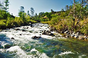
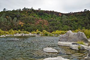
Putah Creek above Monticello Dam
|
|
|
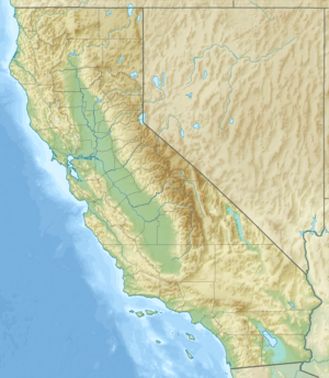
Location of the mouth of Putah Creek in California
|
|
| Country | United States |
| State | California |
| Counties | Yolo, Solano, Napa, Lake |
| Physical characteristics | |
| Main source | Cobb Mountain 3,651 ft (1,113 m) 38°48′26″N 122°43′21″W / 38.80722°N 122.72250°W |
| River mouth | Yolo Bypass Prospect Slough in Yolo Bypass 7.5 ft (2.3 m) 38°30′56″N 121°35′20″W / 38.51556°N 121.58889°W |
| Length | 85 mi (137 km) |
| Basin features | |
| Basin size | 638 sq mi (1,650 km2) |
Putah Creek is a large stream in Northern California. It flows into the Yolo Bypass, which then connects to the Sacramento River. The creek is about 85 miles (137 km) long. It starts high up in the Mayacamas Mountains, which are part of the Coast Range.
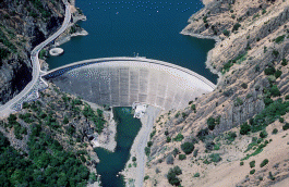
As it flows east, Putah Creek passes through two dams. The first dam, Monticello Dam, creates Lake Berryessa. Below this lake, Putah Creek forms the border between Yolo and Solano Counties. Then, it flows to the Putah Diversion Dam and Lake Solano.
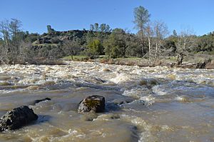
In the late 1980s, after several dry years, most of Putah Creek dried up. This led to a big lawsuit. In 2000, an agreement called the Putah Creek Accord was signed. This agreement made sure that water would be released from the dams to keep the creek flowing. It also helped bring back the natural way the river flows, with more water in winter and spring, and less in summer and fall.
Because of these changes, the number of bird species living near the creek has doubled. Native fish like steelhead trout and Chinook salmon have also returned to lay their eggs. This also helps farmers who rely on the creek's water.
Contents
History and Naming the Creek
The name "Putah" for Putah Creek has been talked about a lot. It was first called "Arroyo de los Putos" in 1844 and "Puta Creek" in 1845. However, the "Puta" name was not approved by the United States Board on Geographic Names.
Records from Mission San Francisco Solano in 1824 mention native people with names like Putto and Puttato. In 1817, a person from "Putü" was mentioned in baptism records. By 1842, the stream was well known as "Putos."
A map from 1844 by a French explorer, Eugène Duflot de Mofras, shows that Putah Creek was once called Young's River. It was named after a fur trapper named Ewing Young. He hunted beavers on an trip up Putah Creek to Clear Lake in March 1833.
Sometimes, the lower parts of the creek were called Walnut Bayou. This was because the water was warm and slow, and there were many California Black Walnut trees along its banks.
Where Putah Creek Flows
The creek starts from springs on the east side of Cobb Mountain. This is south of the town of Cobb in Lake County. It flows about 80 miles (130 km) to Lake Berryessa.
It goes downhill to Whispering Pines, then turns southeast. It flows past Anderson Springs and joins Bear Canyon Creek. North of Middletown, it curves around Harbin Mountain. Here, other creeks like Dry Creek and Big Canyon Creek join it.
From Harbin Mountain, it flows east again. It joins Bucksnort Creek and then enters Napa County. In Napa County, the creek flows southeast. It merges with Butts Creek just before it enters Lake Berryessa and the Monticello Dam.
Flowing Below the Dam
After the Monticello Dam, Putah Creek leaves Napa County. It becomes the border between Yolo County and Solano County. It flows about 8 miles (13 km) to the Putah Diversion Dam (PDD). Most of the water here is sent south through the Putah South Canal to people in Solano County.
This part of the creek is great for fishing all year. Rules from the California Department of Fish and Wildlife say you must "catch and release" fish here. You also need to use special lures with hooks that don't have barbs.
There have been some concerns about chemicals in the fish from Putah Creek. The California Office of Environmental Health Hazard Assessment (OEHHA) has advice for safely eating fish caught here. This is because of levels of mercury found in some fish. A nearby cleanup site, once called the Laboratory for Energy-Related Health Research, had some mercury flow into the creek. This site has been closed since the late 1980s. The mercury can build up in fish, which could then affect birds and people who eat them.
The creek continues east along State Route 128. It receives Pleasants Creek before reaching Lake Solano. Here, the Putah Diversion Dam sends water to the Putah South Canal. This canal carries water to people in Vallejo.
Journey to the Sacramento River
Below Lake Solano, Putah Creek flows about 23 miles (37 km) more. It then reaches the Yolo Bypass, which is an artificial waterway that leads to the Sacramento River. In this section, McCune Creek and Dry Creek join Putah Creek.
After Dry Creek, it flows through the town of Winters. Putah Creek used to flow near downtown Davis. But in 1871, early settlers changed its path to flow south of Davis. In the late 1940s, levees were added to what is now the South Fork Putah Creek. A few miles east of Davis, the South Fork Putah Creek continues east. It flows into the Yolo Bypass near the Sacramento Deep Water Channel.
Dams and Water Use
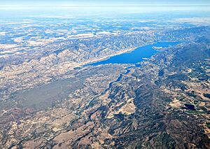
The Monticello Dam is the main dam on Putah Creek. It is a concrete arch dam. It creates Lake Berryessa, which can hold a lot of water (about 1.6 million acre-feet or 2 billion cubic meters). This makes it one of the biggest reservoirs in California.
The dam and lake are part of the Solano Project, built in 1957. This project helps provide water for farming. It also supplies drinking water to cities in Solano County. About 32,000 acre-feet (39 million cubic meters) of water are provided each year. A power plant at the dam also makes electricity for the Solano Irrigation District.
Putah Diversion Dam
The Putah Diversion Dam (PDD) was also built in 1957. It sends water into the Putah South Canal, about 6 miles (10 km) downstream from Monticello Dam. This dam creates the smaller Lake Solano, which holds about 750 acre-feet (925,000 cubic meters) of water.
The Putah South Canal is mostly lined with concrete. It carries water to farms and homes. The canal ends at Terminal Dam, which forms a small reservoir called Solano Lake. This reservoir provides drinking water to the city of Vallejo.
Ecology and Fish Life
Steelhead trout (a type of rainbow trout) and Chinook salmon still live in Putah Creek. These fish are called anadromous, meaning they live in the ocean but return to freshwater to lay their eggs. They cannot pass the Putah Diversion Dam. However, rainbow trout that live only in the stream can be found above Monticello Dam and grow large just below the dam.
The Putah Creek Accord, signed in 2000, was very important for the creek's environment. It made sure that water would be released from the Putah Diversion Dam. These releases help native fish lay eggs and grow. The water flow is now more like a natural river, with higher flows in winter and spring, and lower flows in summer and fall. But there is always enough water for the young salmon and trout.
The Accord also set up a special three-day release of water between February 15 and March 31. This helps start the fish's egg-laying behavior. Then, a month of higher flows follows. Monthly baseline flows were also set to keep the creek flowing all year from the PDD to the Yolo Bypass.
In December 2014, Putah Creek was named a "Wild Trout Water" by the California Fish and Game Commission. Groups of people have worked to restore the creek. This has led to more young Chinook salmon growing in the lower part of the creek. The natural water flows, made possible by the dam releases, have helped native fish. They have also reduced non-native fish, which prefer warmer, still water. By releasing more water in winter/spring and less in late summer/fall, there has been little impact on the water available for farming and homes.
"Green River" Connection
Putah Creek is also known as the Green River. This is because algae and plants grow a lot in the late summer, making the water look green. The famous band Creedence Clearwater Revival wrote a song called "Green River" about it. The band's singer, John Fogerty, used to vacation near Putah Creek when he was a child.
See also
 In Spanish: Arroyo Putah para niños
 | Emma Amos |
 | Edward Mitchell Bannister |
 | Larry D. Alexander |
 | Ernie Barnes |


