Piner Creek facts for kids
Quick facts for kids Piner Creek |
|
|---|---|

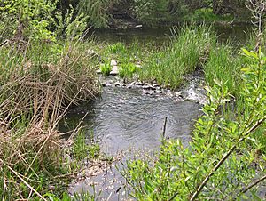
Piner Creek immediately above the confluence with Santa Rosa Creek
|
|
|
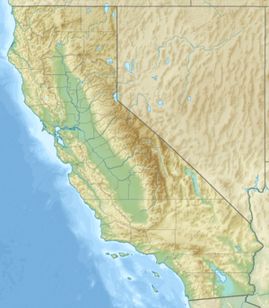
Location of the mouth of Piner Creek in California
|
|
| Country | United States |
| State | California |
| Region | Sonoma County |
| City | Santa Rosa, California |
| Physical characteristics | |
| Main source | Fountaingrove Lake Santa Rosa, California 495 ft (151 m) 38°29′12″N 122°43′10″W / 38.48667°N 122.71944°W |
| River mouth | Santa Rosa Creek west of Santa Rosa, California 38°26′43″N 122°46′35″W / 38.44528°N 122.77639°W |
| Basin features | |
| Basin size | 6.3 sq mi (16 km2) |
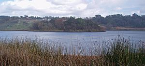
Piner Creek is a small stream in Santa Rosa, California, United States. It starts from Fountaingrove Lake and flows into Santa Rosa Creek. Santa Rosa Creek then joins the Laguna de Santa Rosa.
The creek's journey begins in the foothills of the Mayacamas Mountains. Here, the land is higher, about 200 to 300 feet (60 to 90 meters) above sea level. As it moves into the Santa Rosa Plain, the land becomes flatter.
In the flatter areas, the creek flows at elevations between 110 and 140 feet (33 and 43 meters). This means the water flows gently downhill. Before many buildings were put up, this area was mostly used for farms. People grew plums, which were then dried to make prunes.
The area that Piner Creek drains is called its watershed. This watershed covers about 4,048 acres (16.4 square kilometers). Most of this area is inside the city of Santa Rosa. About one-third of the land is used for homes. Another part is open space, parks, or farms. An old building called the Round Barn, built in 1899, is in this watershed. It shows how the land was used for pasture (grazing animals) a long time ago.
Contents
The Flow of Piner Creek

Piner Creek starts at Fountaingrove Lake in the Mayacmas Mountains. From the lake, the creek flows downhill quite steeply. At first, it flows over rocks placed to control the water, called riprap. This part of the creek was changed when Fountaingrove Lake was updated.
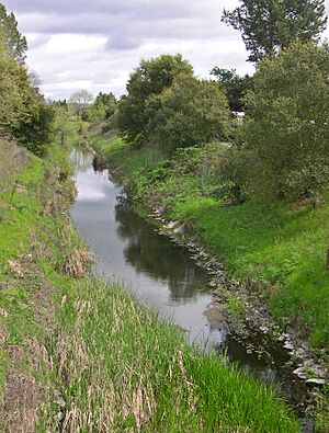
After that, Piner Creek flows past a modern office park. It then goes under Redwood Highway and U.S. Highway 101. West of the highway, the creek winds through shops and industrial areas. It then goes under Piner Road. In this area, there was a past issue where some chemicals from old factories seeped into the groundwater.
Water Quality of Piner Creek
The water in Piner Creek is usually a bit basic. In the upper parts, the pH is about 8.5. As it flows closer to Santa Rosa Creek, the pH drops to about 7.8. The soil where the creek starts has a pH of about 6.9.
The water in Piner Creek is usually clear. It only gets cloudy after very heavy rains. The water also has no bad odor. In springtime, the water temperature is usually between 60 and 65 degrees Fahrenheit (16 to 18 degrees Celsius).
Piner Creek ends when it meets Santa Rosa Creek. Santa Rosa Creek then flows into the Laguna de Santa Rosa. Finally, the Laguna de Santa Rosa joins the Russian River, which flows into the Pacific Ocean.
How the Land Was Formed

Long, long ago, about twelve million years ago during the Miocene period, the entire area of Piner Creek was under the Pacific Ocean. Over time, volcanoes erupted and the Earth's plates moved. This caused the Mayacmas Mountains to rise out of the ocean.
Piner Creek was one of the first streams to form on this new land. It helped shape the Santa Rosa Plain, where the middle and lower parts of the creek now flow. Sometimes, you can see basalt rocks in the upper part of Piner Creek. These rocks are a clue that the Mayacmas Mountains were formed by volcanoes.
Soils Along the Creek
The soil in the upper part of the Piner Creek watershed is called Goulding cobbly clay loam. This soil is on slopes up to 15 percent and can wear away easily. It's usually only about 20 inches (50 cm) deep and can have many cobblestones. Historically, this soil was used for grazing animals.
As the creek gets closer to the Santa Rosa Plain, east of U.S Highway 101, the slopes become gentler. Here, the main soil type is Felta very gravelly loam. This soil is grayish-brown on top and feels fine, sticky, and plastic.
West of U.S. Highway 101, Piner Creek flows over the Santa Rosa Plain. The land here is very flat, with slopes less than two percent. The main soil type is Zamora silty clay loam. This soil was left behind by floods, forming a floodplain. The top layer of Zamora soil is grayish-brown, hard, firm, sticky, and plastic. Water soaks into it slowly, but it's very fertile. This is why it was used for orchards in the past and now for vineyards.
Plants and Animals of Piner Creek
Scientists have studied the habitat (the natural home) of Piner Creek. They found its habitat value to be "Fair." Other creeks like Matanzas Creek and Brush Creek had better habitats. Colgan Creek had lower values.
Much of Piner Creek has been changed because of buildings in Santa Rosa. Some parts were also changed to help control floods. The most common tree along the creek banks is the coast live oak (Quercus agrifolia). In the streambed, you can see many cattail plants (Typha latifolia). Many different species of birds also live along the creek.
Creek Life and Water Health
Scientists also looked at tiny creatures living on the bottom of the creek, called benthic macroinvertebrates. They found that there wasn't a lot of different kinds of these creatures, meaning low diversity. Also, the number of different types of creatures seemed to go down between 2000 and 2003.
Compared to other creeks in the Santa Rosa Creek area, Piner Creek had good epifaunal cover (animals living on surfaces), good riffle frequency (places where water flows fast over rocks), and less siltation (mud building up). However, there were many tubificid worms in Piner Creek. A lot of these worms can mean there's too much organic material in the water. This often comes from high levels of nitrate and phosphate from runoff from city areas. This can also mean there's less dissolved oxygen in the water, which is important for other aquatic life.
 | Mary Eliza Mahoney |
 | Susie King Taylor |
 | Ida Gray |
 | Eliza Ann Grier |


