Matanzas Creek facts for kids
Quick facts for kids Matanzas Creek |
|
|---|---|

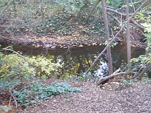
Matanzas Creek at Doyle Community Park, Santa Rosa, California
|
|
|
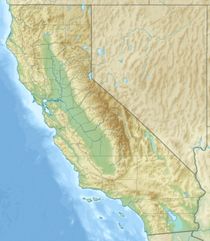
Location of the mouth of Matanzas Creek in California
|
|
| Country | United States |
| State | California |
| Region | Sonoma County |
| City | Santa Rosa, California |
| Physical characteristics | |
| Main source | north slope of Sonoma Mountain 3 mi (5 km) west of Glen Ellen, California 1,980 ft (600 m) 38°21′23″N 122°34′49″W / 38.35639°N 122.58028°W |
| River mouth | Santa Rosa Creek downtown Santa Rosa 151 ft (46 m) 38°26′15″N 122°42′45″W / 38.43750°N 122.71250°W |
| Basin features | |
| Tributaries |
|
Matanzas Creek is a stream in Sonoma County, California. It flows all year round and is about 11.4 miles (18.3 km) long. This creek is a "tributary," which means it's a smaller stream that flows into a larger one. Matanzas Creek joins Santa Rosa Creek.
Where Matanzas Creek Flows
Matanzas Creek starts high up on the northern side of Sonoma Mountain. From there, it flows north into a flat area called Bennett Valley. In the valley, it meets up with another stream called the South Fork Matanzas Creek.
The creek then travels through Bennett Valley, flowing between Taylor Mountain and Bennett Mountain. It passes under Grange Road and goes through the Matanzas Creek Reservoir and the Bennett Valley Golf Course.
As it reaches the city of Santa Rosa, the creek runs alongside Creekside Road, Cypress Road, and Hoen Avenue. At Doyle Community Park, it is joined by Spring Creek. Finally, Matanzas Creek flows into Santa Rosa Creek, just north of the Luther Burbank Home and Gardens.
The water from Matanzas Creek eventually reaches the Pacific Ocean. It travels through Santa Rosa Creek, then the Laguna de Santa Rosa, Mark West Creek, and finally the Russian River before reaching the ocean near Jenner, California.
Life and Environment Around the Creek
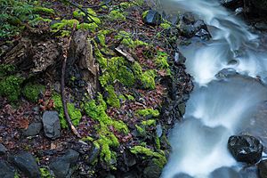
Where Matanzas Creek begins on Sonoma Mountain, the land is quite steep. The water flows quickly, like a series of small waterfalls.
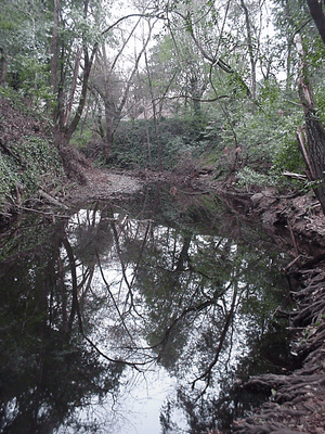
In some parts of Santa Rosa, the creek's path has been made deeper by about 4 to 5 meters (13 to 16 feet). This was done to help prevent flooding in the city.
Fish and the Culvert
In downtown Santa Rosa, a long tunnel-like structure called a "culvert" was built. It's about 1,400 feet (427 meters) long. This culvert helps the city develop, but it also makes it hard for certain fish to travel upstream.
These fish are called "anadromous fish." This means they live in the ocean but swim up rivers and creeks to lay their eggs (spawn). The culvert makes it difficult for them to reach the upper parts of Matanzas Creek to reproduce.
To help the fish, people have suggested adding special inflatable parts to the culvert. These parts would create small pools and allow the fish to climb up, like a "fish ladder." This way, the fish can still reach their spawning grounds, and the creek can continue to support its natural wildlife.
 | Delilah Pierce |
 | Gordon Parks |
 | Augusta Savage |
 | Charles Ethan Porter |


