
Flood control facts for kids
Flood control means using different ways to stop or reduce the harmful effects of too much water, like when rivers overflow. Flood relief is about helping people and places deal with high water levels.

Contents
What Causes Floods?

Floods happen for many reasons. Sometimes it's from a lot of rain over a long time, or when snow melts very quickly. Strong winds over water, unusually high tides, or even tsunamis can also cause floods. Sometimes, structures like dams or levees that hold water can break, leading to floods.
Human activities can make floods worse. For example, building lots of paved surfaces means water can't soak into the ground. Also, draining wetlands, which naturally store water, removes a helpful buffer. When water can't soak in or be held back, it runs off the land too quickly. This water can't fit into normal stream channels or be held in lakes and reservoirs.
Many rivers have natural flood plains around them. These areas often flood when the river gets too full. A flood that happens very fast, with little warning, is called a flash flood. These usually come from intense rain in a small area, especially if the ground is already soaked.
Strong Winds Over Water
Even if it's not raining much, strong winds can push water from lakes and bays onto the shore. This often happens during big storms like hurricanes.
Very High Tides
Areas near the coast can sometimes flood because of very high tides, like spring tides. This is even worse when strong winds and storm surges (a rise in sea level caused by a storm) happen at the same time. A famous example is the North Sea flood of 1953, which caused a lot of damage in the Netherlands and England.
What Happens When Floods Occur?
Floods can cause a lot of problems. They damage homes and buildings and can be dangerous for people and animals. Fast-moving water can wash away soil, which is called soil erosion. This soil then gets dumped somewhere else, like further down a river or along the coast. Fish spawning grounds and other animal homes can be ruined or polluted.
Long floods can stop traffic, especially where roads aren't raised. They can also make it hard to use land for things like farming. Bridges, riverbanks, and sewer lines can get damaged. It can also affect boat travel and power plants that use water. Floods often cost millions, or even billions, of dollars in damages each year.
Good Things About Floods
Even though floods cause problems, they can also bring some good things. Floods can make soil more fertile by adding nutrients. In ancient times, regular floods were very important for communities along rivers like the Nile and Yellow River, helping their farms grow. Places that flood often can also be good for making renewable energy from water.
How Do We Manage Floods?
People have been trying to control floods for a very long time. Some old methods include planting trees and plants to soak up water, and building terraces on hillsides to slow down water flow. People also built floodways, which are man-made channels to move floodwater away. Today, we also build levees, lakes, dams, reservoirs, and retention ponds to hold extra water during floods.
Dams

Many dams and their reservoirs are built to help with flood protection. Before the rainy season or when snow melts, the water level in these reservoirs is kept low. This creates space to hold floodwaters. Dams can also be used to make hydroelectric power, save water, and for fun activities like boating.
Some dams, called dry dams, are only for flood control. They don't store water for other uses.
Diversion Canals
Floods can be managed by sending extra water into special canals or floodways. These channels then move the water to temporary holding areas or other bodies of water where it won't cause as much harm. Good examples include the Red River Floodway in Canada, which protects Winnipeg, and the Manggahan Floodway in the Philippines, which protects Manila.
Floodplains and Groundwater
Extra floodwater can also be used to refill groundwater supplies. This is done by sending the water onto land that can soak it up. This method can help during later droughts by using the ground as a natural water storage. In California, for example, some farms are flooded on purpose without harming crops.
River Defenses
Many rivers around the world are carefully managed because they often flood. Defenses like levees, bunds, reservoirs, and weirs are used to stop rivers from overflowing. A weir is a low dam often used to create millponds. On the Humber River (Ontario) in Toronto, a weir was built to prevent another flood like the one caused by Hurricane Hazel in 1954.
Some places, like Leeds in the UK, use movable weirs. These weirs can be lowered when water levels are high to reduce flooding upstream.
Coastal Defenses
To protect against coastal flooding, people build sea walls, add sand to beaches (called beach nourishment), and create barrier islands.
Tide gates are also used with dykes and culverts. They are placed where streams meet the sea. These gates close when the tide comes in to stop seawater from moving inland. They open when the tide goes out to let water drain from the land into the sea. The gates open and close based on the water level difference on each side.
Living Breakwaters: A Case Study After Hurricane Sandy (2012) hit the US East Coast in 2012, causing huge damage, a competition was held to find new ways to prevent future floods. One winning idea was the "Living Breakwaters" project.
This project, led by landscape architect Kate Orff, involves building barriers in the water that also act as homes for oyster reefs. These "living" structures aim to protect the coast from strong storms and reduce erosion. The oysters also help clean the water. This project is part of a bigger plan that includes working with groups like the Billion Oyster Project and teaching local communities about the benefits of oysters and protecting the coastline.
Self-Closing Flood Barrier
The self-closing flood barrier (SCFB) is a special flood defense system. It protects people and property from floods caused by heavy rain or melting snow. This barrier is always ready to be used. It uses the rising floodwater itself to deploy and create a protective wall.
Temporary Barriers
When permanent defenses aren't enough, emergency measures are used. These include sandbags or inflatable, waterproof sacks.
In 1988, a new method was found using water-filled barriers. These are like two parallel tubes inside a third outer tube. When filled with water, they form a stable wall that can hold back water up to 80% of its height. For example, 8-foot-tall water-filled barriers were used around the Fort Calhoun Nuclear Generating Station during the 2011 Missouri River Flood. This method can be easier than using sandbags, as it uses water already on site. However, these barriers are not perfect; one was punctured during the 2011 flood, causing a section of the facility to flood.
Other temporary solutions, like HydroSacks, are bags with wood pulp inside that soak up water. These are for one-time use.
Reducing Flood Risks
Moving Away from Flood Zones
One way to reduce flood damage is to move buildings out of areas that flood often. These areas can then become parks or natural wilderness. Programs exist where the government buys properties in flood-prone areas to prevent repeated disasters. For example, after the 1993 flood in the US Midwest, the government bought 25,000 properties and turned them into wetlands. When floods returned in 1995, these new wetlands acted like sponges, and the government didn't have to spend money helping those areas again.
In the United States, maps are made to show areas at risk of future floods. This helps local governments make rules to prevent or reduce property damage.
Making Cities Stronger
Buildings and city structures can be designed to recover quickly from floods. For example, homes can be built on stilts, and important equipment like electrical systems can be placed on roofs instead of in basements. Subway entrances can have special movable barriers to keep water out. After Hurricane Sandy (2012), New York City started many projects to make its infrastructure more resilient to floods.
Flood Control Around the World
North America
In Manitoba, Canada, there's a big system of flood defenses for the Red River of the North. This river flows north into Lake Winnipeg. When snow melts in the south, the river can rise before the northern parts have thawed, leading to big floods. To protect Winnipeg, a huge system of diversions and dykes was built, including the Red River Floodway. This system saved Winnipeg during the 1997 Red River flood, which badly hit other towns upriver.
In the United States, the United States Army Corps of Engineers is the main agency for flood control. After Hurricane Sandy, New York City's subway system added special fabric covers, called Flex-Gate, to protect subway entrances from high water.
The New Orleans metropolitan area is mostly below sea level and is protected by many miles of levees and flood gates. However, this system failed during Hurricane Katrina in 2005, causing about half of the city to flood. The Morganza Spillway is another important structure that can divert water from the Mississippi River to protect cities like New Orleans and Baton Rouge from floods. It has been opened twice, in 1973 and 2011.
Asia
In Kyoto, Japan, the Hata clan successfully controlled floods on the Katsura River around 500 A.D. In China, some rural areas are purposely flooded in emergencies to protect cities.
Losing forests (deforestation) can increase the risk and severity of floods. Forests help soak up rainfall, so having natural forest cover can reduce how long floods last. Reducing deforestation and using land wisely can help improve flood safety.
Africa
In Egypt, the Aswan Low Dam (built in 1902) and the Aswan High Dam (built in 1976) have helped control floods along the Nile River.
Europe

After a big flood in Paris in 1910, the French government built a series of reservoirs called Les Grands Lacs de Seine (Great Lakes). These lakes help reduce pressure on the Seine River during floods, especially in winter.
London is protected by a huge mechanical barrier across the River Thames, called the Thames Barrier. It is raised when water levels get too high. Venice has a similar system. However, if sea levels keep rising, these defenses might not be enough in the future.
The largest and most complex flood defenses are in the Netherlands. They are called the Delta Works, with the Oosterschelde dam being a major part. These were built after the North Sea flood of 1953. The Dutch had already built one of the world's largest dams, the Afsluitdijk, in 1932.
The Saint Petersburg Dam in Russia was finished in 2008. It protects Saint Petersburg from storm surges and also serves as part of a ring road around the city.
Flood Clean-up Safety
Cleaning up after floods can be dangerous for workers and volunteers. There are risks like electric shock, carbon monoxide from generators, muscle injuries, and problems from being too hot or too cold. There are also dangers from vehicles, fire, drowning, and contact with hazardous materials. Flood sites can be unstable, with sharp debris, dirty floodwater, exposed electrical wires, and even animal or human remains. To stay safe, clean-up workers should wear hard hats, goggles, heavy gloves, life jackets, and waterproof boots with steel toes.
New Flood Control Technology
Europe is a leader in flood control technology, especially low-lying countries like the Netherlands and Belgium. They are developing new techniques that other countries facing similar problems can learn from.
After Hurricane Katrina, the US state of Louisiana sent people to the Netherlands to study their advanced flood control system. Experts believe that by 2050, many more people will live in delta cities, meaning more people will be affected by rising sea levels. The Netherlands is constantly developing new ways to manage water, such as storing water underground, in large parking garages, or even on playgrounds. Rotterdam has started a project to build a floating neighborhood to deal with rising sea levels. From high-tech sensors that detect problems with levees to huge movable barriers that close off entire rivers, new solutions are being developed and used worldwide. However, keeping these water control structures in good working order is also very important.
Images for kids
-
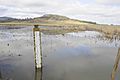
A water control structure gauge in a wetlands.

See also
 In Spanish: Defensa ribereña para niños
