Marsh Creek (California) facts for kids
Quick facts for kids Marsh Creek |
|
|---|---|

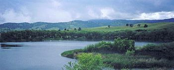
Marsh Creek Reservoir, October 9, 2014
|
|
|
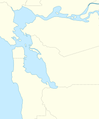
Location of the mouth of Marsh Creek in California
|
|
| Other name(s) | Arroyo De Los Poblanos |
| Country | United States |
| State | California |
| Region | Contra Costa County |
| Physical characteristics | |
| Main source | Eastern Mount Diablo in Morgan Territory Regional Preserve 12 mi (19 km) SSE of Clayton, California 2,360 ft (720 m) 37°48′43″N 121°48′06″W / 37.81194°N 121.80167°W |
| River mouth | Sacramento–San Joaquin River Delta at Oakley, California 0 ft (0 m) 38°00′52″N 121°41′04″W / 38.01444°N 121.68444°W |
| Basin features | |
| Tributaries |
|
Marsh Creek is a stream in Contra Costa County, California. It starts on the eastern side of Mount Diablo. The creek flows for about 30 miles (48 km) (48 km). It ends in the Sacramento–San Joaquin River Delta near Oakley, California. You can find it close to Big Break Regional Shoreline. The creek also flows through Marsh Creek State Park (California). Here, its water forms the Marsh Creek Reservoir. It then continues through the city of Brentwood, California.
Contents
History of Marsh Creek
Marsh Creek is named after John Marsh. He was a famous pioneer in California. In 1838, he built his home right on the creek. This was after he got a large piece of land called Rancho Los Meganos. This land was near Brentwood, California and Clayton, California. The creek was first called Arroyo De Los Poblanos.
Marsh Creek's Water System
The Marsh Creek water system collects water from about 100 square miles (260 km2) (260 km²) of land. This includes the eastern slopes of Mount Diablo and nearby Black Hills. The smaller streams that feed into Marsh Creek often dry up sometimes. They flow northwest until Marsh Creek turns east at Marsh Creek Springs.
In the 1960s, a dam was built on the creek. This created the Marsh Creek Reservoir. The reservoir is located south of Brentwood. It is part of Marsh Creek State Park (California).
Tributaries of Marsh Creek
Marsh Creek has several important smaller streams, called tributaries, that flow into it:
- Briones Creek
- Dry Creek
- Deer Creek
- Sand Creek
Briones Creek flows into Marsh Creek at the reservoir. Dry, Deer, and Sand creeks join Marsh Creek inside the city of Brentwood, California. The lower part of the creek has been changed by people. It flows through a channel, and there's a structure that blocks fish from moving upstream.
Protecting Marsh Creek's Animals
Many years ago, there were lots of Chinook salmon in the Sacramento River and San Joaquin River areas. But human activities have caused over 80 percent of their spawning (egg-laying) places to be lost. Old records show that Chinook salmon lived in the Marsh Creek area long ago.
Challenges for Fish Migration
In 1958, a 6 foot (1.8 m) waterfall-like structure was built in Marsh Creek. This was to help control floods. Then, in 1963, the Marsh Creek Reservoir dam was built. Both of these structures completely blocked fish from swimming upstream. This meant salmon and steelhead trout couldn't reach their old spawning grounds.
Helping Fish Return
In December 2010, some groups worked together to build a special "fish ladder." This ladder cost $400,000. It helps fish get past the waterfall structure. For the first time in 52 years, salmon and steelhead could swim further up the creek. This opened up about 7 miles (11 km) (11 km) of new habitat for them.
People who watch the salmon saw them gathering below the old barrier before the ladder was built. In December 2012, Chinook salmon were even filmed swimming above the new fish ladder! By December 2016, hundreds of Chinook salmon were using the ladder to return to Marsh Creek to lay their eggs.
Other Animals in the Watershed
The middle and upper parts of the Marsh Creek area are home to special animals:
- Alameda whipsnake
- California red-legged frog
- San Joaquin kit fox
- Vernal pool fairy shrimp
The tidal waters where Marsh Creek meets the Delta are also important. They provide a home for the Sacramento splittail and Delta smelt. These fish are threatened. The area called Big Break is one of the few places where many adult splittail still gather.
In 2017, a project called the Dutch Slough Tidal Marsh Restoration Project began. It will change the last part of Marsh Creek. It will create a tidal plain. This will help young salmon grow and provide habitat for other endangered species.
Protecting Land Along the Creek
In 2014, a group called Save Mount Diablo (SMD) bought a 51 acres (21 ha) (21 ha) piece of land along Marsh Creek. This area, called Big Bend, is between Clayton and Brentwood. SMD wants to turn this land into a public park someday. For now, they are protecting it.
Marsh Creek Regional Trail
The Marsh Creek Regional Trail is a path for fun activities along Marsh Creek. It connects Creekside Park in Brentwood, California to Big Break Regional Shoreline in Oakley, California. You can use the trail for hiking and bicycling. Most of it is paved and can be used for many activities.
The East Bay Regional Park District (EBRPD) manages the trail. It is about 6.5 miles (10.5 km) (10.5 km) long. There are plans to make the trail even longer. It could stretch from Brentwood to Morgan Territory Regional Preserve and Round Valley Regional Preserve. This would make the total length about 14 miles (23 km) (23 km).
 | Frances Mary Albrier |
 | Whitney Young |
 | Muhammad Ali |


