
Nut Tree Airport facts for kids
Quick facts for kids
Nut Tree Airport
|
|||||||||||
|---|---|---|---|---|---|---|---|---|---|---|---|
.jpg)
Yak-9U at Nut Tree Airport
|
|||||||||||
| Summary | |||||||||||
| Airport type | Public | ||||||||||
| Owner/Operator | County of Solano | ||||||||||
| Serves | Vacaville, California | ||||||||||
| Elevation AMSL | 117 ft / 36 m | ||||||||||
| Coordinates | 38°22′40″N 121°57′42″W / 38.37778°N 121.96167°W | ||||||||||
| Website | http://www.flynuttree.com/nta/Home.html | ||||||||||
| Runway | |||||||||||
|
|||||||||||
| Statistics (2022) | |||||||||||
|
|||||||||||
|
Source: Federal Aviation Administration
|
|||||||||||
Nut Tree Airport (ICAO: KVCB, FAA LID: VCB, formerly O45) is a public airport in California. It is owned by Solano County. The airport is located about two nautical miles (3.7 km) northeast of Vacaville.
This airport is very close to two big highways. These are Interstate 80 and Interstate 505. It is also right next to the Nut Tree shopping area. Both the airport and the shopping area got their name from a famous stop on an old highway, US 40.
Contents
What You'll Find at Nut Tree Airport
Nut Tree Airport covers a large area, about 262 acres (106 hectares). That's a lot of space! It sits 117 feet (36 meters) above sea level. The airport has one main runway. This runway is called 2/20. It is made of asphalt. It measures 4,700 feet (1,433 meters) long and 75 feet (23 meters) wide.
How Busy is the Airport?
In one year, ending in March 2022, there were 87,000 aircraft operations at the airport. An "operation" means a plane taking off or landing. This averages out to about 238 operations every day! Most of these (97%) were general aviation flights. These are usually smaller planes used for personal travel or training. About 2% were air taxi flights.
Planes at the Airport
At that same time, 214 aircraft were based at Nut Tree Airport. Most of these were single-engine planes (189 of them). There were also 19 multi-engine planes and 6 helicopters.
History of Nut Tree Airport
The Nut Tree Airport was started in 1955. It was founded by Ed Power Jr.. He loved airplanes and wanted to bring more pilots to the Nut Tree area. His parents, Ed "Bunny" Power Sr. and Helen Harbison Power, were the ones who first created the famous Nut Tree stop.
Gallery
-
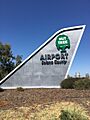
Nut Tree Airport sign in Vacaville
-
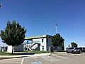
Nut Tree Airport
-
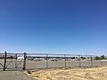
Planes at the Nut Tree Airport
-
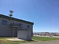
Nut Tree airport building with planes in background
-
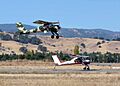
Wilgas Formation taking off at Nut Tree
-
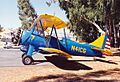
Waco UPF-7 at Nut Tree
-
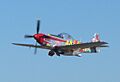
P-51D N151D taking off at Nut Tree


.jpg)
.jpg)
.jpg)
