West Jordan, Utah facts for kids
Quick facts for kids
West Jordan, Utah
|
|
|---|---|
|
City
|
|
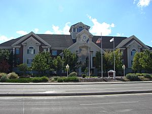
West Jordan City Hall
|
|
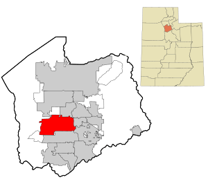
Location in Salt Lake County and the state of Utah
|
|
| Country | United States |
| State | Utah |
| County | Salt Lake |
| Settled | 1848 |
| Incorporated | 1941 |
| Named for | Jordan River |
| Area | |
| • Total | 32.33 sq mi (83.73 km2) |
| • Land | 32.33 sq mi (83.73 km2) |
| • Water | 0.00 sq mi (0.00 km2) |
| Elevation | 4,373 ft (1,333 m) |
| Population
(2020)
|
|
| • Total | 116,961 |
| • Density | 3,617.72/sq mi (1,396.88/km2) |
| Time zone | UTC−7 (Mountain (MST)) |
| • Summer (DST) | UTC−6 (MDT) |
| ZIP codes |
84081, 84084, 84088
|
| Area code(s) | 385, 801 |
| FIPS code | 49-82950 |
| GNIS feature ID | 1434086 |
West Jordan is a city in Salt Lake County, Utah, USA. It's like a neighbor city to Salt Lake City. In 2020, about 116,961 people lived here, making it the third biggest city in Utah!
The city is located in the southwest part of the Salt Lake Valley. It sits about 4,330 feet (1,320 meters) above sea level. West Jordan is named after the nearby Jordan River. The city stretches from the river's west bank to the eastern hills of the Oquirrh Mountains. This is where the Kennecott Copper Mine is, which is the world's largest human-made hole in the ground.
West Jordan was settled in the mid-1800s. It has grown into an important center for the region. As of 2012, the city had four main shopping areas. One of the biggest is Jordan Landing, a huge shopping and living complex. Many companies have their main offices in West Jordan. These include Mountain America Credit Union and Cyprus Credit Union. The city also has a major hospital, Jordan Valley Medical Center. There is also a campus of Salt Lake Community College.
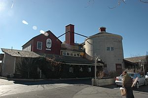
Cool places in West Jordan include Gardner Village, which started in 1850. Another is South Valley Regional Airport. This airport is used for smaller planes and is a base for the Utah Army National Guard. They fly Apache and Black Hawk helicopters from here.
Contents
History of West Jordan
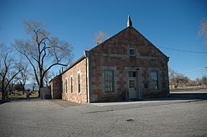
West Jordan got its name from early settlers. These Mormon pioneers arrived in the Salt Lake Valley in 1847. Their leader was Brigham Young. They named the river west of their first settlement, Salt Lake City, the "Western Jordan." This was a nod to the River Jordan in the Middle East. Later, the name was shortened to "Jordan River." Just like its Middle Eastern twin, the Jordan River flows from a freshwater lake (Utah Lake) to a salty inland sea (Great Salt Lake). West Jordan was founded around 1849 on the west side of this river.
One of the first sawmills in the area was built in 1850. It was built by Archibald Gardner in the city. Gardner was a very religious Mormon. His old mills and homes are now a special shopping area called Gardner Village.
In its early days, West Jordan's economy relied on farming, mills, and mining. The very first place to make leather west of the Mississippi River was built here in 1851.
Today, West Jordan is one of Utah's fastest-growing cities. Its population has grown a lot since the 1970s. In 1970, about 4,221 people lived here. By 2010, that number was over 100,000! This fast growth has led to some challenges. The city is working on transportation and school crowding issues.
West Jordan has also become a center for government services. The Veteran’s Park Area has City Hall and the Thomas Rees Justice Center. This center houses the West Jordan Police and Justice Court. Other buildings include a fire station, the Salt Lake County Health Department, and the Utah Third District Court. There's also the Viridian Events Center and Library. The park also has a rodeo area, a senior center, and the Gene Fuller Recreation Center. This center is named after the famous boxer, Gene Fullmer.
Where is West Jordan?
West Jordan covers about 30.9 square miles (80.0 square kilometers) of land. There is no water area within the city limits.
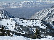
The city is bordered by the Oquirrh Mountains to the west. To the east is the Jordan River. The western parts of the city, like Welby and Copper Hills, are growing quickly. These areas are on the lower slopes of the eastern Oquirrh Mountains. New buildings are popping up fast between 4800 West and State Route 111. This highway goes through the mountain slopes.
West Jordan is about 18 miles (29 kilometers) southwest of downtown Salt Lake City. It shares borders with several other cities. To the north are Taylorsville and Kearns. To the south is South Jordan. To the east are Sandy, Murray, and Midvale. To the west is Copperton. And in the far northwest, it touches West Valley City.
Population Growth
| Historical population | |||
|---|---|---|---|
| Census | Pop. | %± | |
| 1950 | 2,107 | — | |
| 1960 | 3,009 | 42.8% | |
| 1970 | 4,221 | 40.3% | |
| 1980 | 27,192 | 544.2% | |
| 1990 | 42,892 | 57.7% | |
| 2000 | 68,336 | 59.3% | |
| 2010 | 103,712 | 51.8% | |
| 2020 | 116,961 | 12.8% | |
| U.S. Decennial Census, 2020 | |||
The population of West Jordan has grown a lot over the years. In 1950, there were just over 2,000 people. By 2020, the population had reached nearly 117,000!
People in West Jordan (2020 Census)
| Race / Ethnicity (NH = Non-Hispanic) | Pop 2000 | Pop 2010 | Pop 2020 | % 2000 | % 2010 | % 2020 |
|---|---|---|---|---|---|---|
| White alone (NH) | 57,688 | 77,360 | 77,760 | 84.42% | 74.59% | 66.48% |
| Black or African American alone (NH) | 396 | 855 | 1,363 | 0.58% | 0.82% | 1.17% |
| Native American or Alaska Native alone (NH) | 323 | 517 | 596 | 0.51% | 0.50% | 0.51% |
| Asian alone (NH) | 1,381 | 2,732 | 3,761 | 2.02% | 2.63% | 3.22% |
| Pacific Islander alone (NH) | 632 | 1,588 | 2,450 | 0.92% | 1.53% | 2.09% |
| Other race alone (NH) | 55 | 190 | 528 | 0.08% | 0.18% | 0.45% |
| Mixed race or Multiracial (NH) | 979 | 2,106 | 4,455 | 1.43% | 2.03% | 3.81% |
| Hispanic or Latino (any race) | 6,882 | 18,364 | 26,048 | 10.07% | 17.71% | 22.27% |
| Total | 68,336 | 103,712 | 116,961 | 100.00% | 100.00% | 100.00% |
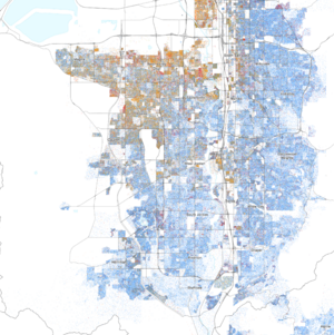
In 2017, about 113,905 people lived in West Jordan. Most people were non-Hispanic White. There were also people who identified as Black, Native American, Asian, and Pacific Islander. Many people also identified as being of two or more races. About 19.6% of the population were Hispanic or Latino.
Schools and Colleges
Most of West Jordan is part of the Jordan School District. However, a couple of small areas in the north are in the Granite School District. The city has 16 elementary schools. One of these, Jim Bridger Elementary, is in the Granite District. There are also four middle schools and two high schools: West Jordan High and Copper Hills High.
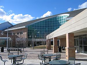
West Jordan is also home to campuses of Salt Lake Community College and Broadview University. The Jordan Campus of Salt Lake Community College is located here. It offers general education classes. It also has all of the college's health science courses. The Jordan School District's Applied Technology Center is also on this campus.
Getting Around West Jordan
There are several ways to get around West Jordan and connect to other cities.
Highways and Roads
Interstate 15 is a large freeway east of the city. It has twelve lanes and helps people travel north and south. Interstate 215 is an eight-lane beltway northeast of the city.
Bangerter Highway (State Route 154) is a six-lane expressway. It goes through the middle of West Jordan. It passes near South Valley Regional Airport and the Jordan Landing shopping center. A new ten-lane freeway, the Mountain View Corridor (SR-85), is being built. It will have three exits in the city and run north-south. The first part of this project was finished in December 2012.
7800 South is a road that starts at the Jordan River. It runs west through the city until it meets Utah Road 111. Redwood Road (State Route 68) is a six-lane road in the eastern part of the city. In the far west, State Route 111 is a two-lane road. It goes through the developing areas along the hills.
Airport
The South Valley Regional Airport is located in the middle of West Jordan. Its official name is U-42. It used to be called Airport #2. This is because Salt Lake City owns it, and it's part of Salt Lake City International Airport. The airport was once part of Camp Kearns. It was called Kearns Army Airfield during World War II. A large shopping center, Jordan Landing, was built next to the airport. This is why the shopping center got its name.
Public Transportation
West Jordan has bus service from the Utah Transit Authority (UTA). Buses run every half-hour during busy times. All bus routes in the city connect to nearby TRAX stations. TRAX is a light rail system. These connections are in Midvale and Sandy, or to downtown Salt Lake City. Bus service in the city improved in August 2007.
A TRAX light rail line also serves West Jordan. This line starts in Murray and goes southwest through West Jordan. It has 6 stops in the city. Then it turns south and ends at the Daybreak Community in South Jordan. This train line opened on August 7, 2011.
Transportation has been a big topic in city discussions. West Jordan's population has grown from about 4,000 in 1970 to over 100,000 in 2010. This growth has made roads and other services very busy. People often talk about long commutes to Salt Lake City. City leaders say this is because West Jordan is the biggest city in Utah without a direct freeway connection. To help with this, many roads are being made wider. The Mountain View Corridor freeway is also being built in the western part of the city.
Famous People from West Jordan
- Delila Abbotts, a Utah state lawmaker
- Don Fullmer, a boxer
- Gene Fullmer, a boxer who was the world middleweight champion in 1957
- Wassef Ali Hassoun, a U.S. Marine
- Carolyn Jessop, who wrote a book called Escape
- Eric Rhead, a racing car driver
- Sealver Siliga, a professional football player in the National Football League
West Jordan in Movies and TV
- In the TV show Big Love on HBO, one of the main character's home improvement stores is located in West Jordan.
Sister City
West Jordan has a special connection with another city in the world. This is called a sister city relationship:
 Votkinsk, Udmurtia, Russia
See also
 In Spanish: West Jordan (Utah) para niños
 | William M. Jackson |
 | Juan E. Gilbert |
 | Neil deGrasse Tyson |


