Sandy, Utah facts for kids
Quick facts for kids
Sandy
|
||
|---|---|---|
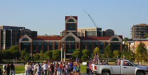
Sandy City Hall in September, 2009
|
||
|
||
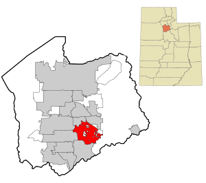
Location in Salt Lake County and the state of Utah.
|
||
| Country | United States | |
| State | Utah | |
| County | Salt Lake | |
| Founded | 1871 | |
| Incorporated | 1893 | |
| Area | ||
| • Total | 24.16 sq mi (62.58 km2) | |
| • Land | 24.15 sq mi (62.55 km2) | |
| • Water | 0.01 sq mi (0.03 km2) | |
| Elevation | 4,450 ft (1,356 m) | |
| Population
(2020)
|
||
| • Total | 96,904 | |
| • Density | 4,010.9/sq mi (1,548.48/km2) | |
| Time zone | UTC−7 (MST) | |
| • Summer (DST) | UTC−6 (MDT) | |
| ZIP codes |
84070, 84090-84094
|
|
| Area code(s) | 385, 801 | |
| FIPS code | 49-67440 | |
| Website | www.sandy.utah.gov | |
Sandy is a city in Utah, USA. It's part of the Salt Lake City metropolitan area. In 2020, about 96,904 people lived there.
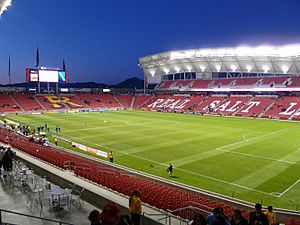
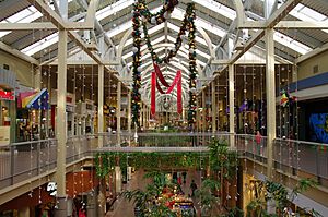
Sandy has cool places like the Shops at South Town mall, the Jordan Commons entertainment center, and the Mountain America Exposition Center. It's also home to America First Field. This is a special stadium for soccer. It hosts games for Real Salt Lake and Utah Royals FC. The stadium opened on October 8, 2008.
The city is building a new downtown area called The Cairns. It's designed to be easy to walk around and close to public transportation. A plan was made in 2017 to help the city grow over the next 25 years. This plan focuses on sustainable living, walking, and nature-friendly designs. It helps manage how the city's population grows.
Contents
History of Sandy
First People and Settlers
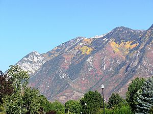
Sandy is located at the bottom of the Wasatch Mountains. It's about 13 miles (19 km) south of Salt Lake City. This area was a good spot for early settlements. Long ago, groups like the Paiute, Shoshone, and Bannock Native Americans used to travel through here. They moved between their winter homes near Utah Lake and summer fishing spots at Bear Lake.
Permanent settlers started moving to Sandy in the 1860s and 1870s. They liked the open land in the southern part of the Salt Lake Valley. The first town area was about one square mile. It was on a flat, raised area of land near the Jordan River.
No one is completely sure how Sandy got its name. Some people think Brigham Young named it "Sandy" because of its dry, sandy soil. But there's no proof of this. Another idea is that it was named after a Scottish engineer, Alexander "Sandy" Kinghorn. He ran the first train line to this part of the valley. The original name was "Sandy Station," which supports this idea. However, historians think it's unlikely because the train service started only a short time before the name appeared.
In 1863, there were only a few homes in the area. One farmer, Thomas Allsop, later owned almost half of what is now Sandy. Another person, LeGrand Young, owned land closer to State Street.
Mining and Railroads
Farmers tried to grow crops in Sandy's dry soil. But it was mining that really shaped Sandy's early years. When people started mining for silver in Little Cottonwood Canyon, Sandy became an important supply stop. Its main street soon had hotels and saloons for miners. Three big smelters (places that melt metal from ore) were built in Sandy: the Flagstaff, the Mingo, and the Saturn. This made Sandy a major center for smelting for many years.
The railroad was also very important. Built in 1873, it connected Sandy to Salt Lake City. This made it easy to move ore and other goods in and out of the area. Later, a streetcar line in 1907 helped people travel to jobs in Salt Lake City. Cars continued this trend even more.
When the mines closed in the 1890s, Sandy faced tough times. But it changed into a farming community. Sandy didn't disappear like many other mining towns. This was thanks to its location, resources, and the strong spirit of its people.
Becoming a City
Sandy officially became a city in 1893. This happened partly because people wanted to make the town a more family-friendly place. Because of its mining past, Sandy was a bit of a "boomtown" with many temporary workers. After becoming a city, Sandy changed. By 1900, there were fewer saloons and hotels. Sandy started to look more like other small towns in Utah, where everyone knew each other. Church, farming, business, and family became the main focus of life.
This quiet way of life continued for over 60 years. Wars, the Great Depression, and changing seasons were the only big interruptions. There were no major changes in population or the economy.
However, in the late 1960s, Sandy had its second big growth spurt. People used to think Sandy would grow out from its old center at Main and Center streets. But the population grew so fast that neighborhoods spread out in every direction.
In the 1970s, new communities formed, offering services, schools, and shopping. Sandy became a collection of small communities with many young families. At first, it was mostly a "bedroom community" (where people live but work elsewhere). But now, it has a busy business area along State Street and other main roads.
The Cairns Project
| The Cairns | |
|---|---|
| City center | |
| Design: | IBI Group |
| Construction: | 2014–present |
| Area: | 1,100 acres |
| Owner: | City of Sandy |
In 2014, Sandy's city government shared plans to rebuild 1,100 acres of its downtown. This project, called The Cairns, will take about 25 years. It will add tall multi-family residential buildings and office towers. It will also update the Shops at South Town mall.
The plans include new multi-use trails and a new Hale Center Theatre. The Cairns project stretches between 9000 South and 11400 South. It goes from Interstate 15 to the TRAX Blue Line. The project includes the America First Field (formerly Rio Tinto Stadium) and the Mountain America Exposition Center.
The project divides the city center into different "urban villages." Areas being developed now include:
- Central Village – An office and shopping area along State Street.
- South Village – The largest village, with City Hall, the Hale Center Theatre, and the Shops at South Town.
- East Village – A development near the Sandy Civic Center TRAX light rail station. It has shops, offices, and apartments.
The plan also looks at areas for future growth.
Project Progress
By February 2017, the Shops at South Town mall was finished. The Central Village office towers, the Hale Center Theatre, and the Park at City Center homes were almost done. The East Village development was nearly halfway complete. New homes were almost finished, and mixed-use projects were planned to start in late 2017 or early 2018.
Plans are also being made to improve transportation. This includes connecting the TRAX station to the South Jordan FrontRunner station. It will also link the different villages using buses or trolleys. This route could even become a streetcar line in the future.
Sandy's Geography
According to the United States Census Bureau, Sandy covers about 22.4 square miles (58 km2). Most of this is land, with a very small amount of water.
The eastern part of Sandy, where most homes are, sits on the slopes of the Wasatch Range. The western part is at the bottom of the valley. Interstate 15 and State Street (US-89) run through the western areas. The Jordan River forms part of the western border with West Jordan and South Jordan.
Climate in Sandy
Sandy has a climate that can be described as either humid subtropical climate or humid continental climate. This depends on which climate system is used.
| Climate data for Sandy, Utah | |||||||||||||
|---|---|---|---|---|---|---|---|---|---|---|---|---|---|
| Month | Jan | Feb | Mar | Apr | May | Jun | Jul | Aug | Sep | Oct | Nov | Dec | Year |
| Record high °F (°C) | 63 (17) |
70 (21) |
84 (29) |
89 (32) |
103 (39) |
106 (41) |
111 (44) |
106 (41) |
100 (38) |
94 (34) |
76 (24) |
69 (21) |
111 (44) |
| Mean daily maximum °F (°C) | 41 (5) |
47 (8) |
56 (13) |
65 (18) |
75 (24) |
87 (31) |
95 (35) |
94 (34) |
83 (28) |
69 (21) |
53 (12) |
42 (6) |
67 (20) |
| Mean daily minimum °F (°C) | 22 (−6) |
25 (−4) |
32 (0) |
38 (3) |
46 (8) |
54 (12) |
61 (16) |
60 (16) |
51 (11) |
40 (4) |
30 (−1) |
22 (−6) |
40 (4) |
| Record low °F (°C) | 1 (−17) |
−12 (−24) |
10 (−12) |
21 (−6) |
21 (−6) |
32 (0) |
44 (7) |
37 (3) |
31 (−1) |
18 (−8) |
1 (−17) |
−17 (−27) |
−17 (−27) |
| Average precipitation inches (mm) | 1.51 (38) |
1.22 (31) |
1.56 (40) |
1.82 (46) |
1.79 (45) |
0.85 (22) |
0.95 (24) |
0.95 (24) |
1.08 (27) |
1.73 (44) |
1.32 (34) |
0.96 (24) |
15.74 (400) |
| Source: weather.com | |||||||||||||
Sandy's Population
| Historical population | |||
|---|---|---|---|
| Census | Pop. | %± | |
| 1880 | 488 | — | |
| 1890 | 1,065 | 118.2% | |
| 1900 | 1,637 | 53.7% | |
| 1910 | 1,716 | 4.8% | |
| 1920 | 1,208 | −29.6% | |
| 1930 | 1,436 | 18.9% | |
| 1940 | 1,487 | 3.6% | |
| 1950 | 2,095 | 40.9% | |
| 1960 | 3,327 | 58.8% | |
| 1970 | 6,438 | 93.5% | |
| 1980 | 52,210 | 711.0% | |
| 1990 | 75,058 | 43.8% | |
| 2000 | 88,418 | 17.8% | |
| 2010 | 87,461 | −1.1% | |
| 2020 | 96,904 | 10.8% | |
| U.S. Decennial Census | |||
2020 Census Information
| Race / Ethnicity (NH = Non-Hispanic) | Pop 2000 | Pop 2010 | Pop 2020 | % 2000 | % 2010 | % 2020 |
|---|---|---|---|---|---|---|
| White alone (NH) | 80,523 | 75,260 | 76,172 | 91.07% | 86.05% | 78.61% |
| Black or African American alone (NH) | 404 | 558 | 866 | 0.46% | 0.64% | 0.89% |
| Native American or Alaska Native alone (NH) | 269 | 335 | 376 | 0.30% | 0.38% | 0.39% |
| Asian alone (NH) | 1,894 | 2,599 | 4,020 | 2.14% | 2.97% | 4.15% |
| Pacific Islander alone (NH) | 260 | 541 | 659 | 0.29% | 0.62% | 0.68% |
| Other race alone (NH) | 67 | 124 | 463 | 0.08% | 0.14% | 0.48% |
| Mixed race or Multiracial (NH) | 1,126 | 1,597 | 3,925 | 1.27% | 1.83% | 4.05% |
| Hispanic or Latino (any race) | 3,875 | 6,447 | 10,423 | 4.38% | 7.37% | 10.76% |
| Total | 88,418 | 87,461 | 96,904 | 100.00% | 100.00% | 100.00% |
In 2017, about 96,145 people lived in Sandy. Most residents were White (84.6%). Other groups included Black (0.7%), Native American (0.4%), Asian (3.0%), and Pacific Islander (0.7%). About 8.9% of the population was Hispanic or Latino.
Sandy is the sixth largest city in Utah. In 2010, there were 87,418 people living there. About 31.3% of the population was 19 or younger. The average age was 29 years old. Most households (66.1%) were married couples. The average household had 3.08 people.
The average income for a household in Sandy was $76,904. For families, it was $84,770. About 7.8% of the population lived below the poverty line.
Education in Sandy
Until 2009, the Jordan School District served Sandy. In 2007, people voted to split the district. This created the new Canyons School District. The Canyons School District started in the 2009–10 school year. It is now the main school district in Sandy.
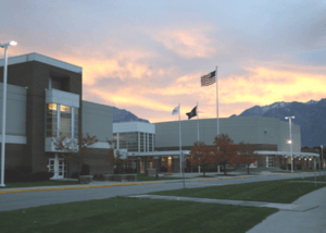
Sandy has 18 elementary schools, six middle schools, and five high schools.
- Elementary Schools: Alta View, Altara, Bell View, Brookwood, Crescent, East Sandy, Edgemont, Granite, Lone Peak, Oakdale, Park Lane, Peruvian Park, Quail Hollow, Sandy, Silver Mesa, Sprucewood, Sunrise, Willow Canyon.
- Middle Schools: Albion, Crescent View, Eastmont, Indian Hills, Mount Jordan, Union.
- High Schools: Corner Canyon, Jordan, Hillcrest, Brighton, and Alta.
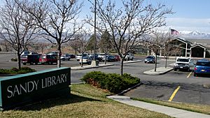
There is also a technical school, Canyons Technical Education Center (CTEC). Southpointe is an alternative high school. The Blessed Sacrament School is a private Catholic elementary school.
Salt Lake Community College has its Miller Campus in Sandy. This campus has training centers for automotive and culinary arts. It also has a business resource center and training facilities for public safety. The University of Utah opened a campus in Sandy in 2015 for adult students.
Sports in Sandy
Sandy is home to two professional soccer teams:
- Real Salt Lake: This Major League Soccer team started in 2004.
- Utah Royals FC: This National Women's Soccer League team started in 2017.
Both teams play at America First Field on the city's west side. Sandy will also be the home of the Utah Hockey Club practice facility.
| Club | League | Venue | Established | Titles |
|---|---|---|---|---|
| Real Salt Lake | Major League Soccer | America First Field | 2004 | 1 |
| Utah Royals FC | National Women's Soccer League | America First Field | 2017 | 0 |
Transportation in Sandy
Roads and Highways
Sandy's roads follow the same grid system as the rest of Salt Lake County. I-15 runs along the west side of Sandy. It has three exits within the city. U.S. Route 89 (State Street) runs next to I-15. Utah State Route 209 goes east-west and ends at Alta Ski Resort in the mountains.
Bus Services
The Utah Transit Authority (UTA) runs a bus system in Sandy. This includes regular routes, flexible routes, and a seasonal ski bus. Bus routes connect to light rail stations, shopping areas, offices, and government buildings. The ski bus goes from the Historic Sandy TRAX station to Alta Ski Area and Snowbird during winter.
Sandy and UTA are planning a new bus or trolley route. It will go between the Sandy Civic Center TRAX station and the South Jordan FrontRunner station. This route could become a streetcar in the future.
Train and Light Rail
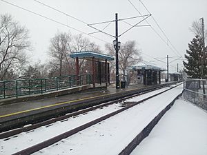
UTA's TRAX light rail system operates in Sandy. The city has four light rail stations:
- Historic Sandy at 9000 South.
- Sandy Expo at 9375 South, near the Mountain America Exposition Center and America First Field.
- Sandy Civic Center at 10000 South, serving the city center.
- Crescent View at 11400 South.
All of Sandy's light rail stations are on the Blue Line. This line goes north to Salt Lake Central Station and south to Draper Town Center.
Notable People from Sandy
- Ryon Bingham - professional football player
- John Brzenk - professional arm-wrestler
- William T. Fairbourn - Marine Corps Major General
- Jim Fullington - professional wrestler
- Bonnie Gritton - pianist and professor
- Derek Hough - professional dancer
- Julianne Hough - professional dancer
- DaMarques Johnson - mixed martial artist
- Sean O'Connell - mixed martial artist
- Doug Jolley - professional American football player
- Megan Joy - finalist on American Idol (season 8)
- Karl Meltzer - ultra-marathon runner
- Craig Richard Nelson - actor and director
- Grant H. Palmer - historian and author
- Jamie Pierre - professional freeskier
- Dalton Schultz, professional football player
- Apa Sherpa - co-record holder for reaching the summit of Mt. Everest (21 times)
- Dick Simon - race car driver
- John Earle Sullivan - photojournalist
- Mike Weir - professional golfer
- Mary Elizabeth Winstead - actress
- Elizabeth Smart, activist
- Daisy C. Allen, Utah State Legislator in 1917
Images for kids
See also
 In Spanish: Sandy (Utah) para niños
 | Jackie Robinson |
 | Jack Johnson |
 | Althea Gibson |
 | Arthur Ashe |
 | Muhammad Ali |


