South Jordan, Utah facts for kids
Quick facts for kids
South Jordan, Utah
|
|
|---|---|
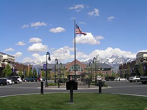
South Jordan City Hall, March 2006
|
|
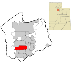
Location in Salt Lake County and the state of Utah.
|
|
| Country | |
| State | |
| County | Salt Lake |
| Established | 1859 |
| Incorporated | November 8, 1935 |
| Named for | Jordan River |
| Government | |
| • Type | council–manager |
| Area | |
| • Total | 22.31 sq mi (57.77 km2) |
| • Land | 22.22 sq mi (57.54 km2) |
| • Water | 0.09 sq mi (0.23 km2) |
| Elevation | 4,439 ft (1,353 m) |
| Population
(2020)
|
|
| • Total | 77,487 |
| • Density | 3,452.07/sq mi (1,332.86/km2) |
| Time zone | UTC−7 (Mountain (MST)) |
| • Summer (DST) | UTC−6 (MDT) |
| ZIP code |
84009, 84095
|
| Area code(s) | 385, 801 |
| FIPS code | 70850 |
| GNIS feature ID | 1432728 |
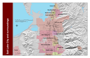
South Jordan is a city in Utah, located in the southern part of Salt Lake County. It is about 18 miles (29 km) south of Salt Lake City. The city is part of the larger Salt Lake City metropolitan area.
South Jordan sits in the Salt Lake Valley right next to the Jordan River. It is nestled between the tall Oquirrh Mountains (about 10,000 feet or 3,000 meters high) and the even taller Wasatch Mountains (about 11,000 feet or 3,400 meters high). The city has a beautiful 3.5-mile (5.6 km) section of the Jordan River Parkway. This area includes fishing ponds, walking trails, parks, and natural places for animals to live. You can also find the Salt Lake County fairgrounds, an equestrian park, and a 67-acre (27 ha) lake called Oquirrh Lake here. South Jordan is home to 37 public parks. In 2020, about 77,487 people lived in South Jordan.
The city was started in 1859 by settlers from The Church of Jesus Christ of Latter-day Saints. It was originally a farming town. Today, South Jordan has grown quickly and is mostly a "bedroom community." This means many people who live here travel to work in nearby Salt Lake City. A company called Kennecott Land is building a large planned community called Daybreak Community in the western part of South Jordan. This new area could make the city's population much larger. South Jordan was the first city in the world to have two temples of The Church of Jesus Christ of Latter-day Saints. These are the Jordan River Utah Temple and the Oquirrh Mountain Utah Temple. Now, Provo, Utah also has this special feature. The city also has two stops for the light rail system and one stop for the FrontRunner commuter train.
Contents
History of South Jordan
Early People and Explorers
The first people known to live in this area were from the Desert Archaic Culture. They were nomadic hunter-gatherers, meaning they moved around to find food. Later, from about 400 A.D. to 1350 A.D., the Fremont people lived in villages. They grew crops like corn and squash.
The Fremont people eventually left the area. This was due to changes in the weather, which became cooler and drier. Also, ancestors of the Ute, Paiute, and Shoshone tribes moved into the region. When European settlers arrived, there were no permanent Native American villages in the Salt Lake Valley. However, the area was near the lands of several tribes. These included the Northwestern Shoshone to the north, the Timpanogots Utes to the south, and the Goshutes to the west.
A French Canadian fur trapper named Étienne Provost led a group through the area in 1824. His group was attacked near the Jordan River. Provost escaped, but many of his men were killed in the surprise attack.
Latter-day Saint Settlers Arrive
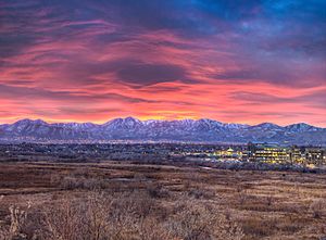
In 1847, the first Latter-day Saint pioneers arrived in the valley. They quickly started to water the land and explore for new places to settle. Alexander Beckstead, a blacksmith, moved his family to the area in 1849. He was the first blacksmith in the southern Salt Lake Valley. He helped dig the first ditch to bring water from the Jordan River. This water helped power Archibald Gardner's flour mill.
In 1859, Beckstead became the first settler of South Jordan. He moved his family next to the Jordan River. They lived in a dugout home built into the river bluffs. The land near the river was flat and good for farming. But it needed a ditch to bring river water to the fields. Beckstead and others built the 2.5-mile (4.0 km) "Beckstead Ditch." This ditch is still used today to water city parks and a golf course.
In 1863, the South Jordan Branch of The Church of Jesus Christ of Latter-day Saints was formed. This is how the area got its name, South Jordan. The Branch started with only nine families. A school was built in 1864 from adobe bricks. This building also served as the Church meetinghouse. As South Jordan grew, a larger building was built in 1873. It was made of large adobe bricks and had a granite foundation. This building was known as the "Mud Temple" and was used until 1908.
In 1876, the South Jordan Canal was finished. This canal brought water from the Jordan River to higher lands for the first time. Because of this new canal, many families moved away from the river to the higher "flats" where they could now farm. In 1881, the Utah and Salt Lake Canal was completed. It runs next to what is now Redwood Road. With these canals, more land could be farmed, and more people moved to the area.
The Twentieth Century in South Jordan
In the late 1890s, alfalfa hay was brought to the area. It became a better food for livestock than the tough native grasses. Alfalfa could be harvested three times a year. Around 1910, sugar beets were also introduced. Farmers liked growing sugar beets because they could sell them for cash to the Utah-Idaho Sugar Company factory.
On January 14, 1914, a big celebration was held. This was to celebrate the arrival of electricity, a new water tank, and a new park for South Jordan. By the 1930s, the area needed a water tank to store water for people living further west. To get money from the government for this, the area needed to become an official city. Citizens voted to become a city on November 8, 1935. They then raised money to build the water tank.
The city was first run by a Town Board. This board was in charge of parks, water, and the cemetery. In 1978, the city changed its government to a mayor-council system. This meant the city took over local services like police, fire, roads, and building inspections from Salt Lake County.
A very sad school bus accident happened on December 1, 1938. A bus carrying 38 students from South Jordan and nearby towns was hit by a train. The train was hard to see because of fog and snow. This accident led to the bus driver and 23 students losing their lives. Because of this tragedy, new laws were made across the country. These laws require school buses to stop and open their doors before crossing railroad tracks. This helps make sure the driver can see and hear any approaching trains, making bus travel much safer.
In 1950, Salt Lake County had a lot of land used for farming. But by 1992, much of that land was used for homes and businesses as the population grew. Because of this urbanization, South Jordan changed from a farming area to a "bedroom community" for Salt Lake City.
In 2004, Kennecott Land started building Daybreak. This is a large planned community of 4,200 acres (1,700 ha). It will have over 20,000 homes, along with shops and businesses. In 2022, the remaining undeveloped land (1,300 acres or 530 ha) was sold to the Larry H. Miller Group.
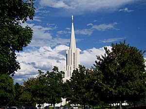
In 1981, the Jordan River Utah Temple was finished. In 2009, the Oquirrh Mountain Utah Temple was completed. This made South Jordan the first city in the world to have two temples of The Church of Jesus Christ of Latter-day Saints. The second city to have this is Provo, Utah, which is about 30 miles (48 km) south of South Jordan. In May 2003, the Sri Ganesha Hindu Temple was also completed in the city.
Geography and Landscape
South Jordan covers about 22.22 square miles (57.54 km2) of land. Only a small part, about 0.09 square miles (0.23 km2), is water.
The land in South Jordan is quite flat. This is because it was once covered by a huge ancient lake called Lake Bonneville. This lake existed from 75,000 to 8,000 years ago. At its biggest, about 30,000 years ago, the lake was very high, reaching 5,200 feet (1,600 m) above sea level. It covered a huge area of 19,800 square miles (51,000 km2).
The elevation in South Jordan changes slightly. It's about 4,300 feet (1,300 m) near the Jordan River in the east. It then gently rises to the foothills of the Oquirrh Mountains in the west, reaching about 5,200 feet (1,600 m).
Population and People
| Historical population | |||
|---|---|---|---|
| Census | Pop. | %± | |
| 1940 | 869 | — | |
| 1950 | 1,048 | 20.6% | |
| 1960 | 1,354 | 29.2% | |
| 1970 | 2,942 | 117.3% | |
| 1980 | 7,492 | 154.7% | |
| 1990 | 12,220 | 63.1% | |
| 2000 | 29,437 | 140.9% | |
| 2010 | 50,418 | 71.3% | |
| 2020 | 77,487 | 53.7% | |
| Population 2010 and 2020 | |||
As of 2020, South Jordan had a population of 77,487 people. Most of the people living in South Jordan are White. The city is also home to people of Asian, Black, Native American, and Pacific Islander backgrounds. About 7.1% of the population is of Hispanic or Latino origin.
The city has many families with children. About 46.8% of households have children under 18 living with them. The average household size is about 3.83 people. The median age in the city is around 29.9 years old. This means half the people are younger than 29.9 and half are older. Many people in South Jordan have graduated from high school, and a good number have also earned a college degree.
Parks and Fun Activities
South Jordan has 35 city parks and playgrounds. These parks have areas for many sports, including:
- baseball
- softball
- football
- soccer
- lacrosse
- volleyball
- pickleball
- tennis
- skateboarding
The city also has an Aquatic and Fitness Center and a Community Center for senior programs. There are three fishing ponds that are stocked with rainbow trout and catfish. Mulligan's is another fun spot with two miniature golf courses and two nine-hole executive golf courses.
Salt Lake County runs two big parks inside South Jordan. The 120-acre (49 ha) Equestrian Park is next to South Jordan City Park. It has a horse racing track, fields for polo and dressage, and indoor stables. The Salt Lake County Fair is held here every August. The 65-acre (26 ha) Bingham Creek Regional Park has sports fields, a large playground, a disc golf course, and trails for biking and walking. There are plans to add 90 more acres (36 ha) to this park, which will include areas for BMX, basketball, pickleball, tennis, and volleyball.
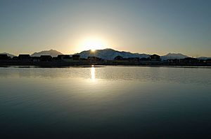
Oquirrh Lake is a 67-acre (27 ha) lake within the Daybreak Community. It is surrounded by 137 acres (55 ha) of park and wetlands. You can go fishing, sail boating, kayaking, and canoeing on the lake. The lake has fish like trout, bigmouth bass, channel catfish, and bluegill. The Daybreak community also has 22 miles (35 km) of trails, 37 parks, and five swimming pools. These are privately owned by the Daybreak homeowners association and are for residents only.
Glenmoor Golf course is a private course within the city that is open to the public. The Salt Lake County-owned Mountain View Golf Course is just north in West Jordan. Sandy-owned River Oaks Golf Course is also nearby, bordering the Jordan River.
Schools and Learning
South Jordan is part of the Jordan School District. The district has seven elementary schools:
- Daybreak Elementary
- Eastlake Elementary
- Elk Meadows Elementary
- Golden Fields Elementary
- Jordan Ridge Elementary
- Monte Vista Elementary
- South Jordan Elementary
There are three middle schools:
- South Jordan Middle
- Elk Ridge Middle
- Mountain Creek Middle
And two high schools:
- Bingham High School
- Herriman High School
In addition to these public schools, there are also charter schools like Paradigm High School, Early Light Academy, and Hawthorne Academy. There are also two private schools: American Heritage and Stillwater Academy.
Roseman University of Health Sciences is a private university in South Jordan. It has schools for pharmacy, dentistry, and nursing.
Getting Around South Jordan
Interstate 15, a large twelve-lane freeway, runs along the eastern edge of South Jordan. It has two exits within the city at 10600 South and 11400 South. Bangerter Highway (State Route 154) is a six-lane expressway that goes through the middle of the city. It has exits at 9800 South, 10400 South, and 11400 South. The Mountain View Corridor, which will eventually be a ten-lane freeway, is on the western side of the Daybreak Community.
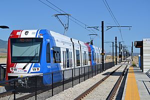
South Jordan is served by the Utah Transit Authority (UTA) bus system. It also has stops for UTA's TRAX light rail Red Line. The Red Line connects to downtown Salt Lake City and the University of Utah. Two TRAX stations are in the Daybreak Community and have parking lots. The South Jordan Parkway Station is at about 10600 South. The Daybreak Parkway Station is at 11400 South. It takes about 60 minutes to travel from Daybreak Parkway Station to downtown Salt Lake City.
UTA's FrontRunner commuter train system also has a station in South Jordan. It is on the eastern edge of the city at 10200 South. The FrontRunner goes north to Ogden and south to Provo.
City Services
Rocky Mountain Power provides electricity to homes and businesses in South Jordan. Questar provides natural gas. For high-speed internet, residents can choose from Comcast, Qwest, and Google.
South Jordan city owns the system that delivers drinking water. The drinking water itself comes from the Jordan Valley Water Conservancy District. There is also "secondary water," which is non-drinking water used for watering lawns and gardens. This water comes from canals that run through the city. The South Valley Sewer District manages the sewer system. South Jordan City also works with Ace Recycling and Disposal for trash and recycling pickup.
The University of Utah and Veterans Affairs have large health clinics in the city.
Local Economy
South Jordan has many important employers. Here are some of the main ones:
| # | Employer | # of Employees |
|---|---|---|
| 1 | Merit Medical | 2,086 |
| 2 | Jordan School District | 1,663 |
| 3 | Ultradent | 1,502 |
| 4 | Willis Towers Watson | 1,000 |
| 5 | Walmart | 760 |
| 6 | AdvancedMD | 655 |
| 7 | City of South Jordan | 502 |
| 8 | Intermountain Healthcare | 480 |
| 9 | OOCL | 475 |
| 10 | Physician's Group of Utah (Steward Health Care System) |
453 |
Famous People from South Jordan
- Edward J. Fraughton - (born 1939), an American artist, sculptor, and inventor.
- Harvey Langi - (born 1992), an NFL linebacker who played for the Denver Broncos.
- Star Lotulelei - (born 1989), a Tongan NFL defensive tackle who played for the Buffalo Bills.
- Dax Milne - (born 1999), an NFL wide receiver and return specialist for the Washington Commanders.
- Apolo Ohno - (born 1982) a retired Winter Olympics short track speed skater and a member of the U.S. Olympic Hall of Fame.
- Denise Parker - (born 1973) an American Olympics archer.
See also
 In Spanish: South Jordan para niños
 | Calvin Brent |
 | Walter T. Bailey |
 | Martha Cassell Thompson |
 | Alberta Jeannette Cassell |


