
Jordan River Parkway facts for kids
Quick facts for kids Jordan River Parkway |
|
|---|---|

Jordan River Parkway in Murray
|
|
| Length | 40 mi (64 km) |
| Location | Utah |
| Use | Hiking, biking, skating, equestrian |
| Elevation change | 294 ft (90 m) |
| Highest point | 4,494 ft (1,370 m) |
| Lowest point | 4,200 ft (1,300 m) |
| Difficulty | Easy |
| Season | All |
The Jordan River Parkway is a cool urban park that stretches about 40 miles (64 km) along the Jordan River in Utah. This amazing parkway follows the river from Utah Lake in Utah County, through Salt Lake County, all the way to the Great Salt Lake in Davis County.
Most of the parkway has a shared path for cyclists, skaters, and joggers. There's even a separate path for horses in the southern part of the trail! You'll find many trailheads, city and county parks, and golf courses along the way. It's a fantastic place for outdoor fun!
Contents
- Discover the Parkway's Story
- Fun Places Along the Jordan River Parkway
- Jordan River State Park: Adventure Awaits
- Salt Lake City's Parkway Gems
- South Salt Lake and West Valley City's River Spots
- Murray and Taylorsville's Parkway Sections
- Midvale and West Jordan's Parkway Areas
- Sandy and South Jordan's River Access
- Draper, Riverton, and Bluffdale's Parkway Plans
- Utah County's Scenic Parkway Sections
- Images for kids
Discover the Parkway's Story
The idea for the Jordan River Parkway started in 1971. At first, it was mainly planned to help control floods. But people also wanted to clean up the river, restore the natural areas, and add trails for everyone to enjoy.
In 1973, the Utah Legislature created the Provo-Jordan River Parkway Authority. This group received $3 million to build the parkway. They worked slowly through the 1970s, buying land and cleaning the river. Other cities along the river also started buying land for the parkway.
By 1986, about $18 million had been spent on the parkway. Much of this money came from the state. Land was bought and trails were built, especially in Utah County. In Salt Lake County, work was done from Murray north, adding parks and trails. By 2000, two areas that had been polluted by old factories were being cleaned up. This helped make the river and its surroundings much healthier.
Fun Places Along the Jordan River Parkway
The Jordan River Parkway offers tons of cool spots and activities! You can find public parks, nature areas, benches, picnic tables, and restrooms. There are also playgrounds, parking lots, and places to launch canoes. Some spots even have areas for off-highway vehicles (OHVs), model planes, and horses!
Jordan River State Park: Adventure Awaits
This park is part of the Utah State Park System and is open from April to November. It's a great place for motorsports fans! There are four tracks for motorbikes and OHVs, with cool tabletops and banked turns.
You can also find a special area with a runway for model airplanes. If you want to use the tracks or model plane area, there's a small fee. But you can always walk or bike on the gravel path for free!
Salt Lake City's Parkway Gems
Salt Lake City takes care of three parks and parts of the trails along the river.
- A paved trail starts near Redwood Road and 1800 North.
- Riverside Park has tennis courts, soccer fields, football fields, and Little League Baseball fields. It also has basketball, horseshoes, volleyball, and playgrounds. Restrooms are available for everyone.
- Cottonwood Park offers small shelters, a walking path, and an off-leash dog park. You'll find a playground, sand volleyball, and a basketball half-court here too.
- The Utah State Fairgrounds are also nearby.
- Jordan Park is a popular spot with picnic areas, fireplaces, and sand volleyball. It has tennis courts, a baseball field, and an International Peace Garden. There's also an off-leash area and a skate park for skateboarders!
- You can also find the 17th South Canoe Marina for water fun.
South Salt Lake and West Valley City's River Spots
The city of South Salt Lake has one park along the river:
- Paul Workman Park features a softball/soccer field, restrooms, and a bridge with trails on both sides of the river.
Salt Lake County manages four parks and connecting trails near West Valley City:
- Redwood Trailhead Park is a small park across from Paul Workman Park.
- Redwood Nature Area is a larger park with a trail that connects to the Decker Lake trail.
- The Utah Cultural Center is a building used for art shows and cultural events.
- Oxbow Park is a place to launch canoes and boats (no motorized boats allowed).
- George P. Holm Park (also known as Little Dell) is another great spot.
Murray and Taylorsville's Parkway Sections
Murray maintains five parks along the river. Most of the Murray section has a special trail for horses next to the paved path.
- Arrowhead Park is located in the community of Xanadu.
- The Nature Center of Murray is the second-largest wetland area on the Jordan River. It has a small outdoor theater by the river.
- Germania Park is a starting or ending point for the equestrian trail.
- Millrace Park has an off-leash area for dogs and is cared for by Taylorsville City.
- Walden Park is another lovely spot.
- Cottonwood Grove / Winchester Park is another start/end point for the equestrian trail.
- Willow Pond Park offers a peaceful setting.
Midvale and West Jordan's Parkway Areas
Midvale finished a part of the trail in 2001. This section connects with West Jordan.
- You can find the 7100 South Trail-head.
- The Gardner Village Trail-head is also in this area.
- There's also a Midvale Trail-head.
Sandy and South Jordan's River Access
- A section of the trail from 9400 South to 9800 South was finished in 2012.
- There's a proposed Dimple Dell Trail-head that will connect to Dimple Dell Regional Park.
- Shield Lane Trail-head has an area for horses.
- You'll find the 9800 South Trail-head.
- A gravel section runs from 9800 South to 10600 South.
- The Jordan River Migratory Bird Reserve is along the river's east side. This area is not open to the public, as it's a special place for birds.
Draper, Riverton, and Bluffdale's Parkway Plans
These areas have some of the longest parts of the parkway that are still being finished.
- You can visit the Riverton City Nature Park.
- The South County Pool is also nearby.
- The Riverbend Nature Area offers a natural escape.
Utah County's Scenic Parkway Sections
Many parts of the parkway in Utah County are already finished, either paved or gravel. Utah County manages five areas and parks, plus about 9 miles (14 km) of trail between the northern county line and Utah Lake.
- Indian Ford Park is near the Salt Lake County line. It has paved trails and is still being developed. This spot was historically a crossing point for Native American tribes.
- Thanksgiving Point is a special area near the river. A non-profit group runs gardens, a golf course, museums, shops, and restaurants here. It's a great place for learning and fun!
- Wildlife Park is a large area south of 9600 North near Lehi, Utah. This area is dedicated to wetlands and is only accessible by the Jordan River Parkway. It's perfect for watching nature. An old bridge from before World War I is still there, adding to the history.
- Willow Park in Lehi, Utah is over 50 acres (20 hectares) and perfect for families or groups. It has lots of old willow trees and open grassy areas. You can camp, have picnics, go canoeing, or fish here. There are also trails, a playground, and a pavilion.
- Model Airplane Park (also called Wetlands Park) is along the Jordan River in Saratoga Springs. It has paved runways for radio-controlled airplanes. The flat, open landscape is perfect for flying.
- Inlet Park in Saratoga Springs is located at the "inlet" to the Jordan River and Utah Lake. This park is over 4 acres (1.6 hectares) and serves as a trailhead for the parkway. It offers open grassy areas and quick access to Utah Lake and the Jordan River for fishing. Future plans include more family activities.
Images for kids
-
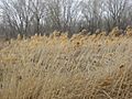
The Jordan River Parkway wetlands nature preserve in Murray-Taylorsville area
-
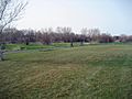
The Jordan River Parkway is popular with bicyclers of all types
-
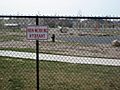
Dog Park on the Jordan River Parkway on 5400 South in Murray-Taylorsville area
-

The Freedom Shrine pays tribute to locals who served in the military


