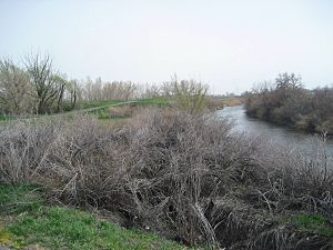
Jordan River (Utah) facts for kids
Quick facts for kids Jordan River |
|
|---|---|
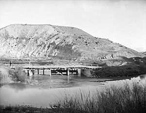
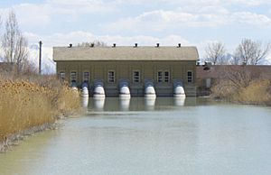
Dam at Jordan River Narrows in 1901
|
|
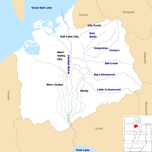
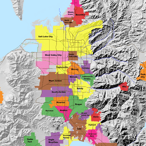
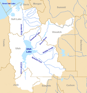
Map of the Jordan Subbasin and the location of Salt Lake County in Utah (inset)
|
|
| Other name(s) | Proveau's Fork, West Jordan River |
| Country | United States |
| State | Utah |
| Counties | Utah, Salt Lake |
| Physical characteristics | |
| Main source | Utah Lake Utah County, Utah 4,489 ft (1,368 m)(compromise level) 40°21′34″N 111°53′40″W / 40.35944°N 111.89444°W |
| River mouth | Great Salt Lake Davis County, Utah 4,200 ft (1,300 m)(historical average) 40°53′52″N 111°58′25″W / 40.89778°N 111.97361°W |
| Length | 51.4 mi (82.7 km) |
| Basin features | |
| Basin size | 791 sq mi (2,050 km2) |
The Jordan River is a river in Utah, United States. It is about 51 miles (82 km) long. The river starts at Utah Lake and flows north. It goes through the Salt Lake Valley and ends in the Great Salt Lake.
Many big cities are along the Jordan River. These include Salt Lake City, West Valley City, West Jordan, and Sandy. Over a million people live in the area around the river. Long ago, during the Pleistocene Ice Age, this area was covered by a huge lake called Lake Bonneville.
The first people known to live here were from the Desert Archaic Culture. They lived along the river about 3,000 years ago. Later, in 1847, Mormon pioneers led by Brigham Young were the first European American settlers. They built farms and towns near the river. People needed water for drinking, farming, and factories. So, they dug canals, built dams, and used pumps to control the river's flow.
The Jordan River used to be a cold-water river with 13 types of native fish. These included the Bonneville cutthroat trout. Now, it is a warm-water river, and the common carp is the most common fish. For many years, the river was very polluted. This pollution came from sewage, farm runoff, and mining waste. In the 1960s, new sewage treatment helped a lot. Today, laws like the Clean Water Act help keep the river cleaner.
Animals like raccoons and red foxes live near the river now. It is also an important place for birds. More than 200 types of birds visit the Jordan River, Utah Lake, and the Great Salt Lake.
Many smaller streams flow into the Jordan River. These include Big Cottonwood, Little Cottonwood, Red Butte, Mill, Parley's, and City creeks. The Jordan River Parkway is a special area along the river. It has natural spaces, gardens, golf courses, and a 40-mile (64 km) trail for bikes and walking. This trail was finished in 2017.
Contents
Where the Jordan River Flows
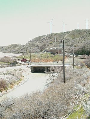
The Jordan River is the only river that flows out of Utah Lake. It starts at the north end of the lake, between Lehi and Saratoga Springs. The river then winds north for about 8 miles (13 km). It goes through a narrow canyon in the Traverse Mountains, called the Jordan Narrows.
Two dams are on the Jordan River. The first one is Turner Dam. It sends water to the East Jordan Canal and the Utah and Salt Lake Canal. Pumping stations near Turner Dam also send water to other canals. The second dam is Joint Dam. It sends water to the Jordan and Salt Lake City Canal and the South Jordan Canal. These dams help control where the river's water goes.
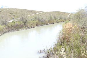
After the narrows, the river flows through the middle of the Salt Lake Valley. It passes through cities like Bluffdale, Riverton, and Draper. It also forms borders between cities like West Jordan and Sandy. Smaller creeks like Midas Creek, Bingham Creek, and Dry Creek join the Jordan River.
The river continues through Taylorsville, West Valley City, Murray, and South Salt Lake. Big Cottonwood and Little Cottonwood creeks join the river in Murray. Mill Creek joins in South Salt Lake. The river flows under highways like Interstate 215 and Interstate 80. Interstate 15 runs next to the river for a long way.
Near the end, the Jordan River splits into the Surplus Canal. Other creeks like Parley's, Emigration, Red Butte, and City creeks join the river through underground pipes. The river's length changes a little each year. This is because the Great Salt Lake's water level goes up and down with the weather. The Jordan River then flows into the Great Salt Lake.
How Much Water Flows in the River?
The United States Geological Survey measures the water in the Jordan River. From 1980 to 2003, about 150,000 acre-feet (190,000,000 m3) of water flowed into the Great Salt Lake each year. The Surplus Canal carries almost 60 percent of this water. The rest goes into irrigation canals.
About 400,000 acre-feet (490,000,000 m3) of water comes from Utah Lake each year. Water also comes from 11 large streams, sewage treatment plants, and groundwater. Each of these sources adds about 15 percent of the water to the river.
The Jordan River Area
The Jordan River area, called the Jordan Subbasin, is in Salt Lake and Utah counties. It is about 791 square miles (2,050 km2) in size. This area is part of a bigger region called the Jordan River Basin. Many large cities are in Salt Lake County, including Sandy, West Jordan, West Valley City, and Salt Lake City.
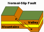
Tall mountains are on both sides of the valley. The Wasatch Range is to the east, with peaks over 11,100 feet (3,400 m) high. The Oquirrh Mountains are to the west, with peaks over 9,000 feet (2,700 m) high. The lowest point is where the river meets the Great Salt Lake, at 4,200 feet (1,300 m). These mountains were formed by faults, where the land moved up and down.
Thousands of years ago, a huge lake called Lake Bonneville covered much of northern Utah. It was there from about 75,000 to 8,000 years ago. This lake made the valley floor flat. As the climate got warmer and drier, Lake Bonneville shrank. The Great Salt Lake and Utah Lake are what's left of it. The Jordan River flows down a steep slope in the Jordan Narrows. But for most of its path, the river has a gentle slope.
About 46 percent of the Jordan Subbasin is in the mountains. The United States Forest Service manages a lot of land in the Wasatch Range. Most of the Oquirrh Mountains are privately owned, mainly by the Kennecott Copper Mine.
The Jordan Subbasin has two main climate zones. Lower areas have cold, semi-arid weather. This means they have four clear seasons. Summers are hot and dry, and winters are cold and snowy. Salt Lake City gets about 16.5 inches (420 mm) of rain and 61 inches (150 cm) of snow each year. Higher elevation areas have two seasons: summer and winter. For example, Alta, Utah, gets a lot of snow, about 544 inches (45.3 ft; 1,380 cm) each year.
History of the Jordan River
The first people known to live along the Jordan River were nomadic hunters and gatherers. An old village site, called Soo'nkahni Village, was found near the river. It is 3,000 years old. Later, the Fremont people lived here from about 400 A.D. to 1350 A.D. They were hunters and farmers. The Fremont people left the area, possibly because the weather changed, making farming hard. Also, ancestors of today's Ute, Paiute, and Northwestern Shoshone tribes arrived.
In 1776, a Spanish missionary named Silvestre Vélez de Escalante explored Utah Valley. He was looking for a route from New Mexico to California. Local Ute people told him about the lakes. He wrote in his journal about Utah Lake and the "extremely salty" Great Salt Lake.
The next Europeans to see the Jordan River were led by Étienne Provost, a French Canadian trapper. In 1824, his group was attacked near the river. The river was sometimes called Proveau's Fork after him.
| Salt Lake County population | ||
|---|---|---|
| Year | Pop. | ±% |
| 1850 | 6,157 | — |
| 1900 | 77,725 | +1162.4% |
| 1950 | 274,895 | +253.7% |
| 1960 | 383,035 | +39.3% |
| 1970 | 458,607 | +19.7% |
| 1980 | 619,066 | +35.0% |
| 1990 | 725,956 | +17.3% |
| 2000 | 898,387 | +23.8% |
| 2010 | 1,029,655 | +14.6% |
| sources: | ||
In 1847, the first Mormon pioneers arrived in the Salt Lake Valley. They saw how this local river flowed from Utah Lake to the salty Great Salt Lake. This reminded them of the Jordan River in the Middle East, which flows from the Sea of Galilee to the Dead Sea. So, on August 22, 1847, they named it the Western Jordan River, later shortened to the Jordan River. By 1850, towns were built along the river and its creeks.
Around 1887, copper was found at Bingham Canyon in the Oquirrh Mountains. Mining began, and by 1907, Kennecott Copper Mine started open pit mining. Mills were built near the Jordan River to process the ore. By 2010, the Kennecott mine was 2.8 miles (4.5 km) wide and 0.8 miles (1.3 km) deep.
For many years, water from the Jordan River helped farms in the Salt Lake Valley. But as more people moved in, the area became more urban. This meant less land was used for farming.
How the River Has Changed
People started changing the Jordan River's flow very early. Just two days after the Mormon Pioneers arrived, they diverted water from City Creek for farming. The first dam and ditch on the Jordan River were built in 1849. Many small dams and ditches were built in the first 25 years, and some are still used today.
By the late 1860s, people needed bigger canals for more farms. The first dam in the Jordan Narrows was built in 1872. This caused arguments with people near Utah Lake who thought the dam was raising the lake's level. In 1885, a decision was made about the lake's water level. It said that if the lake got too high, the river could not be blocked. Also, if the lake got too low, pumps could be turned off to save water.
In 1875, the South Jordan Canal was finished. It brought water to higher areas for the first time. By 1883, five large canals were built from the dams in the Jordan Narrows. A second dam was built in 1890 to better control water flow to two canals. These dams are now used to send water to canals, not to hold back large amounts of water.
During a drought in 1901–1902, the Jordan River sometimes stopped flowing. So, a large pumping plant was built at Utah Lake. It was the biggest pumping plant in the United States at the time. But in very dry years, like 1934 and 1992, Utah Lake got so low that the pumps couldn't work, and the Jordan River dried up. In the 1950s, parts of the river were straightened to help with flood control. This made the water flow faster.
In 1983–1984, floods caused Utah Lake to overflow. Homes and farms were flooded. Dikes were built to protect roads and towns. As a result, the accepted water level for Utah Lake was changed.
River Life and Nature
Tiny Creatures and Fish
Small creatures without backbones, called invertebrates, are very important in the Jordan River. They are food for fish and other water animals. They also show how healthy the river is. There are 34 types of invertebrates in the river, like earthworms, mosquito larvae, and caddisfly larvae. Some rare snails and mussels that live in the river are on Utah's Sensitive Species List. A study in 2007 showed that the river had a lot of pollution.
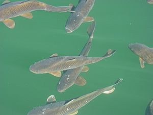
The Jordan River used to be a cold-water river with 13 native fish species. These included the Bonneville cutthroat trout and Utah Lake sculpin. Today, it is a warm-water river. The June sucker, which is an endangered fish, only lives in Utah Lake now. The common carp is the most common fish in the river today. It was brought here as a food source after native fish became scarce. The Utah Division of Wildlife Resources regularly adds catfish and rainbow trout to the river.
Animals Along the River
Before cities grew, animals like bighorn sheep, mule deer, coyote, wolves, beaver, and muskrat lived along the river. After settlers arrived, a big hunt in 1848 counted many animals, including wolves, foxes, and eagles. Today, you won't see those large animals. Instead, you might see raccoons, red foxes, and pets. Some animals from the Jordan River area, like the smooth green snake and western toad, are on Utah's Sensitive Species List.
The Jordan River, along with Utah Lake and the Great Salt Lake, is a great place for birds. Over 200 types of birds use the river for breeding or as a stop during their long migrations. Some native birds, like the willow flycatcher, are no longer found here. But the common yellowthroat and yellow-breasted chat still live in small groups. Common birds now include the black-billed magpie, mourning dove, and the non-native ring-necked pheasant.
Plants Along the River
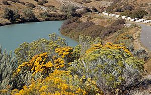
The types of plants in the river area depend on how high the land is and how much rain it gets. About 30 percent of the area, mostly in the mountains, has oak, aspen, and conifer trees. Lower areas have mountain-brush, sagebrush, juniper, and grasses. About 34 percent of the Jordan River area is now city land.
The river's banks used to have willow trees and cottonwood trees. Now, Russian olive and tamarisk trees are more common. You can still find plants like foxtail barley, saltgrass, rabbitbrush, and cattails in small areas. Common grasses now include orchard grass and wheatgrass. A rare flower, the Ute's Ladies'-tresses, also grows along the river.
River Pollution and Cleanup
The Jordan River has been used for waste disposal since people first settled the valley. For 100 years, raw sewage was dumped into it. Farm runoff and mining also added pollution. Mining operations built 40 smelters, which contaminated the river with heavy metals like arsenic and lead. In 1962, the river had very high levels of bacteria.
In 1965, a new sewage treatment plant opened. This stopped millions of gallons of raw sewage from going into the river. The Utah Division of Water Quality helps manage water quality. Rivers that are too polluted are put on a special list. The Clean Water Act requires states to identify polluted waters and plan how to clean them. The Jordan River is on this list for issues like temperature, dissolved oxygen, and bacteria.
EPA Superfund Cleanup Sites
Superfund sites are places with dangerous waste. The Environmental Protection Agency (EPA) decides if a site is dangerous. They plan how to clean it up and find who is responsible. If a site is a Superfund site, federal money helps with the cleanup.
The Kennecott South Zone/Bingham site has pollution from the Kennecott Copper Mine. Lead, arsenic, and sulfates have contaminated the groundwater. This pollution spreads all the way to the Jordan River. A large water treatment plant was built in 2006 to clean the groundwater. Another plant is planned. The full cleanup is expected to take until 2040.
The Murray Smelter site was a large lead smelter from 1872 to 1949. Its groundwater was polluted with arsenic and lead. Most of the cleanup was finished in 2001.
In Midvale, two Superfund sites are along the Jordan River. The Midvale Slag site had five smelters from 1871 to 1958. It was polluted with lead, arsenic, and other metals. The cleanup is mostly done. The Sharon Steel site was used for smelting copper from 1902 to 1971. It was polluted with lead, arsenic, and other metals. This site was cleaned up and removed from the Superfund list in 2004.
Uranium Mill Waste
The Vitro Uranium Mill site was in South Salt Lake. It was used for processing and storing uranium from 1953 to 1964. In 1989, the surface was cleaned, and radioactive waste was removed. However, millions of gallons of contaminated groundwater are still there. Studies are ongoing to decide how to clean it up.
Jordan River Parkway
The Jordan River Parkway was first planned in 1971. It was meant to help control floods and create parks and trails. By 1986, money was used to buy land and build parks and trails. As of 2010, most of the 40-mile (64 km) trail for walking and biking is finished. It goes from Utah Lake to the Davis County border. A water trail for canoeing and kayaking is also being built. However, dams and bridges make it hard to use the river for boating in some places.
Parks along the river include the International Peace Gardens, which has gardens from different countries. Redwood Nature Area is a natural space. South Jordan's Riverfront Park has trails and fishing ponds. Thanksgiving Point has gardens and a golf course. Utah County's Willow Park offers camping and wildlife areas.
See also
 In Spanish: Río Jordan (Utah) para niños
 | Audre Lorde |
 | John Berry Meachum |
 | Ferdinand Lee Barnett |


