Utah County, Utah facts for kids
Quick facts for kids
Utah County
|
||
|---|---|---|
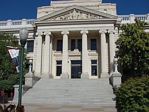
Historic Utah County Courthouse
|
||
|
||
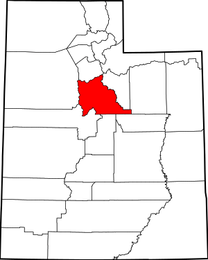
Location within the U.S. state of Utah
|
||
 Utah's location within the U.S. |
||
| Country | ||
| State | ||
| Founded | January 31, 1850 (created) April 18, 1852 (organized) |
|
| Named for | Ute Tribe | |
| Seat | Provo | |
| Largest city | Provo | |
| Area | ||
| • Total | 2,144 sq mi (5,550 km2) | |
| • Land | 2,003 sq mi (5,190 km2) | |
| • Water | 141 sq mi (370 km2) 6.6% | |
| Population
(2020)
|
||
| • Total | 659,399 | |
| • Estimate
(2023)
|
719,174 |
|
| • Density | 307.56/sq mi (118.748/km2) | |
| Time zone | UTC−7 (Mountain) | |
| • Summer (DST) | UTC−6 (MDT) | |
| Congressional districts | 3rd, 4th | |
Utah County is a large county in the state of Utah, in the United States. It's the second-biggest county in Utah when it comes to how many people live there. The main city and largest city in Utah County is Provo. Provo is also the fourth-largest city in the entire state.
Utah County is part of a bigger area called the Provo–Orem metropolitan area. This means it's a busy place with lots of cities and towns close together. In 2020, the middle point of Utah's population was actually in Utah County, in a city called Saratoga Springs.
This county is growing very fast! It's one of the top ten counties in the United States for how many new people move there. This makes the Provo–Orem area one of the fastest-growing big city areas in the country.
Utah County is special because it's one of only seven counties in the U.S. that has the same name as its state.
Contents
History of Utah County
Utah County was officially created on January 31, 1850. This was done by the government of the State of Deseret, which was an early territory before Utah became a state. They wanted to manage the growing number of settlers in Utah Valley.
The name "Utah" comes from the Spanish word Yuta, which was used for the Ute Indians. The Ute people lived in this area for a very long time.
Even though the State of Deseret didn't last long, the counties it set up continued. Utah County started keeping official records and had its first officials on April 18, 1852.
The first building for the county government was built in Provo in 1866. It quickly became too small! A second courthouse was built in 1872. By the 1920s, this building was also too crowded. So, a new building was finished in 1926 that served as both a city and county building.
The borders of Utah County changed a few times in the early years. But since 1884, the county has kept its current shape and size.
Geography of Utah County
Utah County covers a total area of about 2,144 square miles. Most of this area, about 2,003 square miles, is land. The rest, about 141 square miles, is water.
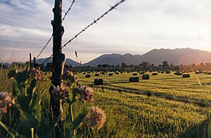
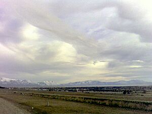
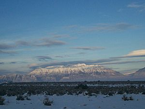
The heart of the county is Utah Valley. This valley is surrounded by the tall mountains of the Wasatch Range on the east side. A big part of the valley is taken up by Utah Lake. The land here ranges from about 4,487 feet above sea level at the lake to a very high 11,928 feet at the top of Mount Nebo.
Neighboring Counties
Utah County shares its borders with several other counties:
- Salt Lake County (to the north)
- Tooele County (to the west)
- Wasatch County (to the east)
- Juab County (to the southwest)
- Sanpete County (to the south)
- Carbon County (to the southeast)
- Duchesne County (to the east)
Cool Places to Visit
Utah County is home to parts of several national protected areas, which are like special parks or forests:
- Ashley National Forest (part of it)
- Manti-La Sal National Forest (part of it)
- Timpanogos Cave National Monument
- Uinta-Wasatch-Cache National Forest (part of it)
Who Lives in Utah County?
This section talks about the people who live in Utah County, including how many there are and their different backgrounds.
Population Changes Over Time
The number of people living in Utah County has grown a lot over the years. Here's how the population has changed:
| Historical population | |||
|---|---|---|---|
| Census | Pop. | %± | |
| 1850 | 2,026 | — | |
| 1860 | 8,248 | 307.1% | |
| 1870 | 12,203 | 48.0% | |
| 1880 | 17,973 | 47.3% | |
| 1890 | 23,768 | 32.2% | |
| 1900 | 32,456 | 36.6% | |
| 1910 | 37,942 | 16.9% | |
| 1920 | 40,792 | 7.5% | |
| 1930 | 49,021 | 20.2% | |
| 1940 | 57,382 | 17.1% | |
| 1950 | 81,912 | 42.7% | |
| 1960 | 106,991 | 30.6% | |
| 1970 | 137,776 | 28.8% | |
| 1980 | 218,106 | 58.3% | |
| 1990 | 263,590 | 20.9% | |
| 2000 | 368,540 | 39.8% | |
| 2010 | 516,564 | 40.2% | |
| 2020 | 659,399 | 27.7% | |
| 2023 (est.) | 719,174 | 39.2% | |
|
|||
Different Backgrounds and Cultures
People in Utah County come from many different backgrounds. Here's a look at the racial and ethnic makeup of the county over the years:
| Race or Ethnicity | 2020 | 2010 | 2000 | 1990 | 1950 | 1900 |
|---|---|---|---|---|---|---|
| White | 81.6% | 89.4% | 95.7% | 96.4% | 99.6% | 99.9% |
| —Non-Hispanic | 78.6% | 84.2% | 87.7% | 94.8% | n/a | n/a |
| Black or African American | 0.7% | 0.5% | 0.4% | 0.1% | 0.02% | 0.02% |
| Hispanic or Latino (of any race) | 13.4% | 10.8% | 8.4% | 3.0% | n/a | n/a |
| Asian | 1.6% | 1.4% | 1.2% | 1.0% | n/a | n/a |
| Hawaiian & Pacific Islander | 1.0% | 0.8% | 0.6% | 0.5% | n/a | n/a |
| Native American | 2.0% | 1.0% | 0.6% | 0.7% | n/a | 0.01% |
| Multiracial | 9.0% | 2.7% | 1.4% | n/a | n/a | n/a |
The 2000 census was the first to allow residents to select multiple race categories. Before 2000, the census used a category called 'Other Race'.
How People Live in Utah County (2020)
In 2020, there were 659,399 people and 171,899 households in Utah County. A household is a group of people living together. The population density was about 329 people per square mile.
- About 35.2% of the people were under 18 years old.
- About 15.8% were between 18 and 24 years old.
- The average age of people in Utah County was 24.6 years old.
Where Do People Come From?
Many people in Utah County have ancestors from different parts of the world. Here are the most common ancestries reported in 2020:
| Ancestry | Percentage of Population |
|---|---|
| Other European-Americans | 30.6% |
| English | 28.1% |
| American or Unclassified | 22.7% |
| Other British (including Scottish & Welsh) | 10.5% |
| German | 10.5% |
| Mexican | 7.7% |
| Irish | 5% |
| Other Latin American | 4.3% |
| Middle Eastern or North African | 0.3% |
Because people can report more than one ancestry, the percentages might add up to more than 100%.
Beliefs and Religions
Here's a look at the different religious beliefs reported in Utah County as of 2014:
| Religion in Utah County as of 2014[update] | ||||
|---|---|---|---|---|
| Religion | Percent | |||
| Latter-day Saints | 88.1% | |||
| None | 10.1% | |||
| Other faiths | 1.8% | |||
Community and Giving Back
Utah County is known for being very generous! It was named one of the most giving counties in the U.S. for charitable donations. This means people in Utah County often donate money to help others.
However, like many places, there are challenges. In 2019, about one in eight people and one in six children in the county did not have enough food to eat. This is an issue that communities work to solve.
Getting Around Utah County
Most of the ways people travel in Utah County are by car. Before the 1950s, people used the U.S. Highway System.
Roads and Highways
When I-15 was built in 1956, it became the main road for travel in the state. The I-15 CORE project added more lanes to I-15 through most of Utah County. This project finished in 2012 and made 24 miles of freeway bigger. Other projects have continued to improve I-15.
Other important roads include Highway 6, which connects Colorado to the Wasatch Front. Parts of Highway 89 are now important local roads called 'State Street'. Highway 189 is known as 'University Avenue' in Provo and goes through Provo Canyon.
Public Transportation
Over the last 15 years, public transportation in Utah County has grown a lot. This is partly because many students (over 70,000!) travel to Brigham Young University (BYU) in Provo and Utah Valley University (UVU) in Orem.
- The cities of Provo and Orem have a special bus system called UVX. It's a fast bus system that helps people get around.
- Provo is also the last stop for the FrontRunner, which is a commuter train service in Utah. The Provo FrontRunner station is near the Amtrak station, where you can catch trains to other states.
- The FrontRunner also has stops in Orem, Vineyard, Utah, American Fork, and Lehi. From Lehi, the FrontRunner leaves Utah County and goes into Salt Lake County.
Learning and Schools
Utah County has many schools and colleges for students of all ages.
School Districts
Children in Utah County attend schools in these districts:
- Alpine School District
- Provo School District
- Nebo School District
Colleges and Universities
There are several places where students can go to college in Utah County:
Four-year institutions
- Brigham Young University (a private university)
- Utah Valley University (a public university)
- Provo College (a private, for-profit college)
- Rocky Mountain University of Health Professions (a private, for-profit university)
Two-year institutions
- Mountainland Technical College (a public college)
Cities, Towns, and Communities
Utah County is made up of many different cities, towns, and smaller communities.
Cities
- Alpine
- American Fork
- Cedar Hills
- Draper
- Eagle Mountain
- Elk Ridge
- Highland
- Lehi
- Lindon
- Mapleton
- Orem
- Payson
- Pleasant Grove
- Provo (this is the county seat, where the main county government offices are)
- Salem
- Santaquin
- Saratoga Springs
- Spanish Fork
- Springville
- Woodland Hills
Towns
Census-designated places
These are areas that are like towns but are not officially incorporated as cities or towns.
- Benjamin
- Elberta
- Lake Shore
- Palmyra
- Spring Lake
- West Mountain
Unincorporated communities
These are small communities that are not part of any city or town.
- Birdseye
- Vivian Park
See also
 In Spanish: Condado de Utah para niños
 | John T. Biggers |
 | Thomas Blackshear |
 | Mark Bradford |
 | Beverly Buchanan |


