Elberta, Utah facts for kids
Quick facts for kids
Elberta, Utah
|
|
|---|---|

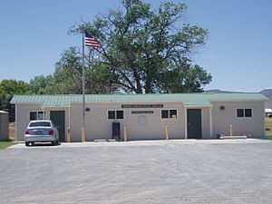
Elberta Post Office
|
|

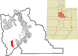
Location in Utah County and the state of Utah
|
|
| Country | United States |
| State | Utah |
| County | Utah |
| Named for | Early Elberta peach |
| Area | |
| • Total | 13.7 sq mi (35.4 km2) |
| • Land | 13.7 sq mi (35.4 km2) |
| • Water | 0.04 sq mi (0.1 km2) |
| Elevation | 4,698 ft (1,432 m) |
| Population
(2010)
|
|
| • Total | 256 |
| • Density | 18.73/sq mi (7.232/km2) |
| Time zone | UTC-7 (Mountain (MST)) |
| • Summer (DST) | UTC-6 (MDT) |
| ZIP code |
84626
|
| Area code(s) | 801 |
| FIPS code | 49-22210 |
| GNIS feature ID | 2408067 |
Elberta is a small community in Utah County, Utah, United States. It's known as a census-designated place (CDP), which means it's a special area identified by the government for statistics, but it's not officially a city or town. Elberta is part of the larger Provo–Orem metropolitan area.
In 2010, about 256 people lived in Elberta. The community was first called Mt. Nebo. However, after a water problem in 1901, many early settlers left. Later, in 1907, a man named Matthew B. Whitney bought the area. He renamed it "Elberta" after a type of peach that was very popular.
Contents
Geography
Elberta is located in the middle of Goshen Valley. You can find it along U.S. Route 6, which is about three miles west of the town of Goshen.
The total area of Elberta is about 35.43 square kilometers (or 13.68 square miles). Most of this area, about 35.36 square kilometers (13.65 square miles), is land. Only a very small part, about 0.07 square kilometers (0.03 square miles), is water.
Demographics
According to information from the year 2000, there were 278 people living in Elberta. These people lived in 56 households, and 53 of these were families. The population density was about 20 people per square mile.
Most of the people in Elberta were White (about 80%). Around 19% were from other racial backgrounds. Also, about 27% of the population identified as Hispanic or Latino.
Many households (about 62%) had children under 18 living with them. Most families (82%) were married couples living together. The average household had about 4.27 people.
The population in Elberta was quite young. About 41% of the people were under 18 years old. The average age was 23 years. For every 100 females, there were about 115 males.
Transportation
Elberta is located at an important crossroads. It's where U.S. Route 6 (US-6) and Utah State Route 68 (SR-68) meet.
US-6 runs from east to west through the southern part of the community. SR-68 starts from US-6 and goes north through the center of Elberta. This road continues north through Utah and Salt Lake counties, and even into southern Davis County.
See also
 In Spanish: Elberta (Utah) para niños
 | William Lucy |
 | Charles Hayes |
 | Cleveland Robinson |


