Juab County, Utah facts for kids
Quick facts for kids
Juab County
|
|
|---|---|
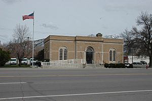
Nephi Post Office (2010)
|
|
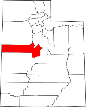
Location within the U.S. state of Utah
|
|
 Utah's location within the U.S. |
|
| Country | |
| State | |
| Founded | March 3, 1852 |
| Named for | Ute word for valley |
| Seat | Nephi |
| Largest city | Nephi |
| Area | |
| • Total | 3,406 sq mi (8,820 km2) |
| • Land | 3,392 sq mi (8,790 km2) |
| • Water | 14 sq mi (40 km2) 0.4% |
| Population
(2020)
|
|
| • Total | 11,786 |
| • Estimate
(2023)
|
13,023 |
| • Density | 3.4604/sq mi (1.33605/km2) |
| Time zone | UTC−7 (Mountain) |
| • Summer (DST) | UTC−6 (MDT) |
| Congressional district | 2nd |
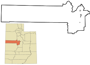
Juab County is a county located in western Utah, United States. As of 2020, about 11,786 people lived there. The main city and county seat (where the county government is) is Nephi.
Juab County is part of a larger area called the Provo–Orem Metropolitan Statistical Area. This means it's connected to the bigger cities of Provo and Orem.
Contents
History of Juab County
How Juab County Began
Long ago, before settlers arrived, nomadic indigenous peoples lived in the area that is now Juab County. In 1847, Mormon settlers started moving into Utah. They soon created a road to California that passed through this area. Travelers often stopped near Salt Creek, which flows through the Wasatch Mountains.
By 1851, Mormon settlers had started a community there, calling it Salt Creek. On March 3, 1852, the Utah Territory government officially created Juab County. Salt Creek was chosen as the county seat because it was the only real settlement. The county's name comes from a Native American word that might mean thirsty valley or simply valley.
Changes Over Time
The borders of Juab County changed several times between 1854 and 1919. In 1856, some western parts of the county were removed as the Nevada Territory was being formed. The current shape of Juab County was set in 1919.
Early settlers in Salt Creek mostly focused on farming and raising animals. However, by 1869, people started mining for valuable metals in the Tintic region. Mining towns like Diamond, Silver City, and Eureka quickly grew. By 1889, this area was known as one of the most productive mining regions in the country. Mining was the main economic activity until the mid-1900s. In 1882, the town of Salt Creek changed its name to "Nephi."
Geography and Nature
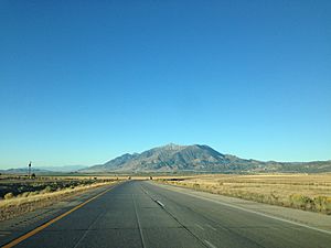
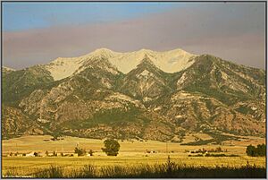
Juab County is located on the western side of Utah, right next to the state of Nevada. The land here is mostly dry, with rough, sandy soil, low hills, and mountains. The eastern border of the county follows the ridge of part of the Wasatch Mountains.
The land generally slopes towards the north. The highest point in the county is Mount Ibapah, which is about 12,087 feet (3,684 meters) above sea level. Juab County covers a total area of about 3,406 square miles (8,821 square kilometers). Most of this is land (3,392 sq mi or 8,785 km²), with a small amount of water (14 sq mi or 36 km²).
Travel and Transportation
Juab County has one airport:
- Nephi Municipal Airport (NPH)
Several important roads pass through the county:
- Interstate 15
- U.S. Route 6
- Utah State Route 28
- Utah State Route 36
- Utah State Route 78
- Utah State Route 132
Neighboring Counties
Juab County shares borders with these other counties:
- Tooele County - to the north
- Utah County - to the northeast
- Sanpete County - to the southeast
- Millard County - to the south
- White Pine County, Nevada - to the west
Protected Natural Areas
Juab County is home to several protected natural areas, including parts of:
- Deep Creek Wildlife Management Area
- Fish Springs National Wildlife Refuge
- Fishlake National Forest
- Uinta-Wasatch-Cache National Forest
- Yuba State Park (which includes Yuba Lake State Recreation Area)
Lakes and Waterways
The county has many natural springs and reservoirs. Some of the notable water bodies include:
- Andys Pond
- Baker Hot Springs
- Blue Springs
- Burraston Ponds
- Chicken Creek Reservoir
- Mona Reservoir
- Yuba Lake (also known as Sevier Bridge Reservoir)
People of Juab County
Population Growth
| Historical population | |||
|---|---|---|---|
| Census | Pop. | %± | |
| 1860 | 672 | — | |
| 1870 | 2,034 | 202.7% | |
| 1880 | 3,474 | 70.8% | |
| 1890 | 5,582 | 60.7% | |
| 1900 | 10,082 | 80.6% | |
| 1910 | 10,702 | 6.1% | |
| 1920 | 9,871 | −7.8% | |
| 1930 | 8,605 | −12.8% | |
| 1940 | 7,392 | −14.1% | |
| 1950 | 5,981 | −19.1% | |
| 1960 | 4,597 | −23.1% | |
| 1970 | 4,574 | −0.5% | |
| 1980 | 5,530 | 20.9% | |
| 1990 | 5,817 | 5.2% | |
| 2000 | 8,238 | 41.6% | |
| 2010 | 10,246 | 24.4% | |
| 2020 | 11,786 | 15.0% | |
| 2023 (est.) | 13,023 | 27.1% | |
| US Decennial Census 1790–1960 1900–1990 1990–2000 2010 2020 |
|||
According to the 2020 United States census, Juab County had 11,786 residents. The population density was about 3.5 people per square mile. Most residents (91.5%) were White, and about 4.9% were of Hispanic or Latino origin.
There were slightly more males (51.48%) than females (48.52%). About 34.2% of the population was under 18 years old, and 13.2% were 65 or older. The average age was 30.7 years.
Households and Income
There were 3,529 households in Juab County. Most households (81.0%) were families, and 67.6% of these were married couples. About 44.9% of all households had children under 18. Most homes (81.1%) were owned by the people living in them.
The average income for a household in Juab County was $68,333 per year. For families, the average income was $76,736. About 11.7% of the population lived below the poverty line.
Education in Juab County
Out of adults aged 25 or older, about 37.8% had a high school diploma, and 35.9% had some college education or an associate degree. About 11.7% had a bachelor's degree, and 7.1% had a graduate or professional degree.
Education
Two school districts serve the students in Juab County:
- Juab School District, which covers the eastern part of the county, including the Juab Valley area.
- Tintic School District, which serves the western part of the county.
Communities in Juab County
Juab County has several cities, towns, and smaller communities.
Cities
Towns
Unincorporated Communities
These are smaller communities that are not officially part of a city or town:
Ghost Towns
These are towns that were once active but are now abandoned:
See also
 In Spanish: Condado de Juab para niños
 | Janet Taylor Pickett |
 | Synthia Saint James |
 | Howardena Pindell |
 | Faith Ringgold |


