White Pine County, Nevada facts for kids
Quick facts for kids
White Pine County
|
|
|---|---|
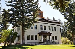
White Pine County Courthouse in Ely
|
|
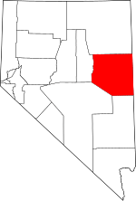
Location within the U.S. state of Nevada
|
|
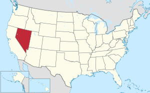 Nevada's location within the U.S. |
|
| Country | |
| State | |
| Founded | 1869 |
| Named for | Rocky Mountain white pine |
| Seat | Ely |
| Largest city | Ely |
| Area | |
| • Total | 8,897 sq mi (23,040 km2) |
| • Land | 8,876 sq mi (22,990 km2) |
| • Water | 21 sq mi (50 km2) 0.2% |
| Population
(2020)
|
|
| • Total | 9,080 |
| • Estimate
(2023)
|
8,522 |
| • Density | 1.0206/sq mi (0.39404/km2) |
| Time zone | UTC−8 (Pacific) |
| • Summer (DST) | UTC−7 (PDT) |
| Congressional district | 4th |
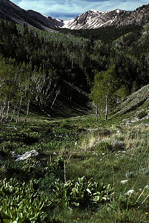
White Pine County is a large, mostly rural area in the eastern part of Nevada. It's known for its mountains and wide-open spaces. In 2020, about 9,080 people lived here. The main town and county seat is Ely.
The county gets its name from the limber pine tree, which used to be called "white pine." These trees are common in the mountains here. White Pine County is famous for its dark night skies, clean air, and millions of acres of wild public land. It's home to Great Basin National Park, a beautiful but less-visited national park. There are also 14 special wilderness areas where people can hike, camp, ski, hunt, and fish. The Ely Shoshone Indian Reservation is also located in the county, near the city of Ely.
Contents
History of White Pine County
European people first started settling in White Pine County because of mining. The famous Pony Express Trail, which carried mail across the country, also passed through the area. Farming was another reason people moved here.
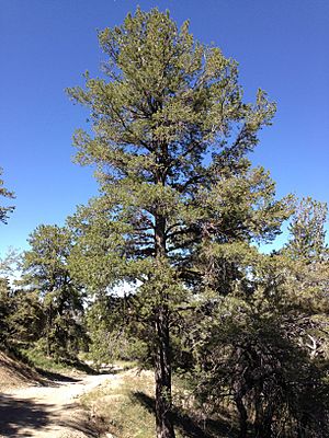
The Nevada government officially created White Pine County in 1869. It was formed from part of Lander County. The county was named after the many limber pine trees in the area. At first, Hamilton was the county seat from 1869 to 1887. But after a big fire, Ely became the new county seat.
Geography and Nature
White Pine County is very large. It covers about 8,897 square miles (23,040 km2) in total. Most of this area, about 8,876 square miles (22,990 km2), is land. Only a small part, about 21 square miles (54 km2), is water.
Many parts of the Humboldt-Toiyabe National Forest are found within the county. These include beautiful mountain ranges like the Snake Range, Egan Range, White Pine Range, Ruby Mountains, and Schell Creek Range. The county also has two state parks: Ward Charcoal Ovens State Historic Park and Cave Lake State Park.
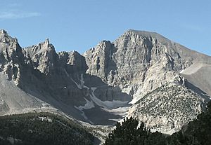
In the southeastern part of the county, inside Great Basin National Park, is Wheeler Peak. This mountain is 13,065 ft (3,982 m) tall. It's the tallest mountain completely within Nevada and the second-highest point in the whole state.
Main Roads
You can find several important highways in White Pine County:
Wilderness Areas
White Pine County has many special areas called wilderness areas. These places are protected by the government to keep them wild and natural. They were created in 2006 by a special law. Many of them are part of the Humboldt National Forest. Some examples include:
- Bald Mountain Wilderness
- Becky Peak Wilderness
- Bristlecone Wilderness
- High Schells Wilderness
- Mount Moriah Wilderness
Neighboring Counties
White Pine County shares borders with several other counties:
- Elko County to the north
- Tooele County, Utah to the northeast
- Juab County, Utah to the east
- Millard County, Utah to the southeast
- Lincoln County to the south
- Nye County to the southwest
- Eureka County to the west
Protected Natural Areas
Besides the wilderness areas, White Pine County is home to parts of these important natural places:
- Great Basin National Park
- Humboldt-Toiyabe National Forest
- Ruby Lake National Wildlife Refuge
Population and People
| Historical population | |||
|---|---|---|---|
| Census | Pop. | %± | |
| 1870 | 7,189 | — | |
| 1880 | 2,682 | −62.7% | |
| 1890 | 1,721 | −35.8% | |
| 1900 | 1,961 | 13.9% | |
| 1910 | 7,441 | 279.4% | |
| 1920 | 8,935 | 20.1% | |
| 1930 | 11,771 | 31.7% | |
| 1940 | 12,377 | 5.1% | |
| 1950 | 9,424 | −23.9% | |
| 1960 | 9,808 | 4.1% | |
| 1970 | 10,150 | 3.5% | |
| 1980 | 8,167 | −19.5% | |
| 1990 | 9,264 | 13.4% | |
| 2000 | 9,181 | −0.9% | |
| 2010 | 10,030 | 9.2% | |
| 2020 | 9,080 | −9.5% | |
| 2023 (est.) | 8,522 | −15.0% | |
| U.S. Decennial Census 1790-1960 1900-1990 1990-2000 2010-2018 |
|||
The number of people living in White Pine County grew quickly in the early 1900s because of mining. Since about 1950, the population has stayed around 9,500 people. Mining has always been a big employer. However, jobs in tourism and outdoor activities are becoming more important now.
In 2010, there were 10,030 people living in the county. Most people were white (85.5%). About 4.2% were American Indian, and 3.9% were black or African American. About 13.2% of the population was of Hispanic or Latino background. The average age of people in the county was about 40.8 years old.
Economy and Jobs
For a long time, from the late 1800s until the late 1900s, the main industry in White Pine County was mining. People mined for copper, silver, and gold in the area. There were large open-pit copper mines near the town of Ruth. There was also a copper smelter in McGill. When mining slowed down, many jobs were lost.
Education
All the schools in White Pine County are part of the White Pine County School District.
Towns and Communities
City
- Ely (This is the main town and county seat)
Census-designated places
These are areas that are like towns but don't have their own local government:
Unincorporated communities
These are smaller communities that are not officially organized as cities or towns:
- Cherry Creek
- East Ely
- Lages Station
- Majors Place
- Riepetown
- Schellbourne
- Strawberry
Ghost towns
These are towns that were once active but are now mostly abandoned:
- Aurum
- Eightmile
- Hamilton
- Hobson
- Kimberly
- Osceola
- Pleasant Valley
- Regan
- Treasure City
- Tungstonia
- Veteran
- Ward
See also
 In Spanish: Condado de White Pine para niños
 | Dorothy Vaughan |
 | Charles Henry Turner |
 | Hildrus Poindexter |
 | Henry Cecil McBay |


