Snake Range facts for kids
Quick facts for kids Snake Range |
|
|---|---|
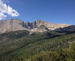
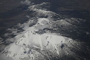
Wheeler Peak, highest mountain in the Snake Range
|
|
| Highest point | |
| Peak | Wheeler Peak |
| Elevation | 13,063 ft (3,982 m) |
| Dimensions | |
| Length | 60 mi (97 km) North-South |
| Geography | |
| Country | United States |
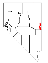
The Snake Range is a group of mountains found in White Pine County, Nevada, United States. A big part of the southern area of these mountains is inside Great Basin National Park. Most of the rest is part of the Humboldt-Toiyabe National Forest.
The tallest point in the Snake Range is Wheeler Peak. It stands about 13,065 feet (3,982 meters) high. This makes it the second highest point in all of Nevada. The Snake Range also has four of the five tallest mountain peaks in Nevada.
Contents
Exploring the Snake Range's Location
The Snake Range stretches for about 60 miles (97 kilometers) from north to south. This is a common way for mountain ranges to run in the Basin and Range Province. This area has many long, parallel mountain ranges.
To the west of the Snake Range are Spring Valley and the Schell Creek Range. To the east, across the Utah border, you'll find Snake Valley and the Confusion Range.
How to Get There: Sacramento Pass
U.S. Route 6 and U.S. Route 50 cross the Snake Range at Sacramento Pass. This pass is about 7,154 feet (2,181 meters) high. U.S. Route 50 is often called the "Loneliest Highway in America." This road is the main way to travel east into this part of Nevada.
Nature and Wildlife in the Snake Range
The southern part of the Snake Range is home to Great Basin National Park. This park was created in 1986. It protects the special rocks, land, and plants and animals of the mountains and the Great Basin Desert.
Amazing Rock Formations
In the southern part of the range, you can find Lexington Arch. This is a natural rock arch that spans about 83 feet (25 meters). You can also explore the Lehman Caves. Both of these amazing features were formed from the limestone rock in the mountains.
Ancient Trees: Bristlecone Pines
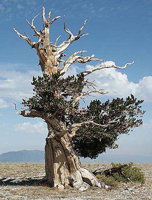
The higher parts of the Snake Range are home to very old Great Basin Bristlecone Pine trees. These trees are some of the oldest living things on Earth! They grow in the cool, high-altitude forests of the range.
Protected Wild Areas
The northern parts of the Snake Range are protected as the Mount Moriah Wilderness Area. The southern parts are protected by the Highland Ridge Wilderness. These areas help keep the natural environment safe.
Tallest Peaks of the Snake Range
The Snake Range has two main groups of peaks: a southern section and a northern section.
Southern Peaks of the Snake Range
The southern part of the Snake Range rises quickly. Just 10 miles (16 kilometers) north of the border with Lincoln County, you'll find Granite Peak, which is 11,218 feet (3,419 meters) high.
As you go further north, the mountains get even taller. Some of the peaks include:
- Lincoln Peak (11,597 feet or 3,535 meters)
- Mt. Washington (11,658 feet or 3,553 meters)
- Pyramid Peak (11,926 feet or 3,635 meters)
- Baker Peak (12,298 feet or 3,748 meters)
- Doso Doyabi (12,775 feet or 3,894 meters)
The highest point in this section, and the entire range, is Wheeler Peak. It reaches an impressive 13,063 feet (3,982 meters).
Northern Peaks of the Snake Range
North of Wheeler Peak, the mountains start to get lower. They drop to 7,154 feet (2,181 meters) at Sacramento Pass, about 11 miles (18 kilometers) away. This pass marks the start of the more remote northern part of the range.
Just 12 miles (19 kilometers) north of the pass, the mountains rise again. You'll find the beautiful Mt. Moriah, which is 12,067 feet (3,678 meters) high.
"The Table" Plateau
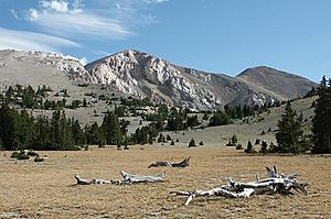
North of Mt. Moriah is a unique flat area called "The Table." This flat plateau is about 2 square miles (5 square kilometers) in size. It sits at an elevation of about 11,000 feet (3,353 meters). You can find a grove of ancient Great Basin Bristlecone Pines growing on this high, flat land.
Deep Canyons
Further north from "The Table" is another interesting geological feature. Deadman Creek and Smith Creek flow east into Snake Valley. They have carved a very deep canyon into the mountain range. The bottom of this canyon is below cliffs that are over 3,000 feet (914 meters) tall. It's about 6,000 feet (1,829 meters) below and 6 miles (10 kilometers) away from the top of Mt. Moriah.
 | Stephanie Wilson |
 | Charles Bolden |
 | Ronald McNair |
 | Frederick D. Gregory |


