Confusion Range facts for kids
Quick facts for kids Confusion Range |
|
|---|---|

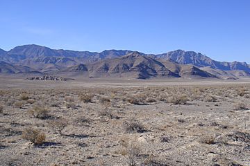
The Confusion Range from Skull Rock Pass, looking west toward Kings Canyon (Utah)
|
|
| Highest point | |
| Peak | King Top |
| Elevation | 8,350 ft (2,550 m) |
| Dimensions | |
| Length | 78 mi (126 km) N/S |
| Width | 31 mi (50 km) E/W |
| Area | 1,323 sq mi (3,430 km2) |
| Geography | |
| Country | United States |
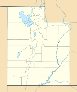
| State | Utah |
The Confusion Range is a long mountain range in west-central Utah, United States. It stretches from north to south. This range is surrounded by different areas. To its west is Snake Valley. To the east is Tule Valley. The Great Salt Lake Desert is to the north. And the Ferguson Desert is to the south.
The Confusion Range connects to other mountains in the south. These include the Burbank Hills, Mountain Home Range, and Wah Wah Mountains. A part of the range to the west is called the Conger Range. The name "Confusion Range" comes from its "rugged isolation and confusing topography." This means it's a wild, remote place with tricky landscapes.
Contents
Tallest Peaks in the Confusion Range
The Confusion Range has two main high points. These are its tallest peaks.
Conger Mountain
Conger Mountain is one of the highest peaks. It stands at 7,713 feet (2,351 meters) tall. Its coordinates are 39°14′00″N 113°42′03″W / 39.23328°N 113.700817°W.
King Top
The very highest point in the range is King Top. This peak reaches 8,350 feet (2,545 meters) high. Its coordinates are 38°54′36″N 113°31′47″W / 38.910000°N 113.529666°W.
Geology of the Mountains
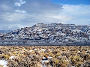
The rocks in the Confusion Range tell an old story. They are made of limestones, dolomites, and shales. These rocks were formed a very long time ago. They date back to the Silurian and Permian periods. Over time, these rocks have been pushed and folded. This created the mountain shapes we see today.
Traveling Through the Confusion Range
There are a few ways to get across or around the Confusion Range. Each route offers a different experience.
- You can go around the northern end. This path goes from Callao, Utah to Sand Pass.
- Another way is on old Highway 6/50. This is a dirt road that passes through Cowboy Pass.
- The most common route is on US Highway 6/US Highway 50. This major road travels through Kings Canyon (Utah).
See also
 In Spanish: Sierra de la Confusión para niños
 | Bayard Rustin |
 | Jeannette Carter |
 | Jeremiah A. Brown |


