Great Salt Lake Desert facts for kids
Quick facts for kids Great Salt Lake Desert |
|
|---|---|

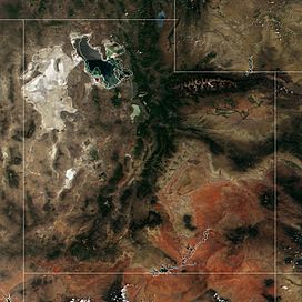
The desert's white salt is depicted in Utah's northwest.
|
|
| Area | 4,000 sq mi (10,000 km2) |
| Geography | |
| Country | United States |
| State | Utah |
| County | Juab County and Tooele County |
| Borders on | Cedar Mountains, Silver Island, Hogup, Newfoundland Mountains, & Lakeside Range West (NV): Pilot Range. |
The Great Salt Lake Desert (also known as the West Desert) is a very large, flat, and dry area in northern Utah, United States. It sits between the famous Great Salt Lake and the border of Nevada. This desert is part of a bigger desert region called the Great Basin Desert. It is well-known for its bright white salt deposits, especially the Bonneville Salt Flats. These salt deposits are left behind when ancient lakes dry up.
Contents
Exploring the Great Salt Lake Desert

The Great Salt Lake Desert is a vast, flat area that was once covered by a huge prehistoric lake called Lake Bonneville. When this lake dried up, it left behind thick layers of salt. This makes the desert floor look like a giant white plain.
Around the edges of the desert, you can find several smaller mountain ranges. These include the Cedar Mountains, Lakeside Mountains, Silver Island Mountains, Hogup Mountains, Grassy Mountains, and Newfoundland Mountains. Just across the border in Nevada, you can see Pilot Peak.
The desert gets very little rain, usually less than 8 inches (200 mm) each year. The salt crust on the ground forms again every year after the rain evaporates. Even though it's dry, some special plants can grow here. The northern part of the desert is used by the military as the Utah Test and Training Range.
Desert History and Famous Journeys
The Great Salt Lake Desert has been part of many important historical events. In 1826-27, explorer Jedediah Smith traveled through this desert. Later, in the 1840s, many pioneers heading west to California used a path called the Hastings Cutoff. This path went for about 130 miles (209 km) through the desert.
However, crossing the desert was very difficult. The famous Donner Party faced huge problems here in 1846. Their struggles in the desert contributed to them getting stuck in the snow in the Sierra Nevada mountains. In 1849, another explorer named Howard Stansbury mapped the desert.
Much later, in 1956, the modern highway I-80 was built across the desert. It replaced an older road and includes a very straight section about 50 miles (80 km) long. This section runs between the Cedar Mountains and Wendover.
The Bonneville Salt Flats, a part of the desert, became famous for speed. After a railway was built across the flats in 1910, people started using them for racing cars in 1914. Today, new world records for land speed are often set here!
Weather in the Desert
The Great Salt Lake Desert has a cold desert climate. This means it has very hot summers and cold winters. The desert is about 4,250 feet (1,295 meters) above sea level. This high elevation makes the temperatures cooler than in lower deserts, like the Mojave.
During summer, days are hot, but nights become comfortably cool because the temperature drops quickly after sunset. In winter, daytime temperatures are usually above freezing. However, winter nights are very cold, often dropping well below freezing.

See also
 In Spanish: Gran desierto del Lago Salado para niños
 | Delilah Pierce |
 | Gordon Parks |
 | Augusta Savage |
 | Charles Ethan Porter |


