Great Basin National Park facts for kids
Quick facts for kids Great Basin National Park |
|
|---|---|
|
IUCN Category II (National Park)
|
|
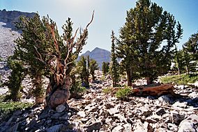
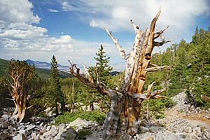
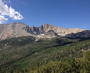
Bristlecone pine and Wheeler Peak
|
|
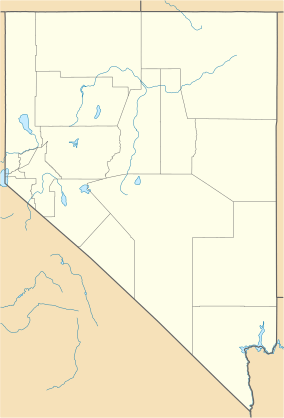
| Location | White Pine County, Nevada, United States |
| Nearest city | Ely, Baker, Border |
| Area | 77,180 acres (312.3 km2) |
| Established | October 27, 1986 |
| Visitors | 144,875 (in 2021) |
| Governing body | National Park Service |
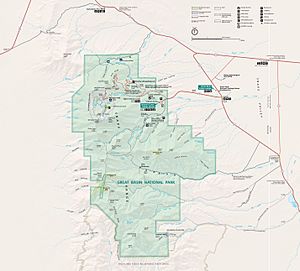
Great Basin National Park is a special place in Nevada, near the Utah border. It became a national park in 1986. You can usually get there by taking Nevada State Route 488 from the small town of Baker.
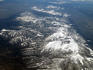
The park gets its name from the Great Basin, which is a dry, mountainous area. This region is between the Sierra Nevada mountains and the Wasatch Mountains. The park is about 290 miles north of Las Vegas. It protects over 77,000 acres of land.
This park is famous for a few amazing things. It has very old bristlecone pine trees, which are some of the oldest living things on Earth. It also has Lehman Caves, the Wheeler Peak Glacier, and some of the darkest night skies in the entire United States. This makes it a great spot for stargazing!
President Warren G. Harding first protected Lehman Caves as a National Monument in 1922. Later, in 1986, the monument and the land around it became a national park. This happened because Congressman Harry Reid worked hard to make it happen.
You can find many places to camp in the park, both in developed campgrounds and in the wild backcountry. The Highland Ridge Wilderness is right next to the park. Together, these areas create a huge safe home for wildlife in eastern Nevada.
Contents
Amazing Plants and Animals
Plants of the Park
Great Basin National Park and its nearby valleys are home to many plants. You can find eleven types of conifer trees and over 800 different kinds of plants here.
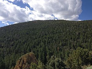
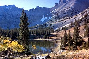
Near the Visitor Center, you'll see plants like sagebrush, saltbush, single-leaf pinyon trees, and Utah juniper. As you go higher up the mountains, you'll find mountain meadows, white fir trees, quaking aspen, Engelmann spruce, and large Ponderosa pine trees. At the very top, where trees stop growing, there are small, delicate plants and rocky areas. Some plants here are unique and can only be found in this park, like Mt. Wheeler sandwort.
One of the oldest non-clonal living things ever found was a Great Basin bristlecone pine tree. It was at least 5,000 years old! This tree grew near Wheeler Peak in the park. Sadly, it was cut down in 1964 for research. People called it Prometheus, like the Greek god who gave fire to humans.
Animals of the Park
Great Basin National Park and its surrounding valleys are home to many different animals. There are 61 types of mammals, 18 types of reptiles, 238 types of birds, two types of amphibians, and eight types of fish.
Mammals
Many animals live in the different habitats of Great Basin National Park. In the lower, dry sagebrush areas, you might see jackrabbits, pygmy rabbits, mountain cottontails, ground squirrels, chipmunks, and various mice. Less common animals there include Pronghorns, coyotes, kit foxes, and badgers.
In the rugged mountain slopes and nearby valleys, you might spot cougars, bobcats, marmots, rock squirrels, and bighorn sheep. Other animals living here include elk, mule deer, spotted skunks, shrews, ringtail cats, and ermine.
Fish
The Bonneville cutthroat trout is the only fish that naturally lives in Great Basin National Park. It came to the mountain waters on its own. Other types of trout, like Lahontan cutthroat trout, rainbow, brook, and brown trout, were put into the lakes and streams before the park was created in 1986.
Birds
Many kinds of birds live in Great Basin National Park. You can see Canada geese, hawks, sparrows, bald eagles, tundra swans, barn owls, snow geese, killdeer, golden eagles, woodpeckers, mallards, wrens, greater roadrunners, chickadees, great horned owls, ravens, magpies, and swallows.
Amphibians
Only two types of amphibians have been found in the southern Snake Range and nearby valleys. These are the western spadefoot toad and the leopard frog.
How the Park Was Made: Rocks and Caves
Many of the rocks in the park formed about 550 million years ago. Back then, this area was at the edge of a huge landmass called Laurentia. Over millions of years, many big geological events happened. This included lots of faulting (where rocks break and move) and mountain-building events. These events pushed up rocks and created different kinds of dikes and sills.
There was also a lot of volcanic activity during this time. This helped lift the area even more. It also caused more block faulting, where layers of rock, ash, and volcanic debris built up in the Snake Range.
Glaciers and Mountains
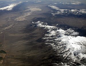
During the Pleistocene ice ages, glaciers carved out the peaks of the Snake Range. These glaciers left behind steep canyon walls, U-shaped valleys, bowl-shaped hollows called cirques, and piles of rock and dirt called moraines.
Lehman Caves Formation
The Lehman Cave system started forming around 550 million years ago. At that time, the area was under a warm, shallow ocean. The caves are mostly made of marble and limestone. These rocks dissolved over time to create the many beautiful cave decorations you see today.
During the ice ages, more water flowed through the caves. This water carved out deeper passages and rooms. Eventually, the water level dropped, leaving behind the large rooms and deep parts of the Lehman Caves system we see now.
Cool Places to See
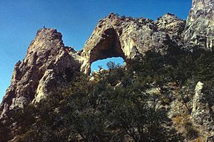
The park has many beautiful spots. These include Lexington Arch, the Lehman Orchard and Aqueduct, Rhodes Cabin, Stella and Teresa Lakes, and the Wheeler Peak Glacier.
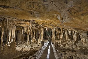
Lehman Caves
The Lehman Caves were first protected as a national monument in 1922. They became part of the national park in 1986. This cave is about two miles long, making it the longest known cave in Nevada. The park offers two different tours: a 0.6-mile tour that takes about 90 minutes, and a shorter 0.4-mile tour that lasts about 60 minutes.
Native American people knew about these caves long before Europeans arrived. In 1885, a rancher named Absalom Lehman started giving tours of the cave. Old writings inside the cave show that many early settlers also visited and enjoyed it.
Many small creatures live in Lehman Caves. Bacteria are the most common. You might also find crickets, spiders, pseudoscorpions, mites, and springtails. These animals can live their whole lives in the cave. They eat organic material brought in by other animals or washed in from outside.
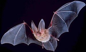
Other animals use the cave for shelter but leave to find food. These include chipmunks, mice, pack rats, and several types of bats. At least 10 species of bats have been found near Great Basin National Park, including the Townsend's big-eared bat.
Hiking Trails
The park has 12 trails for hiking. They range from short paths of 0.3 miles to longer ones of 13.1 miles. Some trails are easy nature walks at lower elevations. The Wheeler Summit trail is much harder and starts at a high elevation. Hiking at high altitudes can be dangerous for people who are not prepared. There are also paths for backcountry hiking in the more remote southern part of the park.
Visitor Centers
The main Great Basin visitor center is in the town of Baker. The Lehman Caves visitor center is about 5.5 miles from Baker, just inside the park. Both centers have exhibits about the park's geology, nature, and history. They also show films to help you learn about the park. A special item on display at the Great Basin visitor center is the "Forgotten Winchester." This rifle, made in 1882, was found leaning against a juniper tree in the park in 2014.
Weather in the Park
Great Basin National Park is in a dry area. It gets very little rain most of the year. Most of the water comes from winter snow or summer thunderstorms. All the water here either evaporates, sinks into the ground, or flows into lakes. This means no water from this region reaches the ocean.
Winters are cool, and summers are mild to hot. The weather can change very quickly, especially in the mountains or on Wheeler Peak. The Lehman Caves stay at a constant temperature of about 50°F (10°C) with 90% humidity all year round.
The climate changes throughout the park. Higher places are cooler and get more snow and rain. Lower places are hotter and drier.
See also
 In Spanish: Parque nacional de la Gran Cuenca para niños
 | James B. Knighten |
 | Azellia White |
 | Willa Brown |


