
Cherry Creek, Nevada facts for kids
Quick facts for kids
Cherry Creek
|
|
|---|---|
|
Census county division & Unincorporated community
|
|
_in_Cherry_Creek,_Nevada.JPG)
Entering Cherry Creek from former SR 489
|
|

Cherry Creek
Location in Nevada
|
|
| Country | United States |
| State | Nevada |
| County | White Pine |
| Elevation | 6,130 ft (1,870 m) |
| Population
(2010)
|
|
| • Total | 72 |
| Time zone | UTC-8 (Pacific (PST)) |
| • Summer (DST) | UTC-7 (PDT) |
| Reference #: | 52 |
Cherry Creek is a historic mining town in northeastern Nevada. It is located in northern White Pine County. In 2010, its population was 72 people.
Contents
Where is Cherry Creek Located?

Cherry Creek is in the northern part of a long valley called Steptoe Valley. It is north of the towns of McGill and Ely. To the west are the Cherry Creek Range mountains. To the east is U.S. Route 93 and the Schell Creek Range. South of Cherry Creek, the Pony Express trail passed through Egan Canyon in the 1860s.
The History of Cherry Creek
Cherry Creek has been a community for over 140 years. It has seen many ups and downs.
How Cherry Creek Started
In the early 1860s, people found a lot of gold and silver in the area. Cherry Creek officially started on September 21, 1872. Two prospectors found rich silver and gold deposits. By spring 1873, about 400 people lived there.
Boom Times and Quiet Periods
In 1873, Cherry Creek was growing fast. It had a stable for horses, a blacksmith shop, a big hotel, and many restaurants. There were also more than twenty saloons. Wells Fargo opened a station, and a post office started.
However, by early 1874, most of the gold and silver was running out. The town's economy and population began to shrink. By 1875, many mines and mills had closed. Cherry Creek became a much smaller mining community.
The town grew quickly again in 1880. More gold and silver were found! The next two years were Cherry Creek's biggest "boom." By late 1881, one large mine employed over 200 men. Cherry Creek became the biggest voting area in White Pine County.
In 1882, the town was at its busiest. Its economy and population were higher than ever before. About 7,800 people lived there. Many were mine workers who moved around. There were 28 saloons and many other businesses. A stagecoach route connected Cherry Creek to Toano. By the end of 1882, one mine had produced over a million dollars in gold. This time was the richest in Cherry Creek's history.
In 1883, a financial problem hit the economy hard. Many mines closed, and the town quickly declined. In 1888, a big fire destroyed many businesses. By 1890, the population was only 350. More fires in 1901 and 1904 burned down many original buildings.
In 1905, Cherry Creek's economy improved a little. Some local mines reopened. The town remained home to hundreds of people. Mining continued until the late 1940s.
Cherry Creek Today

Since the 1940s, the town has slowly gotten smaller. However, mining still happens sometimes. Since 1872, the area has produced about 20 million dollars worth of minerals.
Many old buildings are still standing today. These include a museum, an old one-room schoolhouse, and the Cherry Creek Barrel Saloon. These historic places are mixed with newer buildings.
Cherry Creek's Climate
Cherry Creek has a dry climate, like most of the Great Basin. Winters are cold and dry. Daytime temperatures are usually just above freezing. Nights are very cold. Summer days can be hot, but the air is dry and the town is high up. This makes the heat feel less strong. Nights are cool, even in summer. The thin, dry air cools quickly after the sun sets.
| Climate data for Cherry Creek, Nevada (Elevation 6,130ft) | |||||||||||||
|---|---|---|---|---|---|---|---|---|---|---|---|---|---|
| Month | Jan | Feb | Mar | Apr | May | Jun | Jul | Aug | Sep | Oct | Nov | Dec | Year |
| Record high °F (°C) | 56 (13) |
67 (19) |
78 (26) |
83 (28) |
95 (35) |
98 (37) |
104 (40) |
97 (36) |
94 (34) |
83 (28) |
73 (23) |
64 (18) |
104 (40) |
| Mean daily maximum °F (°C) | 38.4 (3.6) |
43.3 (6.3) |
52.3 (11.3) |
59.0 (15.0) |
70.3 (21.3) |
81.2 (27.3) |
91.9 (33.3) |
88.2 (31.2) |
77.8 (25.4) |
63.8 (17.7) |
50.8 (10.4) |
38.8 (3.8) |
63.0 (17.2) |
| Mean daily minimum °F (°C) | 17.6 (−8.0) |
22.9 (−5.1) |
27.1 (−2.7) |
31.3 (−0.4) |
39.4 (4.1) |
48.1 (8.9) |
57.6 (14.2) |
54.1 (12.3) |
44.7 (7.1) |
34.7 (1.5) |
26.3 (−3.2) |
18.9 (−7.3) |
35.2 (1.8) |
| Record low °F (°C) | −12 (−24) |
−3 (−19) |
9 (−13) |
12 (−11) |
19 (−7) |
31 (−1) |
47 (8) |
34 (1) |
26 (−3) |
19 (−7) |
−4 (−20) |
−9 (−23) |
−12 (−24) |
| Average precipitation inches (mm) | 0.80 (20) |
0.69 (18) |
0.63 (16) |
1.19 (30) |
0.67 (17) |
0.68 (17) |
0.56 (14) |
0.36 (9.1) |
0.69 (18) |
0.75 (19) |
0.48 (12) |
0.83 (21) |
8.32 (211) |
| Source: The Western Regional Climate Center | |||||||||||||
Images for kids
-
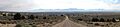
Cherry Creek viewed from the east.
See also
 In Spanish: Cherry Creek (Nevada) para niños
